
Hike Schedule
Join us for a hike! Registration required.
All hikes available to BTC members. Some hikes are open to non-members.
See Refund Policy for Paid Hikes >
TIP: The calendar view displays up to 7 hikes on a day, but often there are more. Click “View more events” to see them all.
Categories
- 25February 25, 2023
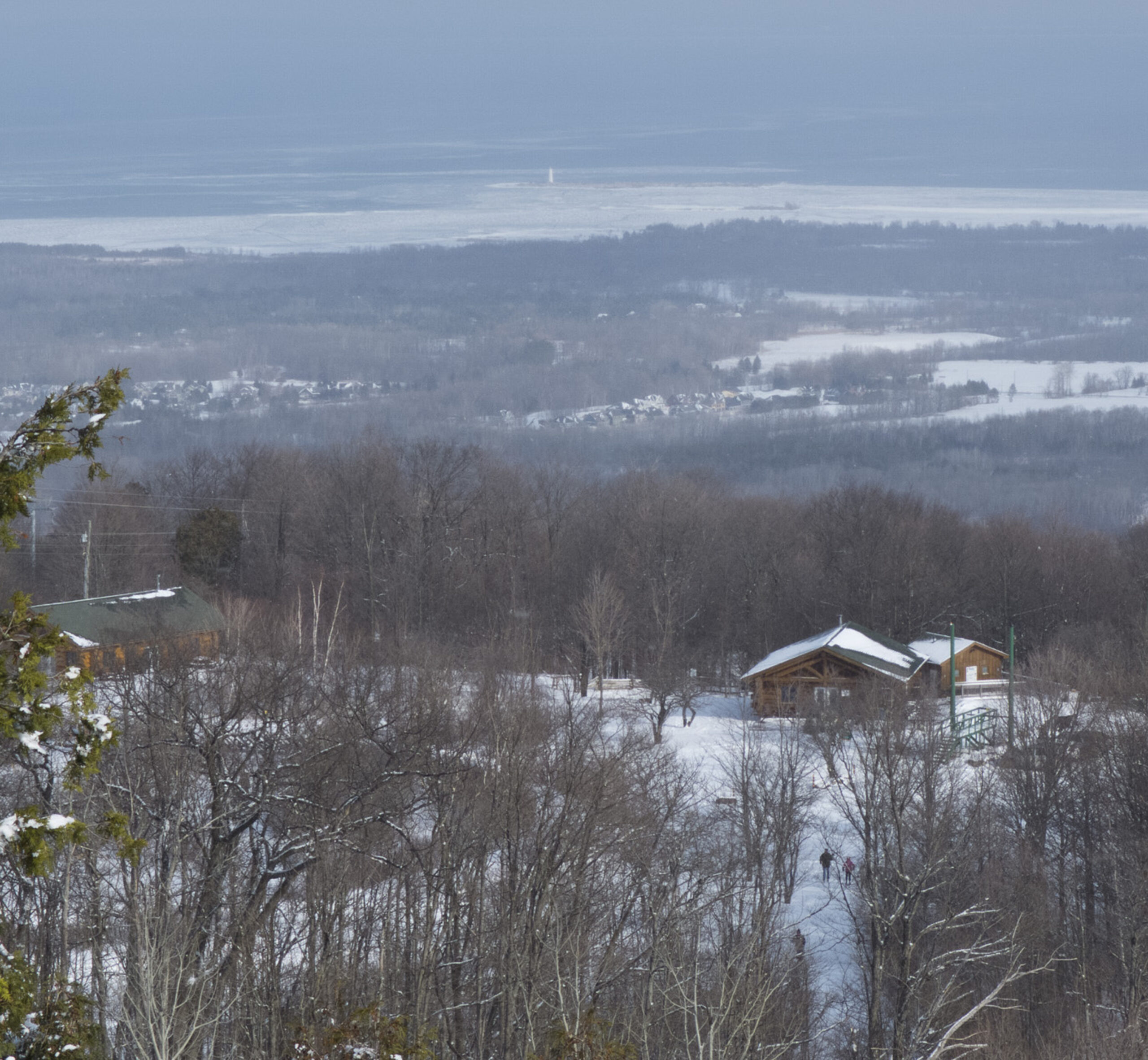
Winter Coach Trip: Scenic Caves
https://hikesstaging.brucetrail.org/event/winter-coach-trip-scenic-caves-2/Sorry, the registration cut-off time for this hike has been reached.Not a member? Click here to join today!Trip Information
Departure Time: 08:00
Return to City Time: 18:30
Departure Point: York Mills Bus PickupTrip Activities
Ski trail pass ($35)
Snowshoe trail pass ($35)
Optional Items
Pick-up at Major Mackenzie Dr and HWY 400 Park and Ride ($0.01)Hosting Club: Toronto
Category: Coach Trips
Location (Google Maps): Scenic CavesHike Leader(s): Martina Furrer, Duro Vukman Click here to contact Hike Leader(s)
Description
Bus departs 10 York Mills Rd at 8 AM and Major Mackenzie Dr and HWY 400 Park and Ride at 8:20 AM. If you wish to be picked up at the Major Mackenzie Dr and HWY 400 Park and Ride, select that option when you register. Please arrive 15 minutes before departure. The bus waits for no one.Join us for an awesome day of skiing and snowshoeing at Scenic Caves Nature Adventures. Cross southern Ontario’s longest suspension bridge and enjoy great views of Georgian Bay. Snowshoers: Join Duro and Geri for a guided snowshoe. The group will maintain a comfortable level II pace, through old growth forest and moderate hills and cover about 11 KM. Prepare to be outside for four hours as we traverse spectacular vistas and some great lookouts. If you prefer, you can explore the resort trails with a friend at your own pace. Skiers: Enjoy forests, fields, and rolling hills on trails expertly groomed for classic and skate skiing.
Join our après ski and shoe party in our cozy, private chalet. Some wine will be provided (bring your own beer) and we will raise a glass to Wayne. If you would like to, bring some finger food to share.
Ski and snowshoe rentals available. Scenic Caves rents equipment on a first-come, first served basis. Rental equipment must be picked up and dropped off in the main chalet and paid for individually.
We’ve reserved the log cabin for our group so there will be plenty of space to leave extra gear and warm up by the fire.
Coach fares must be paid online when you register. Trail fees will be collected in cash on the bus. Masks are mandatory on the bus.
Car Hike: Bethesda Trail Richmond Hill
https://hikesstaging.brucetrail.org/event/car-hike-bethesda-trail-richmond-hill-6/Sorry, the registration cut-off time for this hike has been reached.Not a member? Click here to join today!Hosting Club: Toronto
Location (Google Maps): Oak Ridges Trail head Bethesda parking
Hike Leader(s): Mohammad Aghamiri Click here to contact Hike Leader(s)
Pace: Brisk
Terrain: Hilly, Variable
Distance: 14-15KMDescription
We will explore Oak Ridges Corridor in Richmond Hill, Hike around Bond lake .To reach there turn right to Bethesda side road from Bayview Ave. Then drive around 500 meter and park in Oak Ridges trail head parking.
It is winter time please bring your icers, hiking poles, proper closing and shoes and hot drinks,
Please carefully read safety procedures during the hike:
1-Hikers must stay between the leader and the sweep.
2-Hikers must advise the leader or the sweep if they wish to leave the group.
3- Hikers must follow the whistle instructions: 1 blast- stay where you are; 2 blasts come to the leader; 3 blasts – come to the leader quickly.
4-Hike leader may request volunteers to stop at trail intersections, they need to help hikers to the direction the group walk and wait till they see the sweep .
5-Hikers have to make sure they can see the persons behind and in front of them.

8:30 Niagara Winter End to End #6 Woodend Conservation Area to Queenston Southern BTC Terminus
https://hikesstaging.brucetrail.org/event/830-niagara-winter-end-to-end-6-woodend-conservation-area-to-queenston-southern-btc-terminus/Sorry, the registration cut-off time for this hike has been reached.Not a member? Click here to join today!Hosting Club: Niagara
Category: Car Pool
Location (Google Maps): Meet at Queenston Heights Restaurant Parking lot and Car Pool to WoodendHike Leader(s): Alan Laver Click here to contact Hike Leader(s)
Pace: Medium
Terrain: Moderate
Distance: 14.5Description
We will be car pooling, Bring Icers and poles. No dogs. To earn your Niagara Winter End to End badge, it must be completed between December 21, 2022 to March 21, 2023.
Because of the potential for bad winter trail conditions we have broken this e2e into 6 hikes rather than 5If you have completed all 6 hikes bring $10 for the coveted Winter End to End Badge
9:00 Underground Railway. (Black History)
https://hikesstaging.brucetrail.org/event/900-underground-railway-black-history/Sorry, the registration cut-off time for this hike has been reached.Not a member? Click here to join today!Hosting Club: Niagara
Category: Hike
Location (Google Maps): Butlers Barracks Paring Lot John St NOTLHike Leader(s): Bruce Manion Click here to contact Hike Leader(s)
Pace: Leisurely
Terrain: Easy
Distance: 5kDescription
Learn about Niagara’s role in the legendary Underground Railroad that led an estimated 40,000 slaves to freedom throughout the 19th century
9:00 Port Dalhousie - Jaycee Gardens & Green Ribbon Trail
https://hikesstaging.brucetrail.org/event/900-port-dalhousie-jaycee-gardens-green-ribbon-trail/Sorry, the registration cut-off time for this hike has been reached.Not a member? Click here to join today!Hosting Club: Niagara
Category: Urban
Location (Google Maps): Meet in Jaycee Garden Parking LotHike Leader(s): Margaret Northfield Click here to contact Hike Leader(s)
Pace: Medium
Terrain: Easy
Distance: 10 kmDescription
Escape the mud with this urban hike will take us through Port Dalhousie starting at Jaycee Gardens Park and winding around the town to the Green Ribbon Trail and back close to Lake Ontario. Bring snack and drink.Dundas Valley Winter Hike
https://hikesstaging.brucetrail.org/event/dundas-valley-winter-hike-2/Sorry, the registration cut-off time for this hike has been reached.Not a member? Click here to join today!Hosting Club: Toronto, Dufferin Hi-Land
Category: General Hike
Location (Google Maps): Please note the meeting point location- its at the Dundas Valley Conservation parking lot at the end of Lions Club Rd. Follow this road to the end, then enter the gates leading to the parking lot. You may have to pay at this gate, or there is a pay station in the parking lot. Please note that there are a number of parking lots within this conservation area.Hike Leader(s): Gilles Gagnon Click here to contact Hike Leader(s)
Pace: Medium
Terrain: Moderate, Slippery and Steep Sections
Distance: 10 to 13, depending on conditionsDescription
We will hike to Sherman /Tiffany Falls and back, then take a loop within Dundas Valley Conservation area, taking in Canterbury Falls. Some steep and slippery terrain. Bring icers, hiking poles, and showshoes in the event of heavy snowfalls.Parking fees apply payable by credit card.
Directions to Dundas Valley Trail Parking: From Hwy 403 going west up the escarpment past Hamilton, take Exit 64 following Mohawk /Rousseau road north. Turn right on Wilson St, continuing for 0.75 km to the next traffic light. Turn left on Montgomery Dr, then right following Old Dundas Valley Road down a steep hill, then left on Lions Club Road. Continue for about 1.3 km on Lions Club Road to park gates, and then through gates to parking further down the lane.
Loop through some Niagara Biosphere Land as well as the Bruce Trail near Quiet Valley
https://hikesstaging.brucetrail.org/event/loop-through-some-niagara-biosphere-land-as-well-as-the-bruce-trail-near-quiet-valley/Sorry, the registration cut-off time for this hike has been reached.Not a member? Click here to join today!Hosting Club: Beaver Valley
Location (Google Maps): Meet at Kimbercote Farm 316362 3rd Line C, Grey Highlands. Parking on the premises. Driveway sign says Kimbercote, Wild School, Elephant Thoughts. Near the corner of 3rd Line and Sideroad 22C.
Hike Leader(s): Norine Baron Click here to contact the hike leader.
Pace: Medium
Terrain: Moderate, Some steep sections
Length of Hike: Approximately 6-8 kmDescription
Join Norine and Garth Baron for a hike in the Quiet Valley area, which will also take in parts of the main trail, Kimbercote Farm and the Seigerman Side Trail. Norine and Garth will provide interesting historical notes along the way. Please bring snowshoes and icers as we will decide what is needed on the day.COVID-19 Precautions Before, During and After your Hike
- Each hiker joining a Bruce Trail Club organized hike must perform a self-screening check before hiking.
Find Ontario’s self-assessment tool here: https://covid-19.ontario.ca/self-assessment/ - If you are experiencing COVID-19 symptoms, stay home.
- Personal Protective Equipment:
- Hikers may choose to wear masks
Transportation
It is the Bruce Trail Conservancy’s current policy that car shuttles are allowed. It is at the discrepancy of individual hike leaders to make that decision.
Other Guidelines
- Arrive 15 minutes before the start of the hike.
- Wear sturdy footwear and appropriate attire for the weather and the terrain.
Hiking poles are a good idea in any season, especially if the terrain is rocky or slippery. In winter, snowshoes or icers/crampons are needed when conditions dictate.
Wearing appropriate clothing and footwear prevents injuries and shows consideration for a safe and positive group hiking experience. - Always carry I.D. and your health card.
- Bring sufficient water and snacks (or lunch if indicated). A minimum of 1L of water is recommended on all hikes, and 3L is recommended for long, challenging hikes in the heat of the summer.
- Bring sunscreen and insect repellent (for spring and summer hikes).
- Bring your own first aid kit.
- Please leave dogs at home.

Car Hike: Winter Wonderland Hike at Eldred King Woodlands and Hall Tract
https://hikesstaging.brucetrail.org/event/car-hike-winter-wonderland-hike-at-eldred-king-woodlands-and-hall-tract/Sorry, the registration cut-off time for this hike has been reached.Not a member? Click here to join today!Hosting Club: Toronto
Category: Car Hike
Location (Google Maps): We will meet on the Eldred King Woodlands parking lot off of the west side of Highway 48, north of Aurora Rd.
From Toronto, take the 404 northbound and exit 45 to Aurora Road. Then turn left at highway 48 and travel northbound on highway 48 to the Eldred King Woodlands parking lot on the west side.Hike Leader(s): KJ (Ke-Jia) Chong Click here to contact Hike Leader(s)
Pace: Moderate
Terrain: Flat, Hilly, Variable
Distance: 7-8 kmDescription
Join me on a beautiful snowy hike through the Eldred King Woodlands and then south on the Hall Tract. This is one of the most beautiful times to visit with the picturesque snow on the trees so you don’t want to miss it!We will meet at the Highway 48 parking lot on the west side of Eldred King Woodlands and then hike southward to the Hall Tract and then loop back up to the parking lot.
Most slopes are pretty gentle, there are about two downhill that will require some caution.
While the first half of the hike is sheltered from the wind, the second half has more wind exposure.
Mandatory equipment: given this is a winter hike, you will need to bring icers for your safety and the safety of participants. If you do not have them at the trailhead, you will not be able to participate.
Recommended equipment: Hiking boots and waterproof pants to stay comfortable as there may be some snow to hike through.
While it is winter, please bring 1-2 L of water so you are well hydrated. Please bring a snack as well for a morning break.
Please leave your dogs at home.
There are no washrooms here, so if you need one before the hike, you might try the Tim Hortons on highway 48 and Aurora before coming.
Approximate route: https://onthegomap.com/s/5jm4s5c5
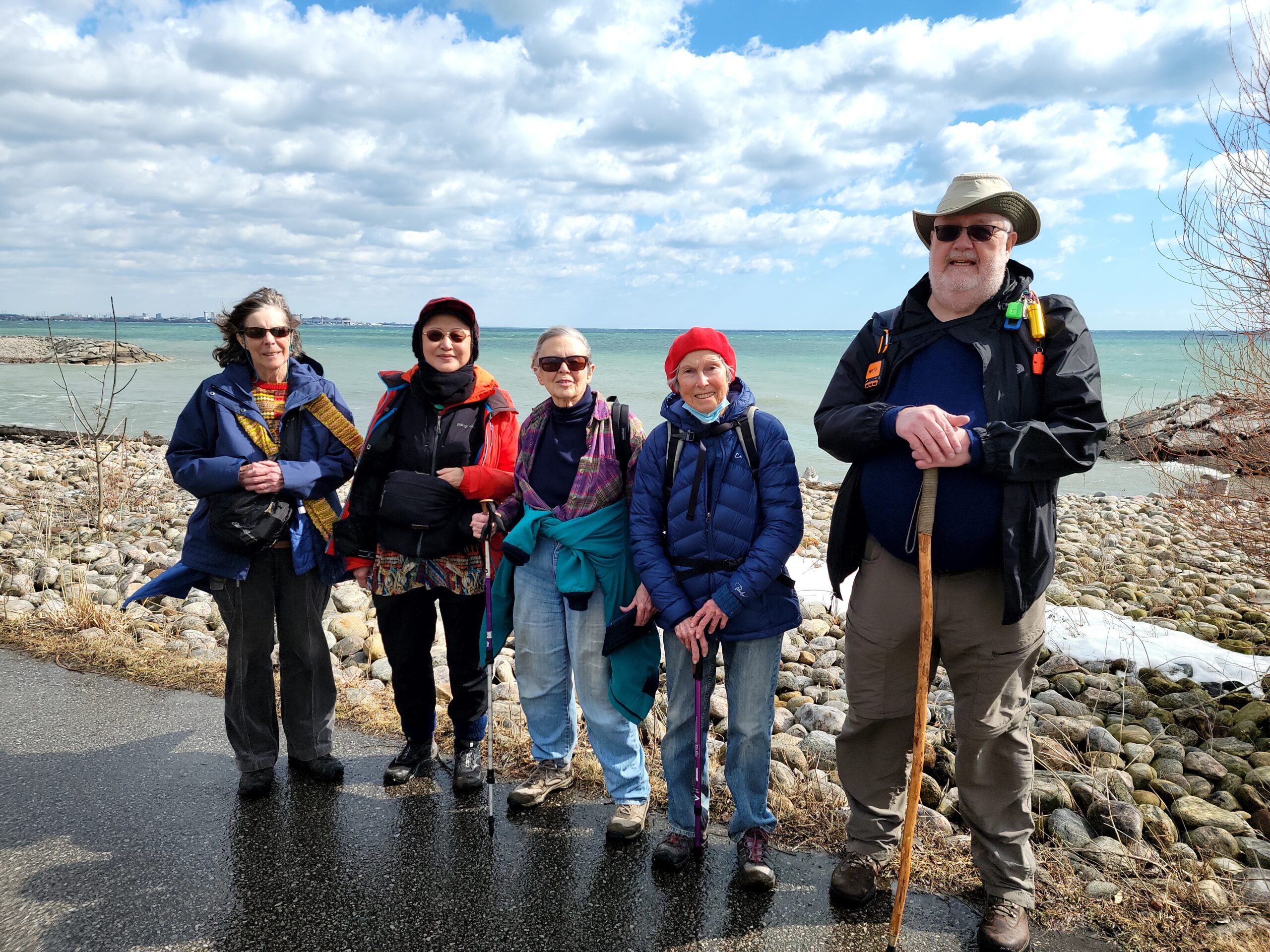
Waterfront Trail 8/8 - Beechgrove to Pickering!
https://hikesstaging.brucetrail.org/event/waterfront-trail-8-8-beechgrove-to-pickering/Sorry, the registration cut-off time for this hike has been reached.Not a member? Click here to join today!Hosting Club: Toronto
Category: Urban Walk
Location (Google Maps): Scarborough/Durham Waterfront TrailHike Leader(s): Brian Rideout Click here to contact Hike Leader(s)
Pace: Moderate
Terrain: Flat
Distance: 11.9 kmDescription
Please meet me at Kennedy Station by 10:04 am. There are a couple of trail closures on the Waterfront Trail so there is a change in the start point which means there is a change in the bus we take. We will take the 86 Scarborough bus departing 10:19 am. We will transfer to the 54 Lawrence Ave bus, arriving at Port Union Rd at 10:54 am. We start hiking 11:00 am.We will hike south to Lake Ontario and along the Waterfront Trail through Port Union and Rouge Hill to Pickering GO. The estimated distance is 9.8 km. Here is an online map of our route – Port Union to Pickering The route has changed slightly from when this hike was first posted.
Bring a snack, at least 2 liters of water, and icers. Dress for cold weather.
- Each hiker joining a Bruce Trail Club organized hike must perform a self-screening check before hiking.
- 26February 26, 2023

Halton Agreement Forest Winter Loops
https://hikesstaging.brucetrail.org/event/halton-agreement-forest-winter-loops/Sorry, the registration cut-off time for this hike has been reached.Not a member? Click here to join today!Hosting Club: Iroquoia
Category: General Hike
Location (Google Maps): Halton Agreement ForestHike Leader(s): Phillip Armstrong Click here to contact Hike Leader(s)
Pace: Medium – 3 to 4 km/hr
Terrain: Moderate – Some hills and/or some poor footing, Slippery Sections Likely
Distance: 12-16 km.Description
Come enjoy the many hiking trails of this wonderful forest area. Please meet at the corner of 10th Sideroad and Nassagaweya Fourth Line. Plenty of roadside parking. Mandatory icers, water and lunch to be enjoyed at Hilton Falls. Bring marshmallows to be roasted for the leader. Leader: Phill Armstrong 416 895 3937 hikingrandpa@gmail.com
Urban Walk: Waterfront Trail 7/8 - Brimley
https://hikesstaging.brucetrail.org/event/urban-walk-waterfront-trail-7-8-brimley-2/Sorry, the registration cut-off time for this hike has been reached.Not a member? Click here to join today!Hosting Club: Toronto
Location (Google Maps): Scarborough Waterfront Trail
Hike Leader(s): Brian Rideout Click here to contact Hike Leader(s)
Pace: Moderate
Terrain: Flat, Hilly
Distance: 11.4 kmDescription
Please join me at Kennedy Station by 10:15 am. We will take the 12 Kingston Rd bus departing 10:30 am, arriving 10:45 am.We will hike along Kingston Rd, down to and east along the Lake on the Doris MacCarthy Trail to Guildwood and then to Coronation Dr. The estimated distance is 11.4 km. Here is an online map of our route – Brimley to BeechgroveBring a snack, at least 2 liters of water, and icers. Dress for cold weather.
2:00 Discover BLACK HISTORY in NOTL
https://hikesstaging.brucetrail.org/event/200-discover-black-history-in-notl/Sorry, the registration cut-off time for this hike has been reached.Not a member? Click here to join today!Hosting Club: Niagara
Category: Urban
Location (Google Maps):Veteran’s Memorial Park. Park on King St. at Centre
Hike Leader(s): Karen Couch Click here to contact Hike Leader(s)
Pace: Medium
Terrain: Easy
Distance: 7 kmDescription
This hike will give us an opportunity to celebrate the strength and perseverance of the early Black community in what once once part of Upper Canada. This hike covers information from the Black History Series offered on Fridays this month in NOTL.We will end at the Niagara Historical Museum, where there is free admission to Niagara residents this month. Participants may want to consider visiting the museum before and/or after this hike. The galleries have integrated the Black history components into the main text, inclusive, not exclusive of other events.
Wear extra warm clothing as we will be stopping several times. While the terrain is easy, consider bringing your walking sticks and/or footwear with micro spikes. Sidewalks and streets may be icy.
- 27February 27, 2023
Frank Holley Side Trail and Fossil Glen
https://hikesstaging.brucetrail.org/event/frank-holley-side-trail-and-fossil-glen/Sorry, the registration cut-off time for this hike has been reached.Not a member? Click here to join today!Hosting Club: Sydenham
Category: Snowshoe Hike
Location (Google Maps): The Galaxy Theatre parking lot. Meet in the parking lot at the tall “Galaxy Centre” sign next to the traffic lights.
1020 10th St. W., Owen SoundHike Leader(s): Maureen McFarland Click here to contact Hike Leader(s)
Pace: Medium: 3 to 4 km/h
Terrain: Moderate: Some hills and/or poor footing, There might be icy and slippery sections.
Distance: 5 kmsDescription
We will hike the main trail and return via the Frank Holley loop where we pass the ruins of the Walker Homestead. We continue down the road allowance to access the Fossil Glen property at the south end, returning to the parking area via the main trail. There are many fossils to be seen on the underside of the rock overhang in this area. Map 33. Depending upon the conditions, icers or snowshoe may be needed. Poles are also useful.Please note: If you are unable to register or if you wish to meet at the hike start point, please call or text Maureen at 647-918-4180 (no calls after 10 pm please). The BTC hike schedule portion of the website will be down all day on February 27th for system upgrades.
- 28February 28, 2023
9:00 CHANGE LOCATION Rockway
https://hikesstaging.brucetrail.org/event/900-long-hike-wiley-road-short-hills-14/Sorry, the registration cut-off time for this hike has been reached.Not a member? Click here to join today!Hosting Club: Niagara
Location (Google Maps): Rockway Conservation Area
Hike Leader(s): Alan Laver Click here to contact Hike Leader(s)
Pace: Medium
Terrain: Moderate
Distance: 10kmDescription
Location change to Rockway. Explore Short Hills and the majestic side trails of Scarlett Tanager, Hemlock. Swayze Falls and Terrace. Register for each hike
Bring Poles water, snack and Dress for the weather, Icers and layers/p>
9:15 Short hike, Rotary Park, St. Catharines NOTE LOCATION CHANGE
https://hikesstaging.brucetrail.org/event/915-short-hike-pelham-road-short-hills-40/Sorry, the registration cut-off time for this hike has been reached.Not a member? Click here to join today!Hosting Club: Niagara
Location (Google Maps): Rotary Park, St. Catharines
Hike Leader(s): janet davey Click here to contact Hike Leader(s)
Pace: Medium
Terrain: Moderate
Distance: 6 kilometresDescription
Hike the main and side trails in Short Hills. Bring hiking boots, icers and water.Limehouse, Map 12
https://hikesstaging.brucetrail.org/event/limehouse-map-12-2/Sorry, the registration cut-off time for this hike has been reached.Not a member? Click here to join today!Hosting Club: Caledon Hills
Category: Tuesday Hikers
Location (Google Maps): Meet at: Limehouse Conservation Area, at baseball diamonds, access from Fifth Line.
Driving directions: Highway 401 going west, north on Trafalgar Road, drive to Highway 7, turn left on Highway 7, left on 22 Sideroad to Limehouse, keep left to cross a small bridge, turn left on Fifth Line, after climbing through a steep hill, parking is on the left.Hike Leader(s): Mohammad Shafiq Click here to contact Hike Leader(s)
Pace: Medium – 3 to 4 km/hour
Terrain: Moderate – some hills and/or some poor footing
Distance: 13 kmDescription
From parking, will access main Bruce Trail and head north for 6 kilometres, there and back; will also hike Black Creek and Todd Bordes Meadowland ST on the way, total of 13 km.
There are about 5 minutes neighborhood walk and 10 minutes road walk both ways.
Bring icers, poles, gaiters and dress in layers.
Bring water and snack as usual.Hike Leader contact # 416-566-0503 (on the day of hike, leave a ring and I will return call asap or leave sms)

Frosty Five Winter Blues Badge Series 5/5 Weekday
https://hikesstaging.brucetrail.org/event/frosty-five-winter-blues-badge-series-5-5-weekday/Sorry, the registration cut-off time for this hike has been reached.Not a member? Click here to join today!Hosting Club: Caledon Hills
Category: Tuesday Hikers
Location (Google Maps): Meet at roadside parking, km 16.1 along the southwest shoulder of the Willoughby Road and Escarpment Sideroad intersection. 43.831244, -79.980588 (Map 15, Edition 30)Directions: From ON-10 turn west onto Escarpment Sideroad. Drive for 1.6 kilometres to 2521 Escarpment Sideroad.
From here, we will carpool to the Forks of the Credit Provincial Park. Individuals can also choose to drive alone. Parking is by reservation and paid by car. Closer to the date, participants will be emailed to indicate travel preferences.
Hike Leader(s): Sandy Green Click here to contact Hike Leader(s)
Pace: Medium – 3 to 4 km/hour
Terrain: Strenuous – hilly with steep climbs and some poor footing
Distance: 12 kilometresDescription
Beat the winter blues! Register individually for one, a few, or all of our Frosty Five Winter Blues Weekday Badge hikes. Participants who complete all five hikes will be eligible to receive a CHBTC Winter badge and a Sideways badge on the final hike. Hike five explores the trails within the Forks of the Credit Provincial Park.Bring your choice of hydration and snacks. Hiking boots and icers/crampons are required. See January 3, January 17, January 31, and February 14 for details pertaining to the other hikes in the series. (Note: If you wish to purchase badges, the cost of each badge is $10.00 for BTC members and $15.00 for non-members.)
Primrose Loop Side Trail to Murphy's Pinnacle
https://hikesstaging.brucetrail.org/event/primrose-loop-side-trail-to-murphys-pinnacle/Sorry, the registration cut-off time for this hike has been reached.Not a member? Click here to join today!Hosting Club: Dufferin Hi-Land
Category: Tuesday Hike
Location (Google Maps): Dufferin Hi-land. Map 20. Meet at roadside parking on Prince of Wales Rd. (County Rd. 19) where the Primrose Loop Side Trail crosses Prince of Wales Rd. From Primrose (intersection of Hwy 10 and 89) drive north for about 1.5 km. Parking is about 0.7 km north of the bridge on the east side of the road.Hike Leader(s): Tony Evangelista, Les Babbage, Inge Eckerick, Julie Daley Click here to contact Hike Leader(s)
Pace: Medium
Terrain: Moderate, Slippery and Steep Sections
Distance: Long hike 7 km Short hike 3kmDescription
We will hike the Primrose Loop Side Trail on the west side of Prince of Wales Rd. Then, after crossing the road, we will head toward the Main Trail where we will turn left towards Murphy’s Pinnacle, climb to the top and take in the view. We will then return to Prince of Wales Rd. The short hike will return to their cars after completing the Primrose Loop Side Trail.Icers are recommended. Bring water and snacks. Snowshoes may be needed if the snow is deep.
Hamilton Soupfest
https://hikesstaging.brucetrail.org/event/hamilton-soupfest/Sorry, the registration cut-off time for this hike has been reached.Not a member? Click here to join today!Hike open to BTC Members only.
Hosting Club: Iroquoia
Category: General Hike
Location (Google Maps): Bayfront ParkHike Leader(s): Jill Parratt Click here to contact Hike Leader(s)
Pace: Medium – 3 to 4 km/hr
Terrain: Easy – Mostly flat and usually good footing
Distance: 6Description
Please meet at 9:45 for a 10am start at Bayfront Park.We will hike along the Bayfront waterfront path to the stairs by the canal. We will then hike to the Hamilton Convention Centre.
The Hamilton Soupfest supports Living Rock Youth Centre. $20 for 4 soup samples. Tickets can be bought in advance or online. https://www.livingrock.ca/soupfest
After soup, music etc we will walk back to our cars.
Any questions email or text me.
Jill Parratt
905-399-3601