
Hike Schedule
Join us for a hike! Registration required.
All hikes available to BTC members. Some hikes are open to non-members.
See Refund Policy for Paid Hikes >
TIP: The calendar view displays up to 7 hikes on a day, but often there are more. Click “View more events” to see them all.
Categories
- 16February 16, 2023
9:00 am Long Hike Jordan to Moyer / Louth
https://hikesstaging.brucetrail.org/event/900-am-long-hike-jordan-to-moyer-louth-37/Sorry, the registration cut-off time for this hike has been reached.Not a member? Click here to join today!Hosting Club: Niagara
Location (Google Maps):
Jordan Hollow Park 3039 King St Jordan
Pace: Medium
Terrain: Moderate
: 10kDescription
From Jordan Hollow Hike the main trail to Upper and Lower Balls Falls, Moyer Road or Louth and Return. You must register for each hike. Bring Poles, snack and a drink ices and dress for the weather
9:15 Short hike, Jordan Hollow
https://hikesstaging.brucetrail.org/event/915-short-hike-jordan-hollow-43/Sorry, the registration cut-off time for this hike has been reached.Not a member? Click here to join today!Hosting Club: Niagara
Location (Google Maps): Jordan Hollow Park Jordan
Hike Leader(s): Bill Russell Click here to contact Hike Leader(s)
Pace: Medium
Terrain: Strenuous
Distance: 6 kilometresDescription
Hike the main trail and side trails around Jordan and Balls Falls. Bring hiking boots, icers and water.Memorial Forest to Jones Falls Loop
https://hikesstaging.brucetrail.org/event/memorial-forest-to-jones-falls-loop-2/Sorry, the registration cut-off time for this hike has been reached.Not a member? Click here to join today!Hosting Club: Sydenham
Category: Snowshoe Hike
Location (Google Maps):Parking area at the west end of Young’s Drive, off Nicol’s Gully Road, east of km 105.8 (Map 32)
Hike Leader(s): Sheri Hatcher Click here to contact Hike Leader(s)
Pace: Medium: 3 to 4 km/h
Terrain: Moderate: Some hills and/or poor footing
Distance: Approximately 6 kmDescription
We will walk along the base of the escarpment on the Memorial Forest Side Trail and ascend through a crevasse to join the Main Trail along the top of the escarpment. We will head to Jones Falls and explore the area. We will then take the Merle Gunby Side Trail loop and join up with the Main Trail again. This hike ends with a steep descent back to the parking lot. Please arrive 15 minutes before the start time. If you are unable to register, please call or text the leader at 519-270-5068. - 17February 17, 2023
Feb. 17-20, 2023 - Family Day Snowshoe Weekend in Tobermory
https://hikesstaging.brucetrail.org/event/feb-17-20-2023-family-day-snowshoe-weekend-in-tobermory/Sorry, the registration cut-off time for this hike has been reached.Not a member? Click here to join today!This is a Multi-Day Hike
You are signing up for the following dates:
2023-02-17, 2022-11-18, 2022-11-19, 2022-11-20Hosting Club: Toronto
Category: TBTC Special Events
Location (Google Maps): Princess Hotel
34 BAY STREET SOUTH TOBERMORY, ONTARIO N0H 2R0, CANADAHike Leader(s): Jeanette Vincent, David Royle, and Brenda Menezes Click here to contact Hike Leader(s)
Pace: Moderate
Terrain: VariableDescription
Jeanette Vincent, Brenda and David Royle will continue the tradition of Greg Vincent’s Family Day Snowshoe Weekend in Tobermory. Celebrate with a weekend trip snowshoeing the trails of the National Park at the “Tip o’ the Bruce” Tobermory.We arrive Friday, February 17th at our comfortable hotel overlooking Little Tub Harbour where we stay and have our meals for three nights at the Princess Hotel in Tobermory.
This outing is restricted to those staying and having their meals with us at the Princess Hotel in Tobermory for the weekend. Please call the Princess for rates and a reservation 1-519-596-8282 and mention Vincent/Royle Winter Snowshoe weekend when booking. Or use the code vinfeb23 to book this package online. Once you have made your reservation, please email Jeanette at vincentjeanette1604@gmail.com

9:00 Niagara-on-the-Lake Tour - Black History
https://hikesstaging.brucetrail.org/event/900-niagara-on-the-lake-tour-black-history-2/Sorry, the registration cut-off time for this hike has been reached.Not a member? Click here to join today!Hosting Club: Niagara
Category: Loop
Location (Google Maps): Park on King St near Centre St, at the entrance to Veteran’s Memorial ParkHike Leader(s): Margaret Northfield Click here to contact Hike Leader(s)
Pace: Medium
Terrain: Easy
Distance: 6-8kmDescription
Black History Hike #3 – The Long Road to FreedomSince 1995, the government of Canada officially recognized February as Black History Month; a time when Canadians are invited to reflect, educate and engage in the ongoing fight against anti-Black racism and discrimination. This series of four hikes will give us an opportunity to celebrate the strength and perseverance of the early Black community here in Upper Canada.
Wear extra warm clothing as we will be stopping several times. While the terrain is easy, consider bringing your walking sticks and/or footwear with micro spikes. Sidewalks and streets may be icy.
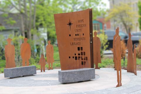
9:30 NOTL Black History SERIES - #3 of 4: The Long Road to Freedom
https://hikesstaging.brucetrail.org/event/930-notl-black-history-series-3-of-4-the-long-road-to-freedom/Sorry, the registration cut-off time for this hike has been reached.Not a member? Click here to join today!Hosting Club: Niagara
Category: Urban
Location (Google Maps):Veteran’s Memorial Park. Park on King St. at Centre.
Hike Leader(s): Karen Couch Click here to contact Hike Leader(s)
Pace: Medium
Terrain: Easy
Distance: 7.5 kmsDescription
Since 1995, the government in Canada officially recognized February as Black History Month; a time when Canadians are invited to reflect, educate and engage in the ongoing fight against anti-Black racism and discrimination. You will find out about some of those who fought enslavement, and how they were pivotal in shaping our society to be as diverse as it is today.Wear extra warm clothing as we will be stopping several times. While the terrain is easy, consider bringing your walking sticks and/or footwear with micro spikes. Sidewalks and streets may be icy.
- 18February 18, 2023
Winter Version R2R Mad River Rim #2 in a series of 3 hikes
https://hikesstaging.brucetrail.org/event/winter-version-r2r-mad-river-rim-2-in-a-series-of-3-hikes/Sorry, the registration cut-off time for this hike has been reached.Not a member? Click here to join today!Hosting Club: Blue Mountains
Category: Experienced hikers ONLY/STRENUOUS
Location (Google Maps): Parking at Devil’s Glen Provincial ParkHike Leader(s): Hart Fischer Click here to contact Hike Leader(s)
Pace: Brisk – 4 to 5 km/hr
Terrain: Strenuous – Hilly with steep climbs and some poor footing
Distance: 19.5kmDescription
**Note different meeting location: Parking at Devil’s Glen Provincial Park. We will start at Devil’s Glen white blazed trail and hike across to a steep, slippery slope reaching Sideroad 15/16 Nottawasaga meeting up with the Ganaraska Trail. Once reaching the Ganaraska sign you have completed half the hike and we will then retrace our steps back! COME PREPARED! Lots of water, snacks and lunch!Please be prepared with icers’s or snowshoes.Must register for this hike. No morning of sign-in.
Cancelled: Winter Coach Trip: Awenda Provincial Park
https://hikesstaging.brucetrail.org/event/winter-coach-trip-horseshoe-resort/Sorry, the registration cut-off time for this hike has been reached.Not a member? Click here to join today!Hosting Club: Toronto
Category: Cancelled
Location (Google Maps): Awenda Provincial ParkHike Leader(s): Martina Furrer, Tanya Cora, Nijole Mockevicius Click here to contact Hike Leader(s)
Description
Cancelled due to lack of registrants.Bus departs 10 York Mills Rd at 8:00 AM and Major Mackenzie Dr and HWY 400 Park and Ride at 8:20 AM. If you wish to be picked up at the Major Mackenzie Dr and HWY 400 Park and Ride, select that option when you register. Please arrive 15 minutes before departure. The bus waits for no one.
Mother nature isn’t cooperating. The coming week will be mild and rainy. Horseshoe only has a 5 to 10 cm base. We have no idea how it will hold up.
Nijole and Martina were in Awenda on Sat Feb 11 and conditions were perfect for everything. So we’re going to try Awenda Provincial Park again. Be prepared to pick your activity according to the conditions on Saturday. If snowshoeing is good – great! If winter hiking is better – enjoy! If skiing is possible – bonus! The trip will run no matter what (assuming we have enough registrants).
Driving time to Awenda is 1.75 hours. It’s so worth it to spend the day on the shore of Georgian Bay.
Winter hikers: Explore the trails on your own or join Nijole and Tanya for a guided 10 KM hike on Awenda’s beautiful winter trails. The hike will traverse parts of the Bluff, Wendat, and Connector trails, and will also circle around Kettle’s Lake. Mostly flat with a few short hills. Pace will be approximately 3 km/hr. Plenty of time to take pictures and enjoy the scenery. Skiers: If conditions allow, enjoy self-guided tours of Awenda’s beautiful ski trails with majestic views of Georgian Bay. No rentals. No food or drink.
For information about trail conditions visit: https://www.ontarioparks.com/skireport.
Coach fare must be paid online when you register. Park admission ($4 per person) will be collected in cash on the bus. No quarters, dimes or nickels will be accepted. Masks are mandatory while on the bus.
Car Hike: Hike of 2 lakes King city
https://hikesstaging.brucetrail.org/event/car-hike-hike-of-2-lakes-king-city-4/Sorry, the registration cut-off time for this hike has been reached.Not a member? Click here to join today!Hosting Club: Toronto
Category: Car Hike
Location (Google Maps): 14350 Dufferin Street King city,Park on Fairfield Drive or Dufferin Street, gathering at the entrance of trail at Dufferin Street,
Hike Leader(s): Mohammad Aghamiri , 19 Willowbrook Rd Click here to contact Hike Leader(s)
Pace: Moderate
Terrain: VariableDescription
We will hike along Seneca and Mary lakes.We will stop at Pine farm for coffee,tea and refreshment.

8:30 Niagara Winter End to End #5 Decew House to Woodend Conservation Area
https://hikesstaging.brucetrail.org/event/830-niagara-winter-end-to-end-5-decew-house-to-woodend-conservation-area/Sorry, the registration cut-off time for this hike has been reached.Not a member? Click here to join today!Hosting Club: Niagara
Category: Car Pool
Location (Google Maps): Meet at Woodend Conservation Area and Carpool to Decew HouseHike Leader(s): Alan Laver Click here to contact Hike Leader(s)
Pace: Medium
Terrain: Moderate
Distance: 14.5Description
We will be car pooling, Bring Icers and poles. No dogs. To earn your Niagara Winter End to End badge, it must be completed between December 21, 2022 to March 21, 2023.
Because of the potential for bad winter trail conditions we have broken this e2e into 6 hikes rather than 5
Frosty Five Winter Blues Badge Series 4/5 Weekend
https://hikesstaging.brucetrail.org/event/frosty-five-winter-blues-badge-series-4-5-weekend/Sorry, the registration cut-off time for this hike has been reached.Not a member? Click here to join today!Hosting Club: Caledon Hills
Category: General
Location (Google Maps): Meet at the BTC parking lot located off 7th Line immediately east of Airport Road. 43.960477, -79.979773 (Map 18, Edition 30)Directions: From Airport Rd/Peel Regional Rd 7 turn east onto 7 Line E/7 Line EHS. Drive for 60 metres.
Hike Leader(s): Sandy Green Click here to contact Hike Leader(s)
Pace: Medium – 3 to 4 km/hour
Terrain: Strenuous – hilly with steep climbs and some poor footing
Distance: 10 kilometresDescription
Beat the winter blues! Register individually for one, a few, or all of our Frosty Five Winter Blues Weekend Badge hikes. Participants who complete all five hikes will be eligible to receive a CHBTC Winter badge and a Sideways badge on the final hike. Hike four explores parts of the main Trail and Harmony, Hockleycrest and Darcy’s Side Trails in the south-east Hockley Valley area. Bring your choice of hydration and snacks. Hiking boots and icers/crampons are required. See January 7, January 21, February 4, and March 4 for details pertaining to the other hikes in the series. (Note: If you wish to purchase badges, the cost of each badge is $10.00 for BTC members and $15.00 for non-members.)
9:00 Hiking in and around Port Weller
https://hikesstaging.brucetrail.org/event/900-hiking-in-and-around-port-weller/Sorry, the registration cut-off time for this hike has been reached.Not a member? Click here to join today!Hosting Club: Niagara
Category: Hike
Location (Google Maps): Grantham Lions Club, corner of Niagara Street and Lakeshore Road, St. CatharinesHike Leader(s): Sheila Massey Click here to contact Hike Leader(s)
Pace: Medium
Terrain: Moderate
Distance: Approximately 9 kmDescription
Hiking various trails in Port Weller East and West; could be paved or trails depending on the mud.Dufferin Hi-Land Winter Badge Hike #4 of 4
https://hikesstaging.brucetrail.org/event/dufferin-hi-land-winter-badge-hike-4-of-4-3/Sorry, the registration cut-off time for this hike has been reached.Not a member? Click here to join today!Hosting Club: Dufferin Hi-Land
Category: General Hike
Location (Google Maps): Dufferin Hi-Land, Map 21. Meet at roadside parking on Prince of Wales Rd, about 1 km south of County Rd 21, where the Main Trail turns east from the road (Km 46.1).Hike Leader(s): Les Babbage;Helen Bailey Click here to contact Hike Leader(s)
Pace: Medium
Terrain: Moderate, Slippery and Steep Sections
Distance: 7.2 kmDescription
We will hike the Main Trail to Km 49.7 and back. The route features a large snowdrift at the top of Black Bank hill. Snowshoes will be required. Depending on conditions, icers may be required. Dress for winter conditions. Bring water, snacks and lunch. Hike leaders will contact all registered hikers a day or two before the hike to advise of trail conditions and any weather alerts.Nottawasaga Bluffs and Keyhole
https://hikesstaging.brucetrail.org/event/nottawasaga-bluffs-and-keyhole/Sorry, the registration cut-off time for this hike has been reached.Not a member? Click here to join today!Hosting Club: Blue Mountains
Category: Register on-line or sign-in morning of hike
Location (Google Maps): Hike meets in the parking lot behind Tim Hortons on First St. in Collingwood.Hike Leader(s): Dick Edwards Click here to contact Hike Leader(s)
Pace: Leisurely – 3 km/hr. or less
Terrain: Moderate – Some hills and/or some poor footing
Distance: 6kmDescription
Please be prepared with icers’s or snowshoes.We will drive to the parking lot at 15/16 Sideroad in Singhampton and explore the Nottawasaga Bluffs. This is a great place for snowshoeing and hiking, offering several options in length, difficulty, beauty and views. Bring a beverage and a light snack.10:00 Family Day Weekend Youth/Family Hike
https://hikesstaging.brucetrail.org/event/1000-family-day-weekend-youth-family-hike/Sorry, the registration cut-off time for this hike has been reached.Not a member? Click here to join today!Hosting Club: Niagara
Category: Youth Hike
Location (Google Maps): Louth Conservation AreaHike Leader(s): Alicia Aitchison Click here to contact Hike Leader(s)
Pace: Leisurely
Terrain: Moderate
Distance: ~4 kmDescription
Join us for some family fun with this Family Day Weekend Youth Hike!We will explore the trails through Louth Conservation Area. This hike can be used to earn one of the NBTC Youth Badges – check out our website for details!
Children must be accompanied by parent/grandparent/guardian.
Please be sure to register in advance as space is limited & the hike will be rescheduled in the event of BAD weather. Please register each family member.
Contact Alicia Aitchison with any questions – aliciaaitchison1@gmail.com

Urban Walk: Waterfront Trail 7/8 - Brimley
https://hikesstaging.brucetrail.org/event/urban-walk-waterfront-trail-7-8-brimley/Sorry, the registration cut-off time for this hike has been reached.Not a member? Click here to join today!Hosting Club: Toronto
Category: Urban Walk
Location (Google Maps): Scarborough Waterfront TrailHike Leader(s): Brian Rideout Click here to contact Hike Leader(s)
Pace: Moderate
Terrain: Flat, Hilly
Distance: 11.4 kmDescription
Please join me at Kennedy Station by 10:15 am. We will take the 12 Kingston Rd bus departing 10:30 am, arriving 10:45 am.We will hike along Kingston Rd, down to and east olong the Lake on the Doris MacCarthy Trail to Guildwood and then to Beechgrove Dr. The estimated distance is 11.4 km. Here is an online map of our route – Brimley to BeechgroveBring a snack, at least 2 liters of water, and icers. Dress for cold weather.Urban Walk: Central Don Parks
https://hikesstaging.brucetrail.org/event/urban-walk-central-don-parks/Sorry, the registration cut-off time for this hike has been reached.Not a member? Click here to join today!Hosting Club: Toronto
Category: Urban Walk
Location (Google Maps): Meet front entrance Civic Garden Centre Pavilion, Toronto Botanical Gardens – Leslie Street & Lawrence Avenue.
Take Bus #54 Lawrence or #51 Leslie from Eglinton Station on Line 1Hike Leader(s): Tom Swales Click here to contact Hike Leader(s)
Pace: Moderate
Terrain: Variable
Distance: 10-12 kmDescription
We’ll hike a couple of loops through Wilket Creek, Sunnybrook, ET Seton, and Serena Gundy Parks. Those who wish may join us for lunch or coffee at Corks Beer & Wine Bar in Longo’s in Leaside.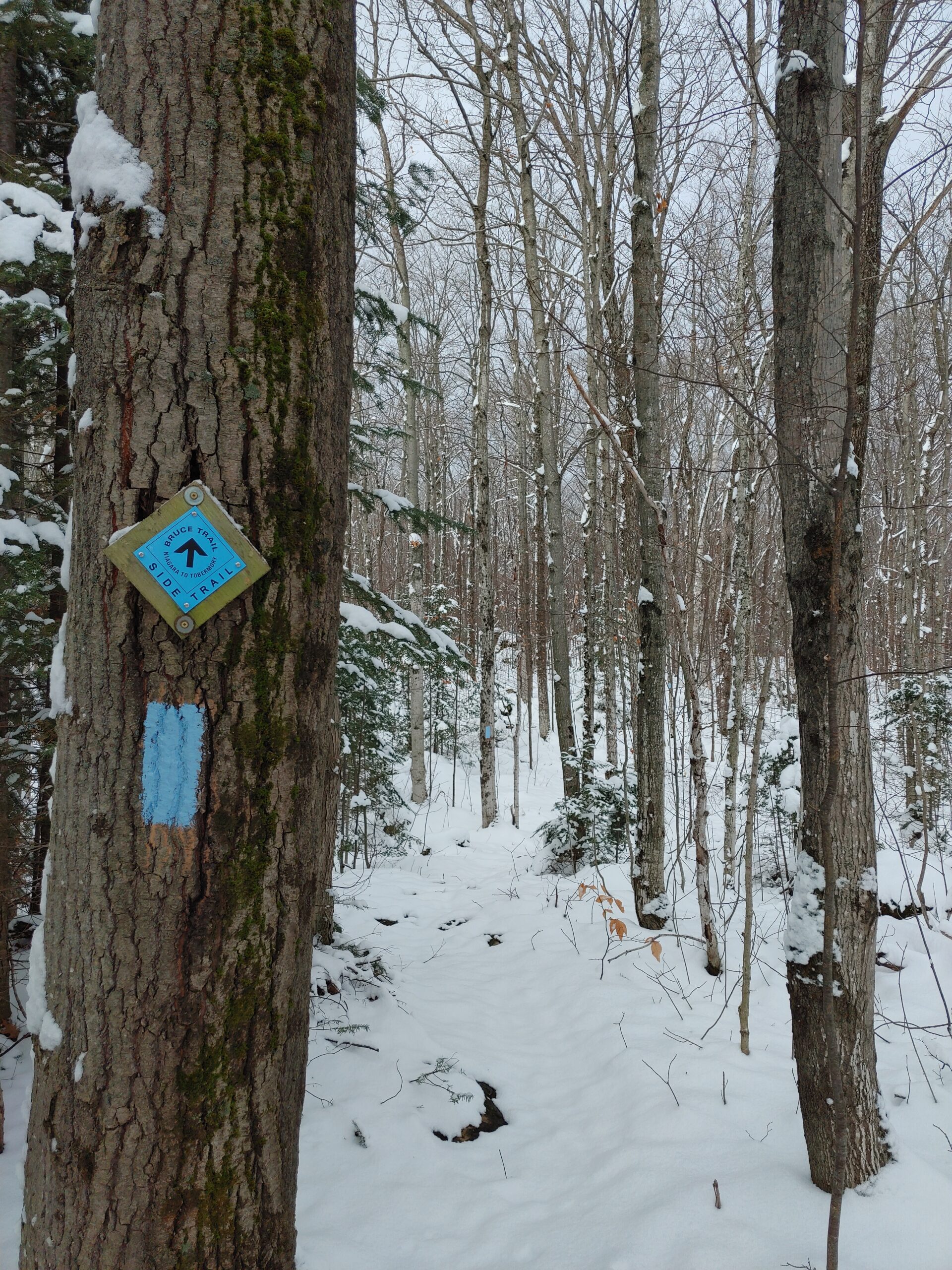
Family Day Weekend Hike - Warder Side Trail
https://hikesstaging.brucetrail.org/event/family-day-weekend-hike-warder-side-trail/Sorry, the registration cut-off time for this hike has been reached.Not a member? Click here to join today!Hosting Club: Peninsula
Location (Google Maps): Lion’s Head Rotary Club – 59 Main St, Lion’s Head, ON N0H 1W0
Hike Leader(s): Tamara Wilson Click here to contact Hike Leader(s)
Pace: Leisurely
Terrain: ModerateDescription
Join us for this Family Day Weekend Hike for some fun with the family!We’ll meet at Rotary Hall and hike for around 7 kilometers through Lion’s Head Village ST, part of the Bruce Main Trail, and Warder ST. We’ll head back to the Rotary Club for more talk and hot cocoa.
Please dress appropriately for the weather; layers, traction-enhancing footwear, hiking poles, and trail crampons are helpful in slick conditions.
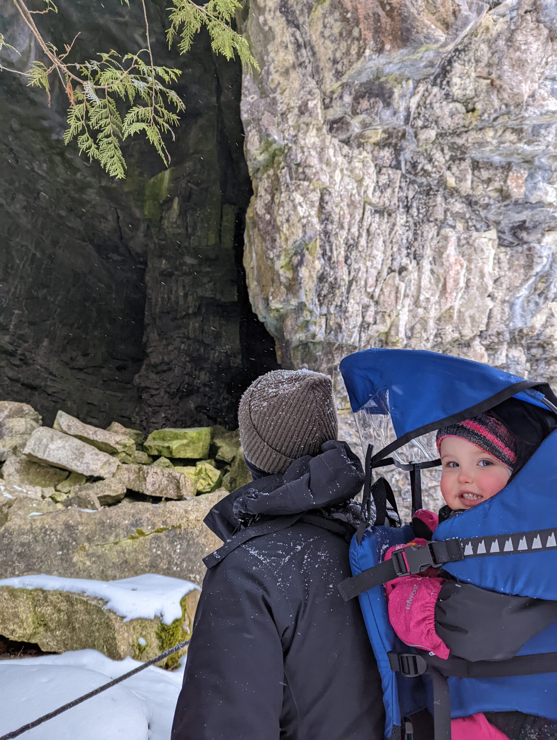
A Winter Hike for the Whole Family!
https://hikesstaging.brucetrail.org/event/a-winter-hike-for-the-whole-family/Sorry, the registration cut-off time for this hike has been reached.Not a member? Click here to join today!Hosting Club: Peninsula
Location (Google Maps): 59 Main St, Lion’s Head, ON N0H 1W0
Hike Leader(s): Leslie McBeth Click here to contact Hike Leader(s)
Pace: Leisurely
Terrain: Moderate
Distance: ~4kmDescription
Join us for a family friendly hike on Family Day! This hike is designed for both adults and children hiking with their families. We will take up the challenge of hiking 3 side trails: Lion’s Head Village
Sidetrail, Bannister’s Hill Side Trail, William’s Cave Side Trail. With only one more side trail, you can tell/draw your hiking story at the Rotary Centre and receive your Bear Cub Badge!The hike leaders will be hiking with a 3 year old and a 1 year old in carriers. We will keep a pace that is appropriate for children, and modify the route if required due to weather. Please come prepared in layered clothing, sturdy shoes and be ready for slick conditions on the trail (icers or crampons are recommended).
Meet at the Rotary Centre at 1 p.m. and join us after the hike for hot chocolate and board games!
Note: if you are bringing children, please also register them separately for the hike so we know how many to expect. Thank you!

Snowshoe Adventure Badge #2 of 2
https://hikesstaging.brucetrail.org/event/snowshoe-adventure-badge-2-of-2-2/Sorry, the registration cut-off time for this hike has been reached.Not a member? Click here to join today!Hosting Club: Beaver Valley
Location (Google Maps): Meet in the Grey Sauble Conservation Area parking lot at the end of the CA access road off Sideroad 7B, about 500 m south of km 43.5, Map 25, Edition 30. In winter Access Sideroad 7B from County Rd. 13, to Artemesia-Euphrasia Townline to 3rd Line A, then 7B. There is paid parking at this location.
Hike Leader(s): Glenda Collings Click here to contact the hike leader.
Pace: Medium
Terrain: Moderate, Some steep sections
Length of Hike: Approx. 5.5 km with the possibility of an extension depending on snow depth and how we feel.Description
This is the second hike of two to earn the Snowshoe Adventure badge. The hike will proceed without snowshoes if they’re not needed. Please do bring snowshoes and icers. We’ll be hiking along the escarpment through forest above the iconic Old Baldy cliffs and then returning to our cars. Some great views to be had!COVID-19 Precautions Before, During and After your Hike
- Each hiker joining a Bruce Trail Club organized hike must perform a self-screening check before hiking.
Find Ontario’s self-assessment tool here: https://covid-19.ontario.ca/self-assessment/ - If you are experiencing COVID-19 symptoms, stay home.
- Personal Protective Equipment:
- Hikers may choose to wear masks
Transportation
It is the Bruce Trail Conservancy’s current policy that car shuttles are allowed. It is at the discrepancy of individual hike leaders to make that decision.
Other Guidelines
- Arrive 15 minutes before the start of the hike.
- Wear sturdy footwear and appropriate attire for the weather and the terrain.
Hiking poles are a good idea in any season, especially if the terrain is rocky or slippery. In winter, snowshoes or icers/crampons are needed when conditions dictate.
Wearing appropriate clothing and footwear prevents injuries and shows consideration for a safe and positive group hiking experience. - Always carry I.D. and your health card.
- Bring sufficient water and snacks (or lunch if indicated). A minimum of 1L of water is recommended on all hikes, and 3L is recommended for long, challenging hikes in the heat of the summer.
- Bring sunscreen and insect repellent (for spring and summer hikes).
- Bring your own first aid kit.
- Please leave dogs at home.
- Each hiker joining a Bruce Trail Club organized hike must perform a self-screening check before hiking.
- 19February 19, 2023

9:00 Queenston Hike
https://hikesstaging.brucetrail.org/event/900-queenston-hike/Sorry, the registration cut-off time for this hike has been reached.Not a member? Click here to join today!Hosting Club: Niagara
Category: Loop
Location (Google Maps): Queenston Heights Park, 14184 Niagara Pkwy, Niagara-on-the-Lake, ON L0S 1J0Hike Leader(s): Dan Wilson Click here to contact Hike Leader(s)
Pace: Medium
Terrain: Moderate
Distance: 7kmDescription
Meet at the Southern Terminus cairn in the Queenston Heights parking lot. Please bring hiking poles and icers, in case it’s icy.Primrose/Boyne Valley Loop (Dufferin Hi-Land Section - Map 20)
https://hikesstaging.brucetrail.org/event/primrose-boyne-valley-loop-dufferin-hi-land-section-map-20/Sorry, the registration cut-off time for this hike has been reached.Not a member? Click here to join today!Hosting Club: Iroquoia, Dufferin Hi-Land
Category: General Hike
Location (Google Maps): Red P BTC parking lot on County Road 19 (Prince of Wales Road) 80 metres south of the southern end of the Prince of Wales Side Trail (about 1 km north of Primrose).Hike Leader(s): Stuart Law Click here to contact Hike Leader(s)
Pace: Medium – 3 to 4 km/hr
Terrain: Dependent on Conditions, Slippery and Steep Sections, Strenuous – Hilly with steep climbs and some poor footing
Distance: 13.5 kmsDescription
Join us for a winter walk in the Dufferin Hi-Lands on the Prince of Wales Side Trail, the Primrose Loop Side Trail, the Boyne Valley Side Trail and parts of the Main Trail. Please arrive at 9:15 am for a 9:30 start. Please bring icers, water, a warm drink, a snack, a lunch and an appreciation of nature. Consider bringing along snow shoes just in case there is sufficient snow. If we do snowshoe, hike length will be reduced accordingly. Snow shoes optional. Poles recommended. This hike has a lot of up and downs but is richly rewarding.
Urban Walk: Neilson Park to Centennial Park Loop Hike
https://hikesstaging.brucetrail.org/event/urban-walk-neilson-park-to-centennial-park-loop-hike/Sorry, the registration cut-off time for this hike has been reached.Not a member? Click here to join today!Hosting Club: Toronto
Category: Urban Walk
Location (Google Maps): Transit users meet Hike Leaders at Kipling Subway upper floor bus platforms near the washrooms by 9:15 am. We will be boarding the 112C West Mall TTC bus for a 9:22 departure. Coming directly to the hike, meet us by 9:45 am at Neilson Park Creative Centre, 56 Neilson Drive, Toronto. Neilson Drive runs north off of Dundas St. W, west of the 427 HWY and The West Mall.Hike Leader(s): Andrew Proczek; Ke Jia Chong Click here to contact Hike Leader(s)
Pace: Moderate
Terrain: Flat, Variable
Distance: 12.5 kmDescription
Join us for a winter’s hike along Etobicoke Creek to Centennial Park where we will transition from winter in deciduous forest to tropical, humid and warm when we visit Centennial Park Conservatory during our lunch stop. We will begin the hike form Neilson Park Creative Centre, hike the entire length of Markland Wood Golf Course to Burnhamthorpe Rd and then along nature trails as far as Eglington Ave where we will loop back along the Etobicoke Creek Trail to Centennial Park. After lunch we will return to Neilson Park by way of the Elmcrest Creek Trail. This is one of the nicest GTA urban loop hikes entirely in valleys, parks and green space.
Public Washrooms at Neilson Park Creative Centre and Centennial Park Conservatory.
Drop-outs at 5 km, 6.4 km and 9.1 km where you can take the TTC.
Online map of the route: https://onthegomap.com/s/85vmhkoo
Please pack a lunch, a thermos of your favourite hot beverage and your icers, in case we need them.

Urban Walk: Waterfront Trail 6/8 - Lakeshore East
https://hikesstaging.brucetrail.org/event/urban-walk-waterfront-trail-6-8-lakeshore-east-2/Sorry, the registration cut-off time for this hike has been reached.Not a member? Click here to join today!Hosting Club: Toronto
Location (Google Maps): Toronto/Scarborough
Hike Leader(s): Brian Rideout Click here to contact Hike Leader(s)
Pace: Moderate
Terrain: Flat
Distance: 10.9 kmDescription
Please join me at the Tim Horton’s at Lakeshore and Leslie no later than 9:50 am. We start hiking at 10:00 am.We will hike east on Lakeshore, along the Beaches Boardwalk, and on Kingston Rd to Brimley Rd. The estimated distance is 10.9 km. Here is an online map of our route Lakeshore to Brimley RdBring a snack, at least 2 liters of water, and icers. Dress for cold weather.
Youth Hike at Mud Lake (Ages 18-25 only) (CANCELLED)
https://hikesstaging.brucetrail.org/event/youth-hike-at-mud-lake-ages-18-25-only/Sorry, the registration cut-off time for this hike has been reached.Not a member? Click here to join today!Hosting Club: Niagara
Category: Youth Hike
Location (Google Maps): Mud Lake Conservation Area, between Welland and Port Colborne.When inputting it into your navigation, it will stop early, the parking lot has a name sign and is just south of where it takes you.
Hike Leader(s): Nolan Repovs Click here to contact Hike Leader(s)
Pace: Brisk
Terrain: Easy, Moderate
Distance: 3 kmDescription
Join me for our first youth hike on the calendar!A great chance to connect with like minded young people, and possibly network, or just enjoy the hike. Mud Lake features a large manmade lake that is shielded from most wind, making it a great spot to see birds
It’s looking like it will be just below zero degrees, and we can expect it to be very muddy! We will meet at the parking lot at noon, start the hike around 12:10pm
Ages 18-25 only
Snowshoe Lindenwood loop
https://hikesstaging.brucetrail.org/event/snowshoe-lindenwood-loop-3/Sorry, the registration cut-off time for this hike has been reached.Not a member? Click here to join today!Hosting Club: Sydenham
Category: Snowshoe Hike
Location (Google Maps):Parking lot on Lindenwood Rd., 900 m east of Grey Rd. 17, at km 128.4 (Map 33)
Hike Leader(s): Bill Snel Click here to contact Hike Leader(s)
Pace: Leisurely: 3 km/h or less
Terrain: Easy: Mostly flat and good footing.
Distance: 2.3 kmDescription
Easy snowshoe of the Lindenwood loop. If you are unable to register, please contact Bill Snel at w.snel2@gmail.com or landline (519) 470-0584.