
Hike Schedule
Join us for a hike! Registration required.
All hikes available to BTC members. Some hikes are open to non-members.
See Refund Policy for Paid Hikes >
TIP: The calendar view displays up to 7 hikes on a day, but often there are more. Click “View more events” to see them all.
Categories
- 05December 5, 2023
9:00 Staff Avenue Louth
https://hikesstaging.brucetrail.org/event/900-staff-avenue-louth/Sorry, the registration cut-off time for this hike has been reached.Not a member? Click here to join today!Hosting Club: Niagara
Category: Loop
Location (Google Maps):Staff Avenue Parking Lot
Hike Leader(s): Alan Laver Click here to contact Hike Leader(s)
Pace: Medium
Terrain: Moderate
Distance: 10kmDescription
CHANGE OF VENUE DUE TO DEER HARVEST Explore Louth Conservation area
Bring Poles water, snack, Icers and dress for the weather
9:15 Short Hike - Rotary Park, St. Catharines
https://hikesstaging.brucetrail.org/event/915-short-hike-rotary-park-st-catharines-10/Sorry, the registration cut-off time for this hike has been reached.Not a member? Click here to join today!Hosting Club: Niagara
Location (Google Maps): Rotary Park, St.Catharines
Hike Leader(s): janet davey Click here to contact Hike Leader(s)
Pace: Medium
Terrain: Moderate
Distance: 6 kmsDescription
Hike the trails around Rotary Park in St. Catharines. Bring water and hiking boots.7th Line North to loop through Hockleycrest
https://hikesstaging.brucetrail.org/event/7th-line-north-to-loop-through-hockleycrest/Sorry, the registration cut-off time for this hike has been reached.Not a member? Click here to join today!Hosting Club: Caledon Hills
Category: Tuesday Hikers
Location (Google Maps): Bruce Trail Parking Lot – 7th Line Access
Airport Road North of Highway 9
Right on 7th Line, parking lot immediately on the right (east) of Airport RoadHike Leader(s): Jennie Greenfield Click here to contact Hike Leader(s)
Pace: Medium – 3 to 4 km/hour
Terrain: Moderate – some hills and/or some poor footing
Distance: 10.5 kmDescription
Come on out and burn off a few calories before the holidays!We will hike the Main Trail north from 7th Line to 5 Side Road then loop through the beautiful Hockleycrest property on a combination of the Main Trail and Darcy, Hockleycrest and Harmony Side Trails before returning to 7th Line on the Main Trail. The terrain varies from rolling hills and open hilltops, hardwood bush and pine plantations. There will be a few ups and downs including one steep valley that we will ascend and descend on both the way out and back!
The leaves are down and can be slippery – hiking boots required, hiking poles are recommended.
There will be stops for water along the way and a longer snack / lunch break later in the hike. Bring plenty of water, and dress in layers appropriate for the cooler weather.
Dunby Rd, Hockley Valley and Cam Snell Side Trail
https://hikesstaging.brucetrail.org/event/dunby-rd-hockley-valley-and-cam-snell-side-trail/Sorry, the registration cut-off time for this hike has been reached.Not a member? Click here to join today!Hosting Club: Dufferin Hi-Land
Category: Tuesday Hike
Location (Google Maps): Caledon Hills Section, Map 18, 68.0
Bruce Trail parking lot on Dunby RdHike Leader(s): Julie Daley, Les Babbage, Inge Eckerich, Tony Evangelista Click here to contact Hike Leader(s)
Pace: Medium
Terrain: Moderate, Slippery and Steep Sections
Distance: 7 km, short hike 4kmDescription
From the parking lot on Dunby Rd, we will hike south 2 km (short hike returns from here), follow the Cam Snell Side Trail loop, and return on the main trail. Please bring a snack, appropriate clothing and equipment for the weather (ie poles and icers).

Sydenham Chipper (km44.2-29.4)
https://hikesstaging.brucetrail.org/event/sydenham-chipper-km44-2-29-4/Sorry, the registration cut-off time for this hike has been reached.Not a member? Click here to join today!Hosting Club: Beaver Valley
Location (Google Maps): Parking along the Townline
Map 30 ED 30
Km44.2Hike Leader(s): Kristina Rettie Click here to contact the hike leader.
Pace: Brisk
Terrain: Some rocky footing, Some steep sections, Strenuous
Length of Hike: 14.8kmDescription
Please join us as we chip away through the Sydenham section. This will be a series of 11 hikes that range between 13-19kms with one longer hike of 24km. We will begin our journey at the northern end of Sydenham and work our way south to try and avoid the dangers the falling leaves and snow will bring.If you complete the 11 hikes in this series you will qualify for Sydenham’s new independent badge. Please keep track of your hikes as each hiker will be submitting their own badge request.
All hikes in this series will include a car shuttle and everyone will take a turn as a shuttle driver. Please have your vehicle passenger ready.
Dec 5 hike – meet @km44.2 carpool to 29.4
** the meeting point/hike direction of this hike might flip depending on conditions of Bognor Marsh**
If you have any questions please text me @ 519-410-9077 (this is the most efficient way)
Please bring plenty of water and snacks/lunch
No dogs
Please text Kristina @ 519-410-9077 for morning of cancelations
COVID-19 Precautions Before, During and After your Hike
- Each hiker joining a Bruce Trail Club organized hike must perform a self-screening check before hiking.
Find Ontario’s self-assessment tool here: https://covid-19.ontario.ca/self-assessment/ - If you are experiencing COVID-19 symptoms, stay home.
Transportation
It is the Bruce Trail Conservancy’s current policy that car shuttles are allowed. It is at the discrepancy of individual hike leaders to make that decision.
Other Guidelines
- Arrive 15 minutes before the start of the hike.
- Wear sturdy footwear and appropriate attire for the weather and the terrain.
Hiking poles are a good idea in any season, especially if the terrain is rocky or slippery. In winter, snowshoes or icers/crampons are needed when conditions dictate.
Wearing appropriate clothing and footwear prevents injuries and shows consideration for a safe and positive group hiking experience. - Always carry I.D. and your health card.
- Bring sufficient water and snacks (or lunch if indicated). A minimum of 1L of water is recommended on all hikes, and 3L is recommended for long, challenging hikes in the heat of the summer.
- Bring sunscreen and insect repellent (for spring and summer hikes).
- Bring your own first aid kit.
- Please leave dogs at home.

Winter Festival of Lights Hike
https://hikesstaging.brucetrail.org/event/winter-festival-of-lights-hike-3/Sorry, the registration cut-off time for this hike has been reached.Not a member? Click here to join today!Hosting Club: Niagara, Dufferin Hi-Land
Category: Urban
Location (Google Maps): Meet in the parking lot of Floral Showhouse, 7145 Niagara River Pkwy, Niagara FallsHike Leader(s): Margaret Northfield Click here to contact Hike Leader(s)
Pace: Medium
Terrain: Easy
Distance: 5-7kmDescription
Get into the holiday spirit with the Annual Winter Festival of Lights. Hot apple cider & tea will be provided. Bring a holiday treat to share. - Each hiker joining a Bruce Trail Club organized hike must perform a self-screening check before hiking.
- 06December 6, 2023
Nottwasaga Bluffs Loop
https://hikesstaging.brucetrail.org/event/nottwasaga-bluffs-loop/Sorry, the registration cut-off time for this hike has been reached.Not a member? Click here to join today!Hosting Club: Blue Mountains
Category: Register in person the morning of hike.
Location (Google Maps): Hike meets in the parking lot behind Tim Hortons on First St. in Collingwood.Hike Leader(s): Richard Edwards Click here to contact Hike Leader(s)
Pace: Medium – 3 to 4 km/hr
Terrain: Moderate – Some hills and/or some poor footing
Distance: 6-8 kmDescription
From Tim’s in Collingwood we will proceed to the NVCA parking area at km 21.9 for a 6 to 8 km loop hike. Depending on the weather we may be wearing boots, icers or snowshoes, please come prepared. We will hike west from the start, make the big loop past the Keyhole Side Trail to the lookout and return via either the Betty Carter Side Trail or the Hamilton Bros. Side Trail. We will pass through the newly acquired Maplecross property. A stop for hot soup in Singhampton may be a desirable option. Bring a snack and water.
9:00 am Side Trail Challenge #2 - Alfred’s Trot, Upper Canada Trail (at York Road), Major Teyoninhokarawen/John Norton
https://hikesstaging.brucetrail.org/event/900-am-side-trail-challenge-2-alfreds-trot-upper-canada-trail-at-york-road-major-teyoninhokarawen-john-norton/Sorry, the registration cut-off time for this hike has been reached.Not a member? Click here to join today!Hosting Club: Niagara
Category: Loop
Location (Google Maps): Park at Queenston Heights parking near the washrooms. The main parking lot by the cairn is closed for winter.Hike Leader(s): Sam Rutherford Click here to contact Hike Leader(s)
Pace: Brisk
Terrain: Moderate
Distance: 7.6 kmsDescription
Take the main trail until it meets Major Tetoninhokarawen/John Norton ST. Take side trail until it meets Upper Canada ST. Take it until it meets the
main trail. Go left on the main trail, up the switchback and along Main Trail until it meets Alfred’s Trot ST. Take the side trail until it, once again meets the Main trail. Take the Main trail back to the cairn. Photos: Major T Side Trail sign, rock wall and kiln on Upper Canada ST, Alfred’s Trot ST signParticipate in all 9 scheduled hikes in the NBTC Side Trail Challenge or hike the side trails on your own. Submit your photos to collect the NBTC Side Trail badge.
http://niagarabrucetrail.club/wp/niagara-side-trails/

Webwood Falls
https://hikesstaging.brucetrail.org/event/webwood-falls/Sorry, the registration cut-off time for this hike has been reached.Not a member? Click here to join today!Hosting Club: Beaver Valley
Location (Google Maps): Meet in the BTC parking lot on Grey Road 40, Km 105.7 Map 28 Edition 31
Hike Leader(s): Margaret Yaraskavitch Click here to contact the hike leader.
Pace: Medium
Terrain: Moderate
Length of Hike: 4.6 kmDescription
We gather in the somewhat new BTC parking lot on Grey Road 40. Our Trail takes us a short distance across a field and then into a forest. Then it’s a country walk beside farm fields towards Webwood Falls. We will view the Falls and poke around the old Harwood Farm to see features left behind from farmstead days. They we return back to our vehicles.Across the Creek
https://hikesstaging.brucetrail.org/event/across-the-creek/Sorry, the registration cut-off time for this hike has been reached.Not a member? Click here to join today!Hosting Club: Iroquoia
Category: Good Companions
Location (Google Maps): Hilton Falls Conservation Area, Campbellville Rd.Hike Leader(s): Anne Armstrong Click here to contact Hike Leader(s)
Pace: Leisurely – 3km/hr or less
Terrain: Dependent on Conditions, Moderate – Some hills and/or some poor footing
Distance: Approx. 8 km.Description
Enjoy a hike to Hilton Falls, across the creek and beyond. The trail is flat with some rocky sections. We will pass a beautiful flooded area to our turn around spot which has a lovely patch of Walking Fern. Meet at 9:45 am. for a 10:00 am. start in the main parking lot. Bring water, a snack and walking poles if using. Icers may be necessary. Who knows what Mother Nature has in store for us. Registration required with Halton Parks. If cancelling the morning of the hike please text hike leader.
Leader: Anne Armstrong 905 617 3937Urban Owen Sound Hike to view the Festival of Northern Lights followed by an Opportunity for Refreshments
https://hikesstaging.brucetrail.org/event/urban-owen-sound-hike-to-view-the-festival-of-northern-lights-followed-by-an-opportunity-for-refreshments/Sorry, the registration cut-off time for this hike has been reached.Not a member? Click here to join today!Hosting Club: Sydenham
Category: An evening walk.
Location (Google Maps): Meet in the municipal parking lot by the river on the west side of 1st Ave. E between 7th St. E and 8th St. E in Owen Sound.Hike Leader(s): Harriet Nixon Click here to contact Hike Leader(s)
Pace: Brisk: 4 to 5 km/h
Terrain: Moderate: Some hills and/or poor footing, There might be icy and slippery sections.
Distance: Approx 5 kmDescription
Join us for an evening hike to view the Festival of Northern Lights displays in the River District and Harrison Park in Owen Sound. Bring icers to wear if it is icy. There will be an opportunity for refreshments following the hike. There is no need to show up 15 minutes early, but the hike will start at 7:00 pm promptly. For further information contact Hike Leader Harriet Nixon at 519-373-6598 or harrietnixon@bmts.com - 07December 7, 2023
9:00 am Long Hike Jordan to Moyer / Louth
https://hikesstaging.brucetrail.org/event/900-am-long-hike-jordan-to-moyer-louth-48/Sorry, the registration cut-off time for this hike has been reached.Not a member? Click here to join today!Hosting Club: Niagara
Category: In and Out
Location (Google Maps):Jordan Hollow Park 3039 King St Jordan
Hike Leader(s): Alan Laver Click here to contact Hike Leader(s)
Pace: Medium
Terrain: Moderate
Distance: 10kDescription
From Jordan Hollow Hike the main trail to Upper and Lower Balls Falls, Moyer Road or Louth and Return. You must register for each hike. Bring Poles, sunscreen, bug spray , snack and a drink and dress for the weather
9:15 Short Hike - Jordan Hollow
https://hikesstaging.brucetrail.org/event/915-short-hike-jordan-hollow-86/Sorry, the registration cut-off time for this hike has been reached.Not a member? Click here to join today!Hosting Club: Niagara
Category: Loop
Location (Google Maps): Jordan Hollow Park, Jordan StationHike Leader(s): Bill Russell Click here to contact Hike Leader(s)
Pace: Medium
Terrain: Moderate
Distance: 6 kmsDescription
Hike the main and side trails around Jordan and Ball’s Falls. Bring water and hiking boots.
The view from Dewitt Hill
https://hikesstaging.brucetrail.org/event/the-view-from-dewitt-hill/Sorry, the registration cut-off time for this hike has been reached.Not a member? Click here to join today!Hike open to BTC Members only.
Hosting Club: Iroquoia
Category: Thursday Group
Location (Google Maps): Meet at the start of the Lewis Road Side Trail km 11.1, Map 6 of the BTC guide. Please do not block driveways. We will hike from Lewis Road to Dewitt Road and back. Great views from Dewitt road. Conditions could be a mix so have icers ready. Bring water and snack. There will be an optional lunch at the Menphis BBQ nearby after the hike.Hike Leader(s): Paul Toffoletti Click here to contact Hike Leader(s)
Pace: Medium – 3 to 4 km/hr
Terrain: Dependent on Conditions, Moderate – Some hills and/or some poor footing
Distance: 9 kmDescription
Explore the Interior of Skinner’s Woods
https://hikesstaging.brucetrail.org/event/explore-the-interior-of-skinners-woods/Sorry, the registration cut-off time for this hike has been reached.Not a member? Click here to join today!Hosting Club: Sydenham
Category: General Hike
Location (Google Maps):Roadside parking on Gleason Lake Rd at the corner of Colpoy’s Range Rd (where the Curly Harnden and Len Holley Side Trails meet), south of km 163.1 (Map 35)
Hike Leader(s): Robert Knapp Click here to contact Hike Leader(s)
Pace: Medium: 3 to 4 km/h
Terrain: Moderate: Some hills and/or poor footing
Distance: 6 kmDescription
This loop hike begins with the Len Holley Side Trail, then follows the snowmobile trail to the Skinner’s Woods Side Trail. We will return to our cars via the Len Holley Side Trail. Bring a snack. Approx. 3 hours. If you have difficulty registering, please call or text 647-918-4180.
Joshua Creek Meander
https://hikesstaging.brucetrail.org/event/joshua-creek-meander/Sorry, the registration cut-off time for this hike has been reached.Not a member? Click here to join today!Hosting Club: Iroquoia
Category: Easy Does It Hikes
Location (Google Maps): OakvilleHike Leader(s): Anne Armstrong Click here to contact Hike Leader(s)
Pace: Leisurely – 3km/hr or less
Terrain: Dependent on Conditions, Easy – Mostly flat and usually good footing
Distance: Approx. 8 – 9 km.Description
Join in for a meander down to Lake Ontario, following Joshua Creek. We will return to our start using mostly the same route. Meet at 9:45 am. for a 10:00 am.start in the parking lot of Maplegrove Mall at the corner of Maplegrove and Cornwall Rd. Park near Tim Horton’s. Bring water and a snack. Icers may be necessary. This will be a leisurely pace hike, suitable for new hikers and those wanting a slower pace. If cancelling the morning of the hike please let the leader know by email or text.
Leader: Anne Armstrong 905 617 3937 hikingrandma@ gmail.com.
Easy Hike - Shining Rainbow Deer Sanctuary
https://hikesstaging.brucetrail.org/event/easy-hike-shining-rainbow-deer-sanctuary/Sorry, the registration cut-off time for this hike has been reached.Not a member? Click here to join today!Hosting Club: Peninsula
Location (Google Maps): 446 Cape Hurd Road, Tobermory, Ontario
Hike Leader(s): Marg Glendon Click here to contact Hike Leader(s)
Pace: Leisurely
Terrain: Easy
Distance: 3 1/2 KMDescription
Shining Rainbow Deer Sanctuary – 3 ½ km boardwalk and forest path – teardrop shaped hike. This is a very pretty hike which meanders through a thriving marsh ecosystem and cedar forest. You feel immersed in the marsh – without getting wet! We will stop at the birding platform to enjoy the soft colours of late Fall and early Winter, in its peace and solitude at this time of year. If you wish to remain here to take in the quiet of the marsh, the hike sweep will keep you company. The rest of the hiking group will continue our adventure through the woods, returning to join you at the birding platform. The hike includes some boardwalk walking which can be slippery in spots. The rest of the hike is on generally flat forest floor terrain.NCC hike interpreter, Justin Johnson will join us for the hike – what a special treat. Thank you Justin! Nature Conservancy Canada protects and cares for this property. We are grateful for their stewardship.
Parking: Roadside parking. Park on the east side of Cape Hurd Road near the entrance to Shining Rainbow Deer Sanctuary.
No washrooms onsite.
Wear layers, hat and warm mittens and boots. Bring a light back pack with water and snack.
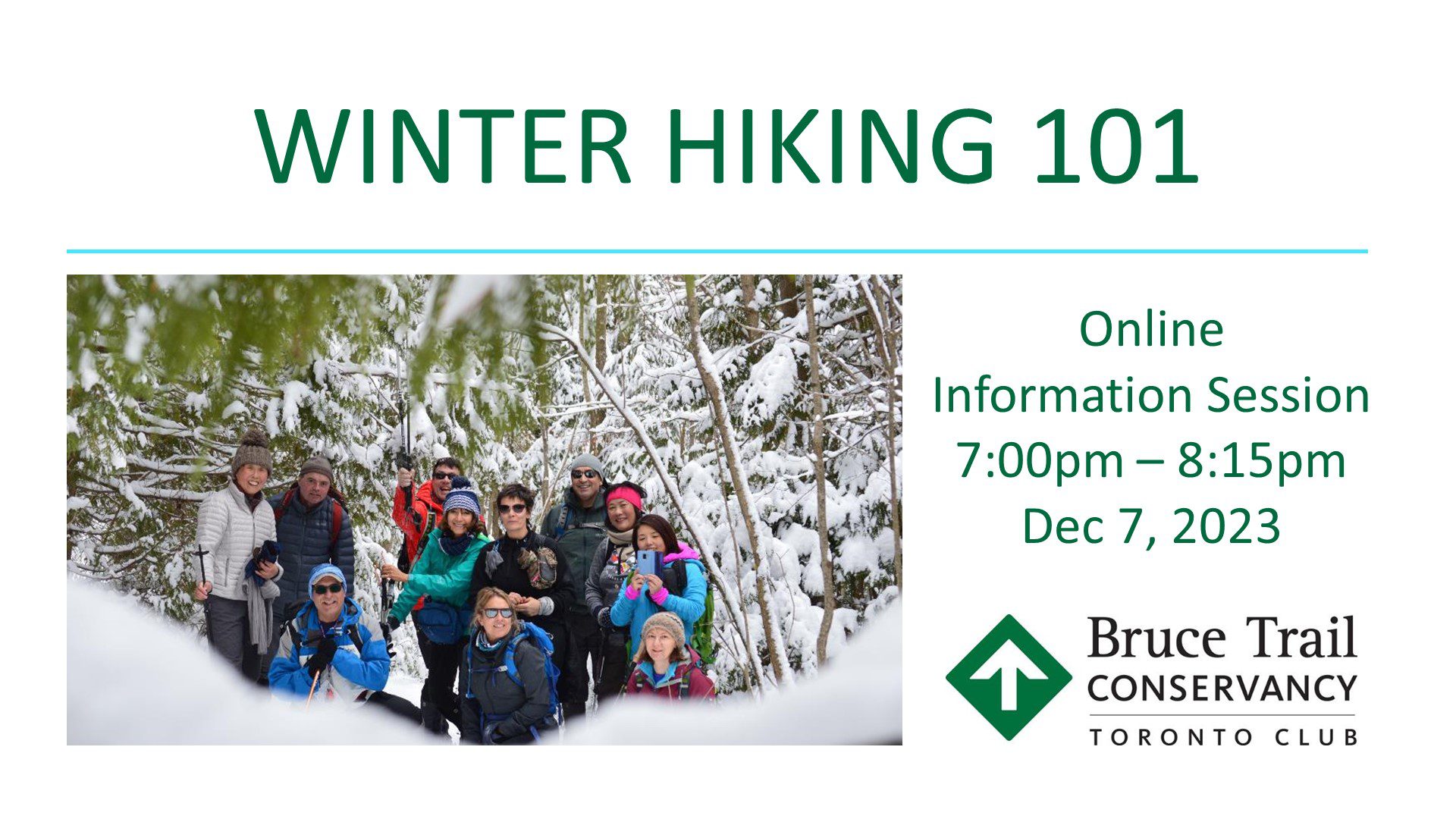
Winter Hiking 101 - Virtual Information Session
https://hikesstaging.brucetrail.org/event/winter-hiking-with-toronto-bruce-trail-club-virtual-information-session/Sorry, the registration cut-off time for this hike has been reached.Not a member? Click here to join today!Hosting Club: Toronto
Category: TBTC Special Events
Location (Google Maps):Virtual on Zoom.
Hike Leader(s): Alina Lin, Tom Swales
Distance: 0
Description
“If you choose not to find joy in the snow, you will have less joy in your life but still the same amount of snow” – so why don’t give yourself a try of winter hiking? If you are new to hiking, or have hiked a lot in spring, summer and fall but never in winter, and want to know how to enjoy the winter hiking with the Toronto Bruce Trail Club, or by yourself in a safe style, welcome to join this online information session. This virtual information session will provide all answers to questions that you would want to ask, including:- The Bruce Trail and the Club;
- Different types of hiking programs;
- How to join a group hike organized by the Bruce Trail Club;
- How to prepare for winter hikes;
- Winter Hiking Badge;
- Our Winter Coach Program.
Zoom invitation will be sent to your at noon on Dec 7. Please check your primary folder as well as the Spam folder just in case.
- 08December 8, 2023

Niagara-on-the-Lake Tour
https://hikesstaging.brucetrail.org/event/niagara-on-the-lake-tour-47/Sorry, the registration cut-off time for this hike has been reached.Not a member? Click here to join today!Hosting Club: Niagara
Category: Urban
Location (Google Maps): Meet on King St near Centre St at the entrance to Veteran’s Memorial ParkHike Leader(s): Margaret Northfield Click here to contact Hike Leader(s)
Pace: Medium
Terrain: Easy
Distance: 5-6kmDescription
Each Friday we will explore different neighbourhoods, trails and parkland throughout Historic Niagara-on-the-Lake.
Moderate pace with some weeks entirely on sidewalks and roads while others may include a mix of trails and paved pathways. Great way to build up endurance for longer more strenuous hikes.
Prepare for cooler windy conditions on open parkland and along Lake Ontario and Niagara River trails.
Plan to stay for conversation and a warm cup of coffee or tea at Sweets & Swirls, Community Centre, Niagara Stone Road, NOTL
Hamilton Rail Trail
https://hikesstaging.brucetrail.org/event/hamilton-rail-trail-2/Sorry, the registration cut-off time for this hike has been reached.Not a member? Click here to join today!Hosting Club: Iroquoia
Category: Good Companions
Location (Google Maps): 101 Osler Dr in Dundas, behind the Shoppers Drug Mart, in the parking area adjacent to the trailheadHike Leader(s): Gayle Laws Click here to contact Hike Leader(s)
Pace: Medium – 3 to 4 km/hr
Terrain: Easy – Mostly flat and usually good footing
Distance: 9Description
This leisurely hike is on a wide path, mostly flat but with a slight ascent to the train station. We will stop at the station for washrooms and snack before heading back. Please arrive at 9:45 in the parking lot for a 10:00 sharp start. Dress warmly and wear good footwear in case there is some ice on the path. Sometimes we need encouragement to get out in the winter, so join in this social walk. The hike will be cancelled if the weather is poor weather. Please text Gayle at 905 270 8588 if you need to cancel shortly before the hike commences.
Easy Hike - Hike! Cool Down! Celebrate!
https://hikesstaging.brucetrail.org/event/easy-hike-hike-cool-down-celebrate/Sorry, the registration cut-off time for this hike has been reached.Not a member? Click here to join today!Hosting Club: Peninsula
Location (Google Maps): Meet up location: We will meet at The Meeting Place – 20 Centennial Dr,Tobermory. Leave some cars here and drive to our starting point at the Bruce Peninsula National Park Visitor’s Centre. Map 42
Hike Leader(s): Marg Glendon Click here to contact Hike Leader(s)
Pace: Leisurely, Medium
Terrain: Easy, Moderate
Distance: ~3 KMDescription
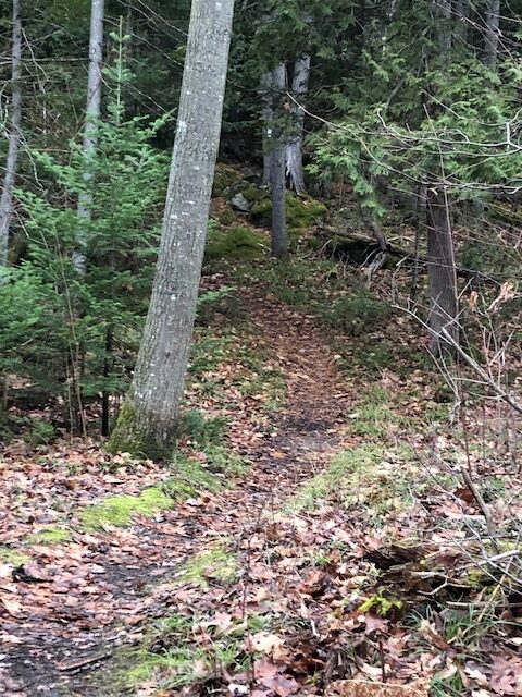
Holiday season brings joy and sometimes a little stress. Take a hike with us to find the balance you need to embrace the festive season.Our final hike of the Easy Hike series is a carpool hike. Meet at the Meeting Place, 20 Centennial Drive, Tobermory. We will leave some cars here and carpool to our starting point – Northern Cairn in the village of Tobermory. We will hike along the Bruce Trail to Dunks Bay Road and return to the Meeting Place via Dunks Bay Road. The trail includes some short inclines and uneven terrain with roots and rocks.
We are grateful to Laura Stevenson, Registered Massage Therapist for joining us today, as we learn about the role of a Registered Massage Therapist and the benefits of stretching and cooling down after exercise. Laura will share some tips which can be integrated into your routine hike practice, helping to reduce the risk of injury on the Bruce Trail!
Celebrate the completion of our hike series and the upcoming holiday season. Holiday cider and shortbread awaits at the Meeting Place!
Please consider bringing a canned good donation for the Tobermory Food Bank.