
Hike Schedule
Join us for a hike! Registration required:
All hikes available to BTC members. Some hikes are open to non-members.
TIP: The calendar view displays up to 7 hikes on a day, but often there are more. Click “More events” to see them all.
Categories
- 02December 2, 2023
Bus Hike Nottawasaga Bluffs and Holiday Luncheon
https://hikesstaging.brucetrail.org/event/bus-hike-noisy-river-and-holiday-luncheon/Sorry, the registration cut-off time for this hike has been reached.Not a member? Click here to join today!Trip Information
Departure Time: 08:00
Return to City Time: 19:00
Departure Point: York Mills Bus PickupOptional Items
Mylar burger ($33)
Chicken caesar wrap ($33)
Fish & chips ($33)
Vegetarian lasagna ($33)
Eggplant parmesan ($33)Hosting Club: Toronto
Category: Bus Hike
Location (Google Maps): Nottawasaga Bluffs Conservation AreaHike Leader(s): Martina Furrer, Nijole Mockevicius, Roland Mark Click here to contact Hike Leader(s)
Pace: Moderate
Terrain: Hilly, VariableDescription
Join us for a fun hike with great views in Nottawasaga Bluffs Conservation Area. We will hike for about four hours at a 3.5 km/hr pace, explore the Key Hole Side Trail and enjoy the view from the Nottawasaga Bluffs Lookout. After the hike we will go to Mylar and Loreta’s for a holiday luncheon. When you register, please select one of the lunch choices listed under optional items. All regular entrées include fries, dessert bar and non-alcoholic beverage. Vegetarian entrées include salad, dessert bar and non-alcoholic beverage. Tax and gratuity are included in the prices. Beer and wine are extra. You will need to pay your bus fare when you register. E-transfer you lunch money ($33 per person) to martinabeatrice@gmail.com.Important: Please register by Sat Nov 25.
Bus departs from 10 York Mills Rd at 8 AM. We hope to be back in Toronto around 7 PM.
Car Hike: Glasgow Village Whitchurch-Stouffville
https://hikesstaging.brucetrail.org/event/car-hike-glasgow-village-whitchurch-stouffville-6/Sorry, the registration cut-off time for this hike has been reached.Not a member? Click here to join today!Hosting Club: Toronto
Category: Car Hike
Location (Google Maps): Glasgow Trail, Concession Road 2 Park in parking lot at the trail head.From Highway 404 turn right to Stouffville Rd, till to the end of road and turn left on York Durham Line. In About 1km turn right to Webb Rd. and turn right to Concession Road 2 ,you will see parking lot in 500 metres,
Hike Leader(s): Mohammad Aghamiri , Click here to contact Hike Leader(s)
Pace: Moderate
Terrain: Variable
Distance: 14-17KMDescription
Approximately 5-hour hike, mostly flat, in the Uxbridge areaIt is wintertime, please bring your icers, hiking poles, warm layers of clothing, boots, and hot drinks.
Some safety procedures during the hike:
1-Hikers must stay between the leader and the sweep.
2-Hikers must advise the leader or the sweep if they wish to leave the group.
3- Hikers must follow the whistle instructions: 1 blast- stay where you are; 2 blasts come to the leader; 3 blasts – come to the leader quickly.
4-Hike leader may request volunteers to stop at trail intersections, they need to help hikers to the direction the group walk and wait till they see the sweep .
5-Hikers have to make sure they can see the persons behind and in front of them.
Path of the Petun
https://hikesstaging.brucetrail.org/event/path-of-the-petun/Sorry, the registration cut-off time for this hike has been reached.Not a member? Click here to join today!Hosting Club: Blue Mountains
Category: Register in person the morning of hike.
Location (Google Maps): Hike meets in the parking lot behind Tim Hortons on First St. in Collingwood.Hike Leader(s): Annette Sandberg Click here to contact Hike Leader(s)
Pace: Leisurely – 3 km/hr. or less
Terrain: Moderate – Some hills and/or some poor footing
Distance: 6 kmDescription
We will park the most easterly end of the 6th Sideroad. Hike with me on the Path of the Petun and learn about a great battle that was fought between the Iroquois and the Petun at the Petun Village of Etharita, also known as the “St. Jean”. As we hike along the escarpment ridge, we will use our imaginations to see the Battle Ground and what this beautiful area was like in the mid 1600’s. We will then take the Russ McConnell Sidetrail back to our cars.
Woodend to Fireman's Loop
https://hikesstaging.brucetrail.org/event/woodend-to-firemans-loop/Sorry, the registration cut-off time for this hike has been reached.Not a member? Click here to join today!Hosting Club: Niagara
Category: Loop
Location (Google Maps): Meet at the entrance to Woodend Conservation Area, Taylor Rd, Niagara-on-The-Lake.Hike Leader(s): Margaret Northfield Click here to contact Hike Leader(s)
Pace: Medium
Terrain: Moderate
Distance: 10-12kmDescription
Hike around Woodend and into the Fireman’s Park, looping back to Woodend. Bring water and a snack.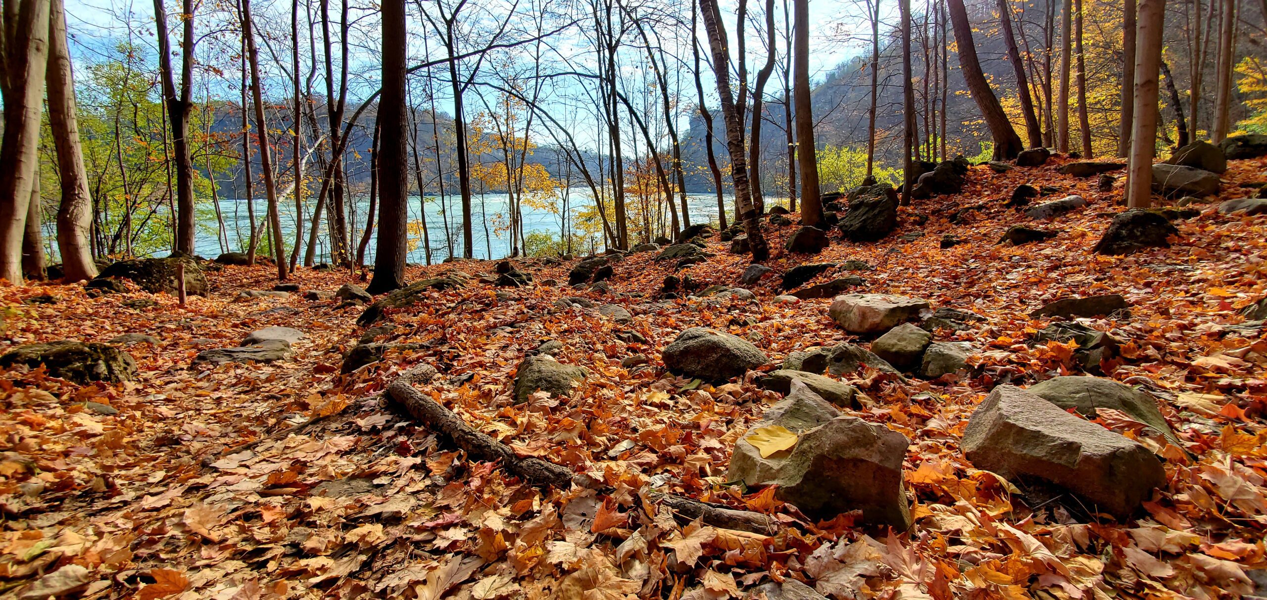
9:00 Niagara Glen Hike
https://hikesstaging.brucetrail.org/event/900-niagara-glen-hike-3/Sorry, the registration cut-off time for this hike has been reached.Not a member? Click here to join today!Hosting Club: Niagara
Category: Register
Location (Google Maps): Meet at the Niagara Glen Nature Centre parking lot, 3050 Niagara Parkway, Niagara Falls. This is located between the Whirlpool Golf Course and the Niagara Botanical Gardens, on the river side of the Niagara Parkway. Parking fees may apply.Hike Leader(s): Dan Wilson Click here to contact Hike Leader(s)
Pace: Medium
Terrain: Strenuous
Distance: 10kmDescription
Hike deep in the Niagara Gorge, along stairways cut into the rock and rugged paths that wind through this pristine pocket of Carolinian Forest. View ancient geological formations and fossils dating back millions of years, while hiking along the turbulent rapids of the Niagara River. This is a strenuous hike and there is a chance hikers will get wet. Bring icers, gaiters and hiking poles, if necessary. Dress appropriately.Sydenham Chipper (km44.2-68.4)
https://hikesstaging.brucetrail.org/event/sydenham-chipper-km44-2-68-4-2/Sorry, the registration cut-off time for this hike has been reached.Not a member? Click here to join today!Hosting Club: Beaver Valley
Location (Google Maps): Parking along St. Vincent-Sydenham Townline
Map 30 ED 30-Km44.2
Map 31 ED 31-km41.7Hike Leader(s): Kristina Rettie Click here to contact the hike leader.
Pace: Brisk
Terrain: Some rocky footing, Strenuous
Length of Hike: 24.2Description
Please join us as we chip away through the Sydenham section. This will be a series of 11 hikes that range between 13-19kms with one longer hike of 24km. We will begin our journey at the northern end of Sydenham and work our way south to try and avoid the dangers the falling leaves and snow will bring.If you complete the 11 hikes in this series you will qualify for Sydenham’s new independent badge. Please keep track of your hikes as each hiker will be submitting their own badge request.
All hikes in this series will include a car shuttle and everyone will take a turn as a shuttle driver. Please have your vehicle passenger ready.
Nov 28 hike – meet@km44.2 carpool to 68.4 (ED 30) (km41.7-65.8ED 31)
If you have any questions please text me @ 519-410-9077 (this is the most efficient way)
Please bring plenty of water and snacks/lunch
No dogs
Please text Kristina @ 519-410-9077 for morning of cancelations
COVID-19 Precautions Before, During and After your Hike
- Each hiker joining a Bruce Trail Club organized hike must perform a self-screening check before hiking.
Find Ontario’s self-assessment tool here: https://covid-19.ontario.ca/self-assessment/ - If you are experiencing COVID-19 symptoms, stay home.
Transportation
It is the Bruce Trail Conservancy’s current policy that car shuttles are allowed. It is at the discrepancy of individual hike leaders to make that decision.
Other Guidelines
- Arrive 15 minutes before the start of the hike.
- Wear sturdy footwear and appropriate attire for the weather and the terrain.
Hiking poles are a good idea in any season, especially if the terrain is rocky or slippery. In winter, snowshoes or icers/crampons are needed when conditions dictate.
Wearing appropriate clothing and footwear prevents injuries and shows consideration for a safe and positive group hiking experience. - Always carry I.D. and your health card.
- Bring sufficient water and snacks (or lunch if indicated). A minimum of 1L of water is recommended on all hikes, and 3L is recommended for long, challenging hikes in the heat of the summer.
- Bring sunscreen and insect repellent (for spring and summer hikes).
- Bring your own first aid kit.
- Please leave dogs at home.
Urban Walk: #2/4 Toronto Urban Badge Hike - 16km
https://hikesstaging.brucetrail.org/event/urban-walk-2-4-toronto-urban-badge-hike-16km/Sorry, the registration cut-off time for this hike has been reached.Not a member? Click here to join today!Hosting Club: Toronto
Category: Urban Walk
Location (Google Maps): Finch West Station – S.E of Keele St. & Four Winds Dr.Hike Leader(s): Alina Lin Click here to contact Hike Leader(s)
Pace: Brisk
Terrain: Flat
Distance: 16KMDescription
Let’s explore the city in winter and build up our appetites for the holiday season while earning the unique Toronto Urban Hike Badge.To qualify for the badge, we will embark on a 74 KM loop (map: https://onthegomap.com/s/c2c1hf3n ) through a series of four Saturday hikes scheduled for Nov 25 (18 KM), Dec 2 (17 KM), Dec 9 (23 KM), and Dec 16 (20 KM). On both Nov 25 and Dec 2, we will conclude our hikes at Leslie & Sheppard, with the option to visit the Mountain Equipment Company North York store for an introduction to winter hiking gear.
Please bring hot beverage and snacks/light lunch for our journey. We will take short breaks for restroom stops and lunch at suitable locations along the trails. The majority of the route consists of paved paths, so running shoes are recommended if it’s dry and water proof shoes if it’s rain or snow.
Badges by request will be presented at the last hike. The cost of the badge is $5 for members and $15 for non-members.
On Dec 2, we will start from Finch West Station and end at Leslie Station at Sheppard & Leslie.
- Each hiker joining a Bruce Trail Club organized hike must perform a self-screening check before hiking.
- 03December 3, 2023
Elora Cataract Trailway: Erin to Forks of the Credit falls.
https://hikesstaging.brucetrail.org/event/car-hike-elora-cataract-trailway-2/Sorry, the registration cut-off time for this hike has been reached.Not a member? Click here to join today!Hosting Club: Toronto
Category: Car Hike
Location (Google Maps): Elora Cataract Trailway. Map 14Hike Leader(s): Al Brown Click here to contact Hike Leader(s)
Pace: Moderate
Terrain: Flat
Distance: 10 kmDescription
We will hike part of the Elora- Cataract Trailway from Erin to Forks of the Credit Provincial Park. This is an easy hike along a former railway corridor. In the Park we will have a a few hills. Parking at the meeting point is along Mississauga Road. Restrictions apply, watch for no parking signs. From this location we will car pool to the start point.After the hike those interested are invited to meet for refreshments at a location TBA.
CANCELED/POSTPONED - Discovery Hike - Cottonwood Loop
https://hikesstaging.brucetrail.org/event/discovery-hike-cottonwood-loop/Sorry, the registration cut-off time for this hike has been reached.Not a member? Click here to join today!Hosting Club: Sydenham
Category: General Hike
Location (Google Maps): Roadside parking on the east side of 11 Line, approxinately 3 km north of Highway 26, at the entrance to the Cottonwood Side Trail, Map 30, Edition 31Hike Leader(s): Jeannine Kralt Click here to contact Hike Leader(s)
Pace: Leisurely: 3 km/h or less
Terrain: Easy: Mostly flat and good footing., Moderate: Some hills and/or poor footing
Distance: 2.1kmDescription
Given the active Freezing Rain warning for the region and upcoming radar indicating mixed precipitation, this hike will be canceled/postponed.—–
This hike will be a discovery hike along the Cottonwood Loop – we’ll take our time, and see what we can find. This trail is a stand-alone trail, separate from the rest of the Bruce Trail. We’ll hike through forests, past a particularly large cottonwood tree, and to a lookout along a ridge. This property is the original location of the Rows homestead – their farmhouse can be seen at Moreston Village at Grey Roots.
The Cottonwood Loop is also featured in Ron Savage’s new book, Exploring Sydenham. There will be sufficient time to find the related code en route.
As we’ll be taking our time, this hike is suitable for families and new hikers. We’ll plan to take upwards of a couple of hours – dress in layers, bring a snack, and wear good footwear. Given that December can be variable, an email re: trail conditions to expect will be sent out prior to our hike together.
If you are unable to register, please contact the hike leader via the link above.
- 04December 4, 2023

9:00 am NBTC Side Trail Challenge #1 - General Brock
https://hikesstaging.brucetrail.org/event/900-am-nbtc-side-trail-challenge-1-general-brock/Sorry, the registration cut-off time for this hike has been reached.Not a member? Click here to join today!Hosting Club: Niagara
Category: Car Pool
Location (Google Maps): Park at Butler’s Barracks (enter from John Street)Hike Leader(s): Robin Garrett Click here to contact Hike Leader(s)
Pace: Brisk
Terrain: Easy
Distance: 12.5 kmDescription
Carpool to the southern cairn. This hike follows the Niagara River from Queenston Heights, down the escarpment and all the way to Butler’s Barracks in Niagara on the Lake. Mainly paved trail with a small portion through a wooded area. Required photos include: Brock’s War Monument, view of Lewiston Bridge, Niagara River, War Memorial, McFarland House. Participate in all 9 scheduled hikes in the NBTC Side Trail Challenge or hike the side trails on your own. Submit your photos to collect the NBTC Side Trail badge. - 05December 5, 2023
9:00 Staff Avenue Louth
https://hikesstaging.brucetrail.org/event/900-staff-avenue-louth/Sorry, the registration cut-off time for this hike has been reached.Not a member? Click here to join today!Hosting Club: Niagara
Category: Loop
Location (Google Maps):Staff Avenue Parking Lot
Hike Leader(s): Alan Laver Click here to contact Hike Leader(s)
Pace: Medium
Terrain: Moderate
Distance: 10kmDescription
CHANGE OF VENUE DUE TO DEER HARVEST Explore Louth Conservation area
Bring Poles water, snack, Icers and dress for the weather
9:15 Short Hike - Rotary Park, St. Catharines
https://hikesstaging.brucetrail.org/event/915-short-hike-rotary-park-st-catharines-10/Sorry, the registration cut-off time for this hike has been reached.Not a member? Click here to join today!Hosting Club: Niagara
Location (Google Maps): Rotary Park, St.Catharines
Hike Leader(s): janet davey Click here to contact Hike Leader(s)
Pace: Medium
Terrain: Moderate
Distance: 6 kmsDescription
Hike the trails around Rotary Park in St. Catharines. Bring water and hiking boots.7th Line North to loop through Hockleycrest
https://hikesstaging.brucetrail.org/event/7th-line-north-to-loop-through-hockleycrest/Sorry, the registration cut-off time for this hike has been reached.Not a member? Click here to join today!Hosting Club: Caledon Hills
Category: Tuesday Hikers
Location (Google Maps): Bruce Trail Parking Lot – 7th Line Access
Airport Road North of Highway 9
Right on 7th Line, parking lot immediately on the right (east) of Airport RoadHike Leader(s): Jennie Greenfield Click here to contact Hike Leader(s)
Pace: Medium – 3 to 4 km/hour
Terrain: Moderate – some hills and/or some poor footing
Distance: 10.5 kmDescription
Come on out and burn off a few calories before the holidays!We will hike the Main Trail north from 7th Line to 5 Side Road then loop through the beautiful Hockleycrest property on a combination of the Main Trail and Darcy, Hockleycrest and Harmony Side Trails before returning to 7th Line on the Main Trail. The terrain varies from rolling hills and open hilltops, hardwood bush and pine plantations. There will be a few ups and downs including one steep valley that we will ascend and descend on both the way out and back!
The leaves are down and can be slippery – hiking boots required, hiking poles are recommended.
There will be stops for water along the way and a longer snack / lunch break later in the hike. Bring plenty of water, and dress in layers appropriate for the cooler weather.
Dunby Rd, Hockley Valley and Cam Snell Side Trail
https://hikesstaging.brucetrail.org/event/dunby-rd-hockley-valley-and-cam-snell-side-trail/Sorry, the registration cut-off time for this hike has been reached.Not a member? Click here to join today!Hosting Club: Dufferin Hi-Land
Category: Tuesday Hike
Location (Google Maps): Caledon Hills Section, Map 18, 68.0
Bruce Trail parking lot on Dunby RdHike Leader(s): Julie Daley, Les Babbage, Inge Eckerich, Tony Evangelista Click here to contact Hike Leader(s)
Pace: Medium
Terrain: Moderate, Slippery and Steep Sections
Distance: 7 km, short hike 4kmDescription
From the parking lot on Dunby Rd, we will hike south 2 km (short hike returns from here), follow the Cam Snell Side Trail loop, and return on the main trail. Please bring a snack, appropriate clothing and equipment for the weather (ie poles and icers).

Sydenham Chipper (km44.2-29.4)
https://hikesstaging.brucetrail.org/event/sydenham-chipper-km44-2-29-4/Sorry, the registration cut-off time for this hike has been reached.Not a member? Click here to join today!Hosting Club: Beaver Valley
Location (Google Maps): Parking along the Townline
Map 30 ED 30
Km44.2Hike Leader(s): Kristina Rettie Click here to contact the hike leader.
Pace: Brisk
Terrain: Some rocky footing, Some steep sections, Strenuous
Length of Hike: 14.8kmDescription
Please join us as we chip away through the Sydenham section. This will be a series of 11 hikes that range between 13-19kms with one longer hike of 24km. We will begin our journey at the northern end of Sydenham and work our way south to try and avoid the dangers the falling leaves and snow will bring.If you complete the 11 hikes in this series you will qualify for Sydenham’s new independent badge. Please keep track of your hikes as each hiker will be submitting their own badge request.
All hikes in this series will include a car shuttle and everyone will take a turn as a shuttle driver. Please have your vehicle passenger ready.
Dec 5 hike – meet @km44.2 carpool to 29.4
** the meeting point/hike direction of this hike might flip depending on conditions of Bognor Marsh**
If you have any questions please text me @ 519-410-9077 (this is the most efficient way)
Please bring plenty of water and snacks/lunch
No dogs
Please text Kristina @ 519-410-9077 for morning of cancelations
COVID-19 Precautions Before, During and After your Hike
- Each hiker joining a Bruce Trail Club organized hike must perform a self-screening check before hiking.
Find Ontario’s self-assessment tool here: https://covid-19.ontario.ca/self-assessment/ - If you are experiencing COVID-19 symptoms, stay home.
Transportation
It is the Bruce Trail Conservancy’s current policy that car shuttles are allowed. It is at the discrepancy of individual hike leaders to make that decision.
Other Guidelines
- Arrive 15 minutes before the start of the hike.
- Wear sturdy footwear and appropriate attire for the weather and the terrain.
Hiking poles are a good idea in any season, especially if the terrain is rocky or slippery. In winter, snowshoes or icers/crampons are needed when conditions dictate.
Wearing appropriate clothing and footwear prevents injuries and shows consideration for a safe and positive group hiking experience. - Always carry I.D. and your health card.
- Bring sufficient water and snacks (or lunch if indicated). A minimum of 1L of water is recommended on all hikes, and 3L is recommended for long, challenging hikes in the heat of the summer.
- Bring sunscreen and insect repellent (for spring and summer hikes).
- Bring your own first aid kit.
- Please leave dogs at home.

Winter Festival of Lights Hike
https://hikesstaging.brucetrail.org/event/winter-festival-of-lights-hike-3/Sorry, the registration cut-off time for this hike has been reached.Not a member? Click here to join today!Hosting Club: Niagara, Dufferin Hi-Land
Category: Urban
Location (Google Maps): Meet in the parking lot of Floral Showhouse, 7145 Niagara River Pkwy, Niagara FallsHike Leader(s): Margaret Northfield Click here to contact Hike Leader(s)
Pace: Medium
Terrain: Easy
Distance: 5-7kmDescription
Get into the holiday spirit with the Annual Winter Festival of Lights. Hot apple cider & tea will be provided. Bring a holiday treat to share. - Each hiker joining a Bruce Trail Club organized hike must perform a self-screening check before hiking.