
This is a fast paced hike on the Main Trail and the Side Trails (ST) on Map 18, in Hockley Valley, Caledon Hills section.
We will walk North from the parking lot Map 18, 45.5KM (Ed 30) on the Main Trail taking the Hemlock Ridge (ST), until we reach 4th Line EHS (54.3KM). We return back, hiking the Glacier Valley Side Trail ST, Hockley Crest ST, Harmony ST and the Darcy ST coming out on Mono 5 Sideroad to walk back to the cars.
Bring 1.5 – 2 liters of water and your lunch. Please dress for the weather.
Hiking boots are required. No dogs.
Hike Schedule
Join us for a hike! Registration required.
All hikes available to BTC members. Some hikes are open to non-members.
See Refund Policy for Paid Hikes >
TIP: The calendar view displays up to 7 hikes on a day, but often there are more. Click “View more events” to see them all.
Niagara
Iroquoia
Toronto
Caledon Hills
Dufferin Hi-Land
Blue Mountains
Beaver Valley
Sydenham
Peninsula
All Clubs
Show Filters
Categories
Reset Filters
- 08November 8, 2023
Car Hike: Caledon Section - White and Blue Trails hike (2) - 18KM
https://hikesstaging.brucetrail.org/event/car-hike-caledon-section-white-and-blue-trails-hike-2-18km/Sorry, the registration cut-off time for this hike has been reached.Not a member? Click here to join today!Hosting Club: Toronto
Category: Car Hike
Location (Google Maps):We meet at Hockley Road Parking Area just east of 61.3KM located on the North side of Hockley Road. Please do not park on Hockley Road.
Hike Leader(s): Fayyaz Mahmood Click here to contact Hike Leader(s)
Pace: Fast
Terrain: Challenging, Rocky
Distance: 17 KMDescription
This is the second hike is a series of fast paced hikes on the Main Trail and the Side Trails (ST) on Map 18, in the Caledon section.
From the parking lot we will enter the Main Trail at 61.3KM, Map 18 (Ed. 30) and walk South on the trail to 5th Line EHS, Map 18, 52.3KM. We will then turn back and hike through the Griffith Ravine ST on the way back to return to the parking lot.
Bring 1.5 – 2 liters of water and your lunch. Please dress for the weather.
Hiking boots are required. No dogs.
Niagara E2E - Hike #2
https://hikesstaging.brucetrail.org/event/niagara-e2e-hike-2/Sorry, the registration cut-off time for this hike has been reached.Not a member? Click here to join today!Hosting Club: Niagara
Category: Car Pool
Location (Google Maps): Meet at the Rockway Presbyterian Church at 2100 Pelham Road near the Rockway Conservation Area parking lot and carpool to Quarry Road parking lot N 43.142846º, W 79.458913º
The Rockway Conservation Area parking lot is still closed. The church is 450m west of the parking lot on the south side of Pelham Road.Hike Leader(s): Sam Rutherford Click here to contact Hike Leader(s)
Pace: Medium
Terrain: Moderate
Distance: 20.2Description
Niagara E2E in 5 hikes. Hike #2 is the longest at 20.2 kms so pack snacks, lunch and lots of water. Be prepared for weather. Poles are recommended. Please bring $10 for the badge once you have completed all 5 hikes.Balsam Wetlands - Glen Huron
https://hikesstaging.brucetrail.org/event/balsam-wetlands-glen-huron/Sorry, the registration cut-off time for this hike has been reached.Not a member? Click here to join today!Hosting Club: Blue Mountains
Category: Register in person the morning of hike.
Location (Google Maps): Hike meets in the parking lot behind Tim Hortons on First St. in Collingwood.Hike Leader(s): David Little Click here to contact Hike Leader(s)
Pace: Medium – 3 to 4 km/hr
Terrain: Moderate – Some hills and/or some poor footing
Distance: 10 kmDescription
Lincoln Views-Frost Rd
https://hikesstaging.brucetrail.org/event/lincoln-views-frost-rd/Sorry, the registration cut-off time for this hike has been reached.Not a member? Click here to join today!Hosting Club: Niagara, Iroquoia
Category: Good Companions
Location (Google Maps): Kinsmen Park, parking lot end of Frost Rd, near Kinsmen Rd and Frost Rd, Beamsville/LincolnHike Leader(s): Craig Sim Click here to contact Hike Leader(s)
Pace: Medium – 3 to 4 km/hr
Terrain: Moderate – Some hills and/or some poor footing, Strenuous – Hilly with steep climbs and some poor footing
Distance: 8-10kmDescription
Beautiful views of farmland from escarpment. A lovely hike, quite rocky at times, some hills. Wear hiking boots or shoes with good tread. Dress in layers according to weather, including rain gear. Bring water and snack. For last minute cancellation cell 289-659-0007 day of hike only.Return to the Hollow
https://hikesstaging.brucetrail.org/event/return-to-the-hollow/Sorry, the registration cut-off time for this hike has been reached.Not a member? Click here to join today!Hosting Club: Iroquoia
Category: Good Companions
Location (Google Maps): City View Park, Kerns Rd. BurlingtonHike Leader(s): Anne Armstrong Click here to contact Hike Leader(s)
Pace: Leisurely – 3km/hr or less
Terrain: Moderate – Some hills and/or some poor footing
Distance: Approx. 9 km.Description
Today we hike to Smokey Hollow and back. This is a favourite hike destination, a place rich in history. It’s hard to imagine this spot bustling with light industry and busy with trade and commerce. This is a “there and back hike”. Please meet in the south parking lot of City View Park at 9:45am. for a 10:00 am. start. Bring water , a snack and sunscreen. Poles would be useful for some rocky sections and climbing back up from the Hollow.
Leader: Anne Armstrong 905-617-3937 hikingrandma@gmail.com Note: If cancelling the morning of the hike please call or text me. - 09November 9, 2023
NEW TIME 9:00 am Long Hike Jordan to Moyer / Louth
https://hikesstaging.brucetrail.org/event/new-time-900-am-long-hike-jordan-to-moyer-louth/Sorry, the registration cut-off time for this hike has been reached.Not a member? Click here to join today!Hosting Club: Niagara
Location (Google Maps):
Jordan Hollow Park 3039 King St Jordan
Hike Leader(s): Alan Laver Click here to contact Hike Leader(s)
Pace: Medium
Terrain: Moderate
Distance: 10kDescription
From Jordan Hollow Hike the main trail to Upper and Lower Balls Falls, Moyer Road or Louth and Return. You must register for each hike. Bring Poles, sunscreen, bug spray , snack and a drink and dress for the weather
9:15 Short Hike - Jordan Hollow
https://hikesstaging.brucetrail.org/event/915-short-hike-jordan-hollow-82/Sorry, the registration cut-off time for this hike has been reached.Not a member? Click here to join today!Hosting Club: Niagara
Location (Google Maps): Jordan Hollow Park, Jordan Station
Hike Leader(s): Bill Russell Click here to contact Hike Leader(s)
Pace: Medium
Terrain: Strenuous
Distance: 6 kmsDescription
Hike the main and side trails around Jordan Hollow and Ball’s Falls. Bring water and hiking boots.Iroquoia End-to-End Hike 10 of 10
https://hikesstaging.brucetrail.org/event/iroquoia-end-to-end-hike-10-of-10/Sorry, the registration cut-off time for this hike has been reached.Not a member? Click here to join today!Hosting Club: Caledon Hills
Category: End-to-End
Location (Google Maps): Meet at Grimsby Lions Community Pool, Elm St. at the south end of Coronation Park, km 0.0. Shuttle to start at Jones Rd.Hike Leader(s): Nancy Mooney Click here to contact Hike Leader(s)
Pace: Medium – 3 to 4 km/hour
Terrain: Moderate – some hills and/or some poor footing, Strenuous – hilly with steep climbs and some poor footing
Distance: From 0.0 to 14.0, 14.0 km. Maps 6, 5Description
This is the last hike of the series! We will hike below the escarpment, then gradually climb and enjoy views over Lake Ontario. We then follow roads to reach Beamer Memorial Conservation Area which offers several lookouts before our descent to the road and vehicles.RBG North Shore Trail
https://hikesstaging.brucetrail.org/event/rbg-north-shore-trail-11/Sorry, the registration cut-off time for this hike has been reached.Not a member? Click here to join today!Hosting Club: Iroquoia
Category: Thursday Group
Location (Google Maps): Meet at the circular parking lot by the pavilion at the RBG Arboretum at 9:45AMHike Leader(s): Linda Robinson Click here to contact Hike Leader(s)
Pace: Leisurely – 3km/hr or less
Terrain: Easy – Mostly flat and usually good footing
Distance: 5-6km approxDescription
Meet at 9:45 AM for a 10 AM start. Easy hike with a couple of hills.
Easy Hike: Black Creek Provincial Park Trail
https://hikesstaging.brucetrail.org/event/easy-hike-black-creek-provincial-park-trail/Sorry, the registration cut-off time for this hike has been reached.Not a member? Click here to join today!Hosting Club: Peninsula
Location (Google Maps): Black Creek Provincial Park
81 Old Womans River Rd., Lion’s Head, ON N0H 1W0
Hike Leader(s): Bill Floyd Click here to contact Hike Leader(s)
Pace: Leisurely
Terrain: Easy
Distance: ~3 1/2 KMDescription
Beach and Forest HikeOur hike starts with a short, sandy beach walk to the entrance of this magical mixed forest trail. Bring a light backpack with water, snack and your camera or binoculars. Poles are beneficial, but not required. This 3 1/2 km hike (out and back) and is generally on flat and even terrain. There may some wet spots along the way.
For those wishing to stay for a cool down at the end of our hike and short visit at the beach – bring a hot beverage and lawn chair.
You can learn more about Black Creek Provincial Park here: https://visitlionshead.ca/profile/black-creek-provincial-park/1575/
Duration: 1 ½ hour total
If needed, driving instructions to Black Creek Provincial Park are available upon request.
Please share any health concerns or considerations with the hike leaders prior to the hike.
- 10November 10, 2023
9:00 am Niagara-on-the-Lake Tour
https://hikesstaging.brucetrail.org/event/900-am-niagara-on-the-lake-tour-16/Sorry, the registration cut-off time for this hike has been reached.Not a member? Click here to join today!Hosting Club: Niagara
Category: Urban
Location (Google Maps): Veterans Memorial Park, park just outside the park on King StreetHike Leader(s): Robin Garrett Click here to contact Hike Leader(s)
Pace: Medium
Terrain: Easy
Distance: 6-7 kmDescription
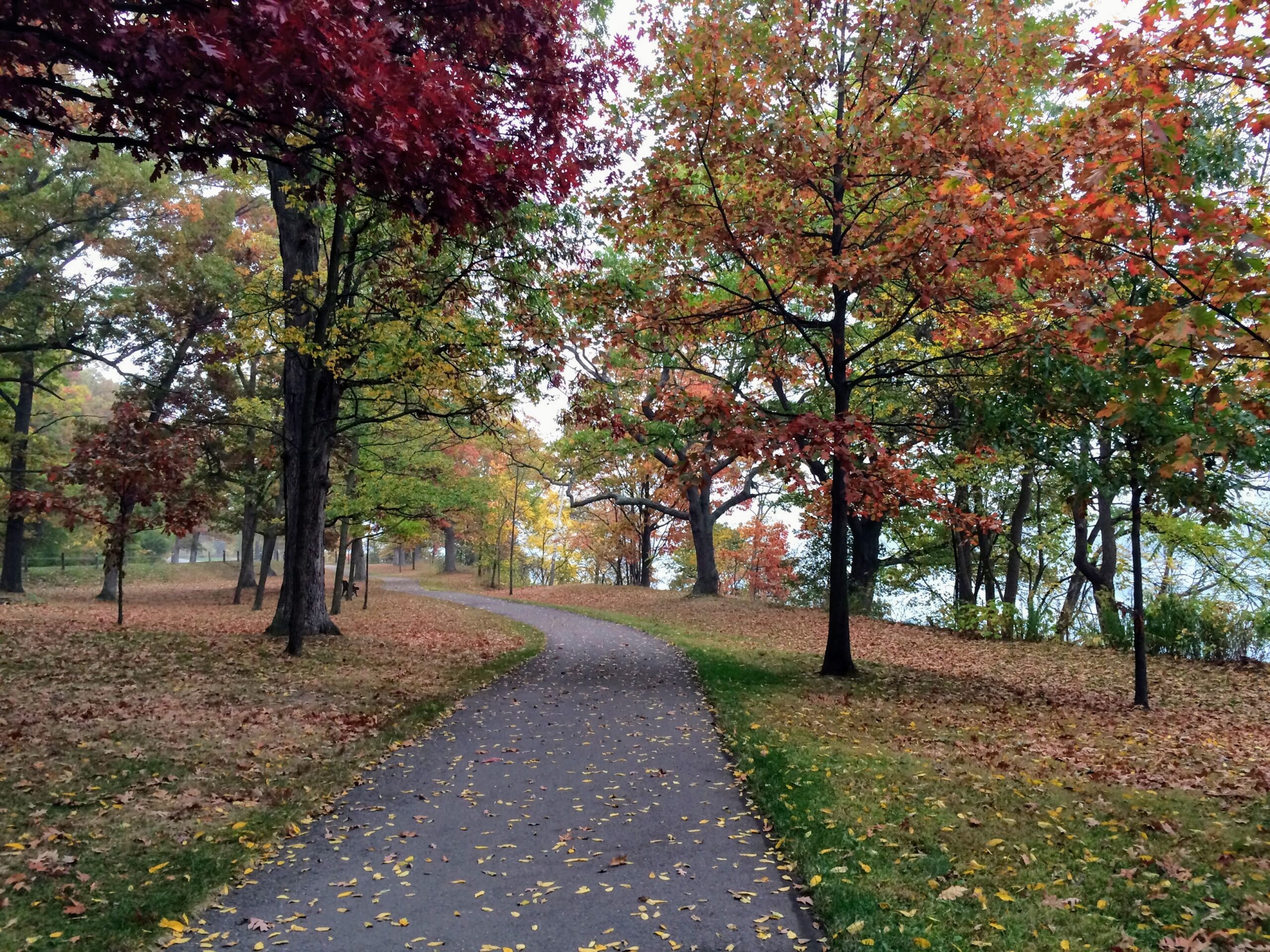
Each Friday we will explore different neighbourhoods, trails and parkland throughout Historic Niagara-on-the-Lake.Moderate pace with some weeks entirely on sidewalks and roads while others may include a mix of trails and paved pathways. Great way to build up endurance for longer more strenuous hikes.
Prepare for cooler windy conditions on open parkland and along Lake Ontario and Niagara River trails.
Plan to stay for conversation and a warm cup of coffee or tea at Sweets & Swirls, Community Centre, Niagara Stone Road, NOTL
Rattlesnake Point to Crawford Lake and back (RESCHEDULED)
https://hikesstaging.brucetrail.org/event/rattlesnake-point-to-crawford-lake-and-back-3/Sorry, the registration cut-off time for this hike has been reached.Not a member? Click here to join today!Hosting Club: Iroquoia
Category: General Hike
Location (Google Maps): Rattlesnake Point Parking Lot – FEE REQUIREDHike Leader(s): Pati Greenwood, Jeff Dowsett Click here to contact Hike Leader(s)
Pace: Medium – 3 to 4 km/hr
Terrain: Dependent on Conditions, Moderate – Some hills and/or some poor footing
Distance: 12 kmDescription
We will hike on the Conservation Trails, the Rattlesnake Point Side Trail, the main Bruce Trail, and Crawford Lake Side Trail to Crawford Lake and back. Wear appropriate clothing and footwear for weather conditions.Park in the Rattlesnake Conservation Area Parking Lot. Reservations will be required, see Conservation Halton web site for details: https://www.conservationhalton.ca/parks/rattlesnake-point/
Please arrive at 9:15 am as we will depart promptly at 9:30 am.

Easy Hike - Bluewater Park - To Pole or Not to Pole?
https://hikesstaging.brucetrail.org/event/easy-hike-bluewater-park-to-pole-or-not-to-pole/Sorry, the registration cut-off time for this hike has been reached.Not a member? Click here to join today!Hosting Club: Peninsula
Location (Google Maps): Meet at the Pavilion (near the campground) at Bluewater Park in Wiarton
Hike Leader(s): Marg Glendon Click here to contact Hike Leader(s)
Pace: Leisurely, Medium
Terrain: Easy
Distance: ~5 kmDescription
To use poles? Or not to use poles? That is the question for today’s hike. Join Jason Watkins, Physiotherapist from Peninsula Physiotherapy in Wiarton, for a short lunch and learn talk about the pros and cons of using hiking poles. Are hiking poles different from walking poles? How should I use hiking poles? Ask Jason the questions you have wondered about! Then, we will practise our new learning by hiking on the Bruce Trail along Colpoy’s Bay shore – aiming for Spirit Rock Spiral Staircase – about 5 km out and back- in total. There will be an option for those wishing to climb the staircase to the top of escarpment, while others enjoy the view from the shoreline. Poles are provided by Grey Bruce Health Unit and can be borrowed through PBTC for the duration of the hiking series. If time allows, we will stop at Lost Art Café in Wiarton for coffee before returning to our parked vehicles at the end of the hike. Be prepared for a 2 1/2 hour group hike experience. Portapotties are available at the Municipal Parking Lot.Donation: Please bring a canned food donation for the local food bank.
Parking: Free Municipal Parking at Bluewater Park (near Dockside Willie’s) – 402 William St., Wiarton.
Map #: 35
- 11November 11, 2023
Merritthon (New Limited Edition Badge
https://hikesstaging.brucetrail.org/event/merritthon-new-limited-addition-badge/Sorry, the registration cut-off time for this hike has been reached.Not a member? Click here to join today!Hosting Club: Niagara
Category: Event Hikes
Location (Google Maps):Port Dalhousie Heritage District, Public Parking Lot St Catharines
Terrain: Easy
Distance: 45Description
Celebrate the 200 year anniversary of the Welland Canal and earn a New Limited Edition Badge. We will award 100 Badges this year and 100 Next Year
Looking for a distance challenge? We invite Hikers, Runners, joggers Walkers and Strollers
The Merrithon is a long distance hike from Port Colborne to Port Dalhousie along the welland Canal. This is a self-guided hike along mainly paved trail.
A Map of the trail can be found at http://niagarabrucetrail.club/wp/badges/ under the Merritthon badgeEveryone who completes the route and goes through all of the checkpoints will earn the Limited Edition Prestigious Merritthon Badge
Fee: $50 includes Bus transport to start of hike, checkpoints, badge and helps to support the Bruce Trail Conservancy in its mission to preserve a ribbon of wilderness, for everyone, forever.
BUS LEAVES AT 7:00 SHARP. Late arrivers will need to check in and make their own way to Port Colborne
BUS Leaves at 7:00 Sharp. Late arrivals must make their own way to the start after checking in at Port Dalhousie
Check in: At Port Dalhousie Parking Lot St Catharines from 6:40. Buses will transport hikers to Port Colborne.
Route: Follow the yellow blazes from Port Colborne to Port Dalhousie back to the parking lot
What to bring: Bring your own water and snacks. Wear comfortable sturdy shoes and dress for the weather.Extra water and snacks will be available at the checkpoints.
COVID Safety Precautions: Please note the precautions before, during and after your hike… https://development.brucetrail.org/pages/explore-the-trail/hike-schedule.
FAQ’s
What if it rains? This is a rain or shine event.
What if I need to drop out? Trail Angel’s will be available from the checkpoints.
How long will it take to finish? We estimate that the hike will take between 8 and 9 hours. If you do not reach the last checkpoint by 4:00pm you will have to withdraw
Is my ticket/registration transferable/refundable? yes. Refundable up to 10 days before event but not transferrable. Please let us know if you cannot make it.
Contact: Alan Laver alanjlaver@gmail.com 416 303 5613

Bus Hike: Blue Mountains End to End Part IV of VI
https://hikesstaging.brucetrail.org/event/blue-mountains-end-to-end-part-iv/Sorry, the registration cut-off time for this hike has been reached.Not a member? Click here to join today!Trip Information
Departure Time: 08:00
Return to City Time: 19:00
Departure Point: York Mills Bus PickupOptional Items
Hosting Club: Toronto
Category: Bus Hike
Location (Google Maps): Map 22 of the Bruce Trail Reference and Guide. Km 34.2 to 21.9kmHike Leader(s): George Lennon and Michael Humpage Click here to contact Hike Leader(s)
Pace: Moderate
Terrain: Variable
Distance: 12.3kmDescription
Bus departs 10 York Mills Rd at 8:00 AM and Major Mackenzie Dr and HWY 400 Park and Ride at 8:20 AM. If you wish to be picked up at the Major Mackenzie Dr and HWY 400 Park and Ride, type ‘yes’ in the additional information field. Please arrive 15 minutes before departure. The bus waits for no one.We will begin the hike at km 34.2 by winding our way through forest and farmland to the entrance of Devil’s Glen Provincial Park. We will walk to the nearby lookout platform to admire the steep bedrock gorge at the edge of the escarpment. The lower valley walls are steep and covered with dense deciduous forest. Rare harts tongue and smooth cliff brake ferns grow on these steep cliffs. We will descend a series of natural steps down to the Mad River. Then we climb uphill switchbacks to reach the junction with the Ganaraska Trail that stretches from here to Port Hope. The Bruce Trail continues along the Escarpment edge to McKinney’s Hill and its superb view to the east. The trail passes Freedom Rock and the Nottawasaga Bluffs Lookout. Some white cedar trees in this park are well over 1,000 years old. We will end the day’s hike at km 21.9, and then head for Shelburne for refreshments before our return to Toronto.
** Hikers are required to bring a mask and wear it on the bus. Masks must fit properly and cover the nose, mouth and chin. For the highest level of protection against Covid-19, respiratory viruses or the flu, KN95 or N95 masks are recommended. **
Car Hike: Rouge National Park Toronto
https://hikesstaging.brucetrail.org/event/car-hike-rouge-national-park-toronto-7/Sorry, the registration cut-off time for this hike has been reached.Not a member? Click here to join today!Hosting Club: Toronto
Category: Car Hike
Location (Google Maps): Rouge Park, Zoo Road Parking Lot, off Meadowvale Road north of Sheppard AveHike Leader(s): Mohammad Aghamiri Click here to contact Hike Leader(s)
Pace: Moderate
Terrain: Hilly
Distance: 14-17KMDescription
Will explore Toronto part of Rouge park along Rouge river and Little Rouge Creek,Some safety procedures during the hike:
1-Hikers must stay between the leader and the sweep.
2-Hikers must advise the leader or the sweep if they wish to leave the group.
3- Hikers must follow the whistle instructions: 1 blast- stay where you are; 2 blasts come to the leader; 3 blasts – come to the leader quickly.
4-Hike leader may request volunteers to stop at trail intersections, they need to help hikers to the direction the group walk and wait till they see the sweep .
5-Hikers have to make sure they can see the persons behind and in front of them.
Car Hike: Caledon Section - White and Blue Trails hike (3) - 19KM
https://hikesstaging.brucetrail.org/event/car-hike-caledon-section-white-and-blue-trails-hike-3-19km/Sorry, the registration cut-off time for this hike has been reached.Not a member? Click here to join today!Hosting Club: Toronto
Category: Car Hike
Location (Google Maps):We meet at the Mono 5 Sideroad parking on the North side of the road where the trail crosses the road.
Hike Leader(s): Fayyaz Mahmood Click here to contact Hike Leader(s)
Pace: Brisk
Terrain: Challenging, Rocky
Distance: 18.8KMDescription
Devilish Madness at Glen Huron
https://hikesstaging.brucetrail.org/event/devilish-madness-at-glen-huron/Sorry, the registration cut-off time for this hike has been reached.Not a member? Click here to join today!Hosting Club: Blue Mountains
Category: Register in person the morning of hike.
Location (Google Maps): Hike meets in the parking lot behind Tim Hortons on First St. in Collingwood.Hike Leader(s): Sandy McNair Click here to contact Hike Leader(s)
Pace: Medium – 3 to 4 km/hr
Terrain: Moderate – Some hills and/or some poor footing
Distance: 11 kmDescription
Starting at Glen Huron the trail will immediately climb the escarpment, taking us through a variety of mixed forests to the edge of the Devils Glen Provincial Park. We will then encounter multiple switchbacks to descend to the Mad River Side Trail where we enjoy seeing this river grow as we travel along the river bank to return to our cars. Bring a snack or lunch and water.Quarry Rd, in and back, 15 km
https://hikesstaging.brucetrail.org/event/quarry-rd-in-and-back-15-km/Sorry, the registration cut-off time for this hike has been reached.Not a member? Click here to join today!Hike open to BTC Members only.
Hosting Club: Niagara
Category: In and Out
Location (Google Maps): Meet at Quarry Rd. by the trail crossing.Hike Leader(s): Vince Zvonar Click here to contact Hike Leader(s)
Pace: Brisk
Terrain: Moderate
Distance: 15Description
Dolostone Arch Side Trail
https://hikesstaging.brucetrail.org/event/dolostone-arch-side-trail/Sorry, the registration cut-off time for this hike has been reached.Not a member? Click here to join today!Hosting Club: Peninsula
Location (Google Maps): Dunk’s Bay Parking Lot
Hike Leader(s): Saabir Sohrab Click here to contact Hike Leader(s)
Pace: Medium
Terrain: Difficult, Moderate
Distance: ~3.5kmDescription
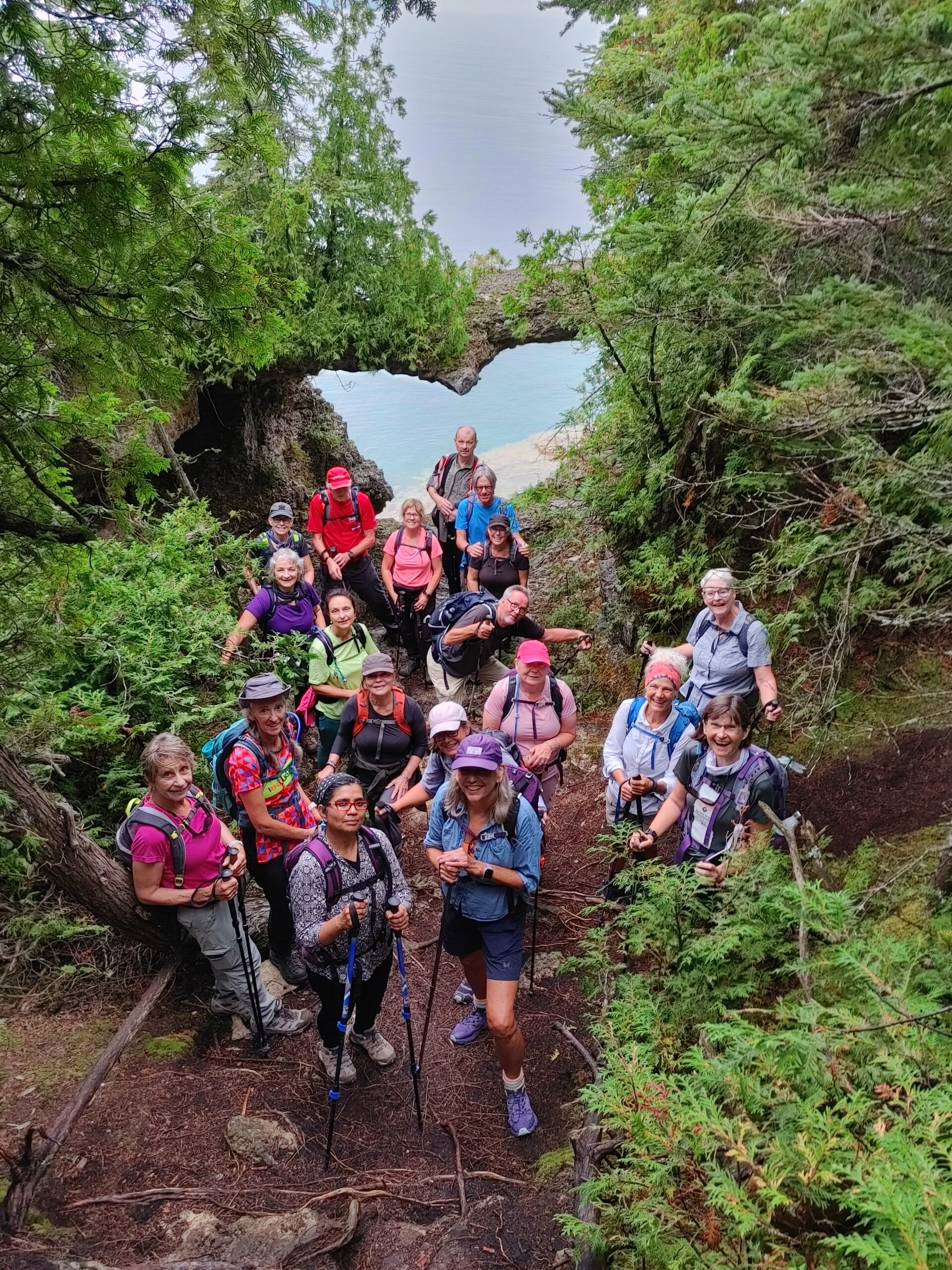
Explore the recently added Dolostone Arch Side Trail in the Peninsula. This scenic trek features two striking rock formations: a captivating natural arch overhang and a limestone grotto.Prepare for the weather and ensure you have water, some light snacks, and sturdy footwear for the rugged terrain.
Expect to spend about 2 hours on this adventure.