
Hike Schedule
Join us for a hike! Registration required:
All hikes available to BTC members. Some hikes are open to non-members.
TIP: The calendar view displays up to 7 hikes on a day, but often there are more. Click “More events” to see them all.
Categories
- 26November 26, 2023
HIKE LEADER CERTIFICATION COURSE
https://hikesstaging.brucetrail.org/event/hike-leader-certification-course-2/Sorry, the registration cut-off time for this hike has been reached.Not a member? Click here to join today!Hosting Club: Niagara
Category: Event Hikes
Location (Google Maps): PLZ308. Plaza is the building behind (attached) to the Cairns building (all glass) right above the campus store. Parking is free in Zone 1 on weekends and it is a short walk from the parking lot.Hike Leader(s): Alan Laver Click here to contact Hike Leader(s)
Description
This is a 2 session course for “Hike Ontario” Certified Hike Leader. Led by Alan Laver a Certified Hike Ontario Instructor, the first session will take place on Zoom at 6:30 to 8:30 on November 24 and will be an opportunity to introduce yourself, get an insight to the course content and share your hiking experiences. The main session on Sunday at Brock University will start at 8:30 and will be in class learning until the afternoon when practical hike leading scenarios will take place. You must bring a backpack with items you would carry on a hike as a leader as we will be sharing this. Dress for the weather and bring a packed lunch.
Most BTC members will be reimbursed by their individual clubs subject to participating in leading hikes
Course Literature will be providedContact details Alan Laver at alanjlaver@gmail.com
Boyne Valley to Kilgorie
https://hikesstaging.brucetrail.org/event/boyne-valley-to-kilgorie/Sorry, the registration cut-off time for this hike has been reached.Not a member? Click here to join today!Hosting Club: Dufferin Hi-Land
Category: General Hike
Location (Google Maps): Roadside parking near post boxes on Centre Road in Kilgorie, 30 metres south of River Road. km 33.8 BTC Map 20.Hike Leader(s): Stuart Law Click here to contact Hike Leader(s)
Pace: Medium
Terrain: Slippery and Steep Sections, Slippery Sections Likely, Strenuous
Distance: 16.5 kmsDescription
Join us for a quiet Sunday shuttle hike from the Boyne Valley to Kilgorie in the beautiful Dufferin Section. Lots of ups and downs! Please bring a garbage bag for your dirty boots and a pair of clean footwear to change into for the ride back (we will leave that stuff in the cars at the end of the hike). Please bring 2L of water, a warm drink, a snack, and a lunch. Please have your icers in your backpack just in case. Boots mandatory. Poles recommended. Please arrive at 8:45 to be ready to shuttle at 9 am sharp.Blantyre to Grey Road 40
https://hikesstaging.brucetrail.org/event/blantyre-to-grey-road-40/Sorry, the registration cut-off time for this hike has been reached.Not a member? Click here to join today!Hosting Club: Beaver Valley
Location (Google Maps): Meet in the Bruce Trail parking lot on Grey Road 40, km 105.7, Map 28, Edition 31, to shuttle to Blantyre on Grey Road 12.
Hike Leader(s): Glenda Collings Click here to contact the hike leader.
Pace: Medium
Terrain: Moderate, Some rocky footing
Length of Hike: 11.6 kmDescription
This is a lovely hike which takes us along a section of escarpment, to the terminus of the Beaver Valley Bruce Trail at Blantyre. We’ll see crevices, some scenic views, creeks, and farmland along the way. Bring snacks (and sufficient water) for a short break at the halfway point. Who knows what the weather will bring by late November, so keep your icers in the car. If there is sufficient snow, we’ll plan to shorten the hike and use snowshoes.Sunday Rambles - Crawford Lake
https://hikesstaging.brucetrail.org/event/sunday-rambles-crawford-lake/Sorry, the registration cut-off time for this hike has been reached.Not a member? Click here to join today!Hosting Club: Iroquoia
Category: General Hike
Location (Google Maps):Hike Leader(s): Colleen Mabalay Click here to contact Hike Leader(s)
Pace: Medium – 3 to 4 km/hr
Terrain: Moderate – Some hills and/or some poor footing
Distance: Approx 7kmDescription
Please register for parking with Halton Conservation before hike.Meet in first parking lot beside gate 15mins before 10am start.
Bring water & snack. Be prepared for weather conditions (snow – bring icers).
If you need to cancel day of hike please text me at (905) 815-7100
Urban Walk: Tommy Thompson Park-Toronto's Urban Wilderness (on the Leslie Street Spit) Toronto
https://hikesstaging.brucetrail.org/event/urban-walk-tommy-thompson-park-torontos-urban-wilderness-on-the-leslie-street-spit-toronto/Sorry, the registration cut-off time for this hike has been reached.Not a member? Click here to join today!Hike open to BTC Members only.
Hosting Club: Toronto
Category: Urban Walk
Location (Google Maps):Tommy Thompson Park, 1 Leslie St. Toronto
Hike Leader(s): Jeanette Vincent Click here to contact Hike Leader(s)
Pace: Moderate
Terrain: Flat
Distance: 12kmDescription
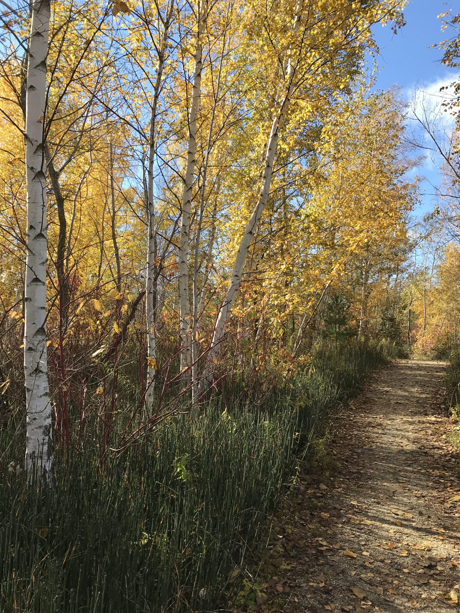
Meet at 10:30 a.m. at the entrance parking lot at 1 Leslie St. We will walk to the end of the spit and back using some of the various side trails. A unique place to experience nature and wildlife. The spit has been made from the rubble from an ever growing Toronto which began in 1959. Excellent views of Toronto and Lake Ontario.No dogs. Bring snack/lunch water. Dropouts along the way. Dress appropriate for the weather conditions.
Sunday Social Hike - Woodford Escarpment Loop(s)
https://hikesstaging.brucetrail.org/event/sunday-social-hike-woodford-escarpment-loop/Sorry, the registration cut-off time for this hike has been reached.Not a member? Click here to join today!Hosting Club: Sydenham
Category: General Hike
Location (Google Maps): Meet in the north-east corner of the parking lot at Home Depot on Highway 26 on the east side of Owen Sound.Hike Leader(s): Maureen McFarland Click here to contact Hike Leader(s)
Pace: Leisurely: 3 km/h or less
Terrain: Moderate: Some hills and/or poor footing, There might be icy and slippery sections., There might be muddy sections.
Distance: 4 kmsDescription
We will carpool to Woodford Community Hall. From there we will walk along the main trail to the Woodford Escarpment Side Trail and follow it until it meets the main trail to return to the parking lot. On this trail there are a couple of crevices (the more difficult one can be avoided), remains of a pioneer homestead, a lime kiln and more. If the group wishes to go further, we can cross the highway to do the Crevice Springs Side Trail Loop. It would add another 1.4 kms to the day. Wear good footwear and bring a snack and water. Map 30. If you are unable to register, please call or text the leader at 647-918-4180. - 27November 27, 2023

Iroquoia End 2 End in 6 Fundraiser Hike
https://hikesstaging.brucetrail.org/event/iroquoia-end-2-end-in-6/Sorry, the registration cut-off time for this hike has been reached.Not a member? Click here to join today!This is a Multi-Day Hike
You are signing up for the following dates and times:
2023-11-27 at 07:45
2023-11-28 at 07:45
2023-12-01 at 07:45
2023-12-04 at 07:45
2023-12-07 at 07:45
2023-12-08 at 07:45Hosting Club: Iroquoia
Category: Iroquoia E2E-in-Six
Location (Google Maps): Fundraiser series of 6 hikes to complete Iroquoia End to End. We will meet at the end point of each hike and carpool shuttle to trailhead. We will take turns to shuttle drivers back to their cars at the end of each hike. List of hike meeting places and trailhead coordinates will be emailed to registered hikers the week before the hikes. Refunds are not allowed.Hike Leader(s): Steven White Click here to contact Hike Leader(s)
Pace: Brisk – 4 to 5 km/hr
Terrain: Strenuous – Hilly with steep climbs and some poor footing
Distance: 19-23 km per dayDescription
This series of hikes entitle the successful hiker to obtain the new stained glass badge with the Jefferson Salamander – a beautiful and unique badge. This series of hikes is for the experienced hiker due to pace (Brisk) , strenuous sections of Iroquoia trail and length of hike each day. Hikers should anticipate fall and winter conditions – boots, icers, poles, gators, layered clothing, water, snacks, lunch, first aid kit. We will take turns shuttling from meeting place to trailhead each day and a driver will need to take the shuttle drivers back to their car at the end of the hike. We will meet each day at 7:45 and shuttle to trailhead – hikers should arrive 15 minutes early to ensure ready to leave at 7:45. Anticipate most hikes will take approx 5-6 hours including lunch and snack breaks.
Please ensure you are physically able to manage the pace, distance and potential wintry conditions of this hike before registering. Refunds are not allowed. Your fee includes the badge.9:00 Observing While Hiking
https://hikesstaging.brucetrail.org/event/900-observing-while-hiking-3/Sorry, the registration cut-off time for this hike has been reached.Not a member? Click here to join today!Hosting Club: Niagara
Location (Google Maps): Fireman’s Park, Lower Parking Lot. The entrance to the parking lot is on Dorchester just after the railway tracks
Hike Leader(s): Mary-Lyn Hopper Click here to contact Hike Leader(s)
Pace: Medium
Terrain: Moderate
Distance: Aprox 6 kmDescription
Hike along the trails around Fireman’s park looking and listening at birds and wildlife
7:00 pm Moonlight Night Hike in Niagara-on-the-Lake
https://hikesstaging.brucetrail.org/event/700-pm-moonlight-night-hike-in-niagara-on-the-lake-3/Sorry, the registration cut-off time for this hike has been reached.Not a member? Click here to join today!Hosting Club: Niagara
Category: Night
Location (Google Maps): Veteran’s Memorial Park, park just outside the park on King St.Hike Leader(s): Robin Garrett Click here to contact Hike Leader(s)
Pace: Medium
Terrain: Easy
Distance: 6-7 kmDescription
Moonlight Night Hike – Take in the magic of the rising moon over Lake Ontario and the Niagara River. This hike includes a stop to connect with your senses – sights, sounds, smells and the rhythm of your breath. Counts towards your night hike badge (5 night hikes). - 28November 28, 2023
River Kwai Side Trail - Bayview Escarpment full/long loop
https://hikesstaging.brucetrail.org/event/river-kwai-side-trail-bayview-escarpment-full-long-loop/Sorry, the registration cut-off time for this hike has been reached.Not a member? Click here to join today!Hosting Club: Sydenham
Category: General Hike
Location (Google Maps): Meet at the Blue sign for the start of the River Kwai side trail on the east side of St Vincent Sydenham Townline, just south of Sideroad 24/km 56.3 (Map 30). There is roadside parking on the east side of the Townline.Hike Leader(s): Fran Turner Click here to contact Hike Leader(s)
Pace: Brisk: 4 to 5 km/h
Terrain: Strenuous: Hilly with steep climbs and some poor footing.
Distance: 13.6 kmDescription
There is time for one last satisfying long hike before winter arrives. The River Kwai trail offers a pleasant hike through a hardwood forest with many magnificent old trees. The Bayview Escarpment section boasts over 2 km of spectacular views to the east, as well as many scenic cracks and crevices. This is a memorable hike. If you are unable to register, please call or text the hike leader at 519-590-0706.NEW TIME 9:00 Staff Avenue Louth
https://hikesstaging.brucetrail.org/event/800-long-hike-wiley-road-short-hills-42/Sorry, the registration cut-off time for this hike has been reached.Not a member? Click here to join today!Hosting Club: Niagara
Location (Google Maps): Staff Avenue Parking Lot
Hike Leader(s): Alan Laver Click here to contact Hike Leader(s)
Pace: Medium
Terrain: Moderate
Distance: 10kmDescription
CHANGE OF VENUE DUE TO DEER HARVEST Explore Louth Conservation area
Bring Poles water, snack, sunscreen and bug spray and dress for the weather
Short Hike - Rotary Park
https://hikesstaging.brucetrail.org/event/short-hike-rotary-park/Sorry, the registration cut-off time for this hike has been reached.Not a member? Click here to join today!Hosting Club: Niagara
Category: Hike
Location (Google Maps): Rotary Park, 395 Pelham Rd ST. CatharinesHike Leader(s): Debbie Demizio Click here to contact Hike Leader(s)
Pace: Medium
Terrain: Moderate
Distance: 6 kmDescription
NOTE MEETING PLACE – Hike around Rotary Park, St. Catharines.Explore the rolling hills of Cold Creek CA
https://hikesstaging.brucetrail.org/event/explore-the-rolling-hills-of-cold-creek-ca/Sorry, the registration cut-off time for this hike has been reached.Not a member? Click here to join today!Hosting Club: Caledon Hills
Category: Tuesday Hikers
Location (Google Maps): Cold Creek Conservation Area is 14125 11th Concession Nobleton On L0G1N0.
From Hwy 410 and Mayfield Rd. it is a 30 minute drive.
From Hwy 410:go east on Mayfield Rd. to Albion Vaughan Rd. and go north to King Rd. where you will go east to Concession Rd. 11.
Go north on Concession 11 to Cold Creek CA. Parking is just outside CA gates. No fee required.Hike Leader(s): Marilyn Ross Click here to contact Hike Leader(s)
Pace: Medium – 3 to 4 km/hour
Terrain: Moderate – some hills and/or some poor footing
Distance: Approximately 8 km with an option of a shorter hike of 6.5 kmDescription
We will explore the beautiful rolling hills of this conservation area, going through a pine plantation, a cedar grove, as well as a mixed forest. The conservation area labels many of the trees with interesting information so we can identify trees from their bark.We will hike the perimeter of the park – 6.5 km – and then for those who would like a little longer hike we can then hike some of the interior trails, adding another couple of kilometres.
Boyne Valley Loop, Main Trail and Boyne Valley Side Trail
https://hikesstaging.brucetrail.org/event/boyne-valley-loop-main-trail-and-boyne-valley-side-trail/Sorry, the registration cut-off time for this hike has been reached.Not a member? Click here to join today!Hosting Club: Dufferin Hi-Land
Category: Tuesday Hike
Location (Google Maps): Dufferin Hi-Land Section, Map 20, 18.7, parking lot on Centre Rd, south of 5 SideroadHike Leader(s): Julie Daley, Les Babbage, Inge Eckerich, Tony Evangelista Click here to contact Hike Leader(s)
Pace: Medium
Terrain: Moderate, Slippery and Steep Sections
Distance: 7km, short hike 4.8kmDescription
This loop hike in Boyne Valley Provincial Park follows the main trail south, joins the Boyne Valley Side Trail, and returns to the parking lot on the main trail. Those wishing a short hike, turn around after 2.4km (16.3). Bring snacks, appropriate clothing, and equipment (ie poles, icers)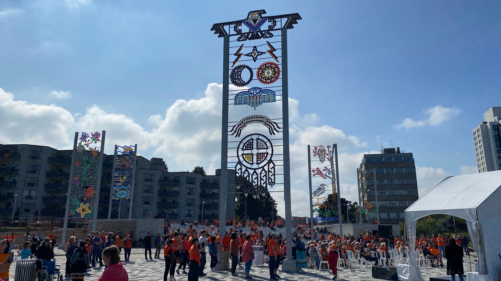
Hamilton Waterfront Urban Hike
https://hikesstaging.brucetrail.org/event/hamilton-waterfront-urban-hike/Sorry, the registration cut-off time for this hike has been reached.Not a member? Click here to join today!Hosting Club: Iroquoia
Category: General Hike
Location (Google Maps):Meet DUNDURN CASTLE 610 York St Hamilton Parking Lot
Hike Leader(s): Cathie Green Click here to contact Hike Leader(s)
Pace: Medium – 3 to 4 km/hr
Terrain: Easy – Mostly flat and usually good footing
Distance: Approximately 8-9 kmsDescription
Meet at 10 am at Dundurn Castle Parking Lot(no fees) off York St Hamilton-easy access from 403We will hike along the ridge(flat) to the stairs leading us down to Hamilton Bay Waterfront and walk the paved path to Bayfront Park and hike along some of their
bayfront trails-all paved paths over to the foot of James street to view the new Indigenous Art Installation -there will be a bathroom and snack break
We will return along city side streets -Please wear suitable clothing and footwear for the weather/poles/ water, snack.
OPTIONAL Social afterwards to have lunch at the Admiral Inn across the street from parking lot-
If interested in lunch-email me at cathiekygreen@gmail.com to let me know

Sydenham Chipper (km44.2-68.4) CANCELLED (due to weather)
https://hikesstaging.brucetrail.org/event/sydenham-chipper-km44-2-68-4/Sorry, the registration cut-off time for this hike has been reached.Not a member? Click here to join today!Hosting Club: Beaver Valley
Location (Google Maps): Parking along the Townline
Map 30 ED 30
Km44.2Hike Leader(s): Kristina Rettie Click here to contact the hike leader.
Pace: Brisk
Terrain: Some rocky footing, Some steep sections, Strenuous
Length of Hike: 24.2Description
Please join us as we chip away through the Sydenham section. This will be a series of 11 hikes that range between 13-19kms with one longer hike of 24km. We will begin our journey at the northern end of Sydenham and work our way south to try and avoid the dangers the falling leaves and snow will bring.If you complete the 11 hikes in this series you will qualify for Sydenham’s new independent badge. Please keep track of your hikes as each hiker will be submitting their own badge request.
All hikes in this series will include a car shuttle and everyone will take a turn as a shuttle driver. Please have your vehicle passenger ready.
Nov 28 hike – meet@km44.2 carpool to 68.4
If you have any questions please text me @ 519-410-9077 (this is the most efficient way)
Please bring plenty of water and snacks/lunch
No dogs
Please text Kristina @ 519-410-9077 for morning of cancelations
COVID-19 Precautions Before, During and After your Hike
- Each hiker joining a Bruce Trail Club organized hike must perform a self-screening check before hiking.
Find Ontario’s self-assessment tool here: https://covid-19.ontario.ca/self-assessment/ - If you are experiencing COVID-19 symptoms, stay home.
Transportation
It is the Bruce Trail Conservancy’s current policy that car shuttles are allowed. It is at the discrepancy of individual hike leaders to make that decision.
Other Guidelines
- Arrive 15 minutes before the start of the hike.
- Wear sturdy footwear and appropriate attire for the weather and the terrain.
Hiking poles are a good idea in any season, especially if the terrain is rocky or slippery. In winter, snowshoes or icers/crampons are needed when conditions dictate.
Wearing appropriate clothing and footwear prevents injuries and shows consideration for a safe and positive group hiking experience. - Always carry I.D. and your health card.
- Bring sufficient water and snacks (or lunch if indicated). A minimum of 1L of water is recommended on all hikes, and 3L is recommended for long, challenging hikes in the heat of the summer.
- Bring sunscreen and insect repellent (for spring and summer hikes).
- Bring your own first aid kit.
- Please leave dogs at home.
- Each hiker joining a Bruce Trail Club organized hike must perform a self-screening check before hiking.
- 29November 29, 2023

Niagara E2E - Hike #5
https://hikesstaging.brucetrail.org/event/niagara-e2e-hike-5/Sorry, the registration cut-off time for this hike has been reached.Not a member? Click here to join today!Hosting Club: Niagara
Category: Car Pool
Location (Google Maps): Meet at Queenston Heights Park and carpool to Woodend Conservation AreaHike Leader(s): Sam Rutherford Click here to contact Hike Leader(s)
Pace: Medium
Terrain: Moderate
Distance: 15.2kDescription
Niagara E2E in 5 hikes. Hike #5 completes the series. A parking fee is charged at Queenston Heights. Please bring snacks and water. Be prepared for weather. Poles are recommended. Please bring $10 for badge once you have completed all 5 hikes.Two Big Rocks-Metcalfe & Pinnacle Rock
https://hikesstaging.brucetrail.org/event/two-big-rocks-metcalfe-pinnacle-rock/Sorry, the registration cut-off time for this hike has been reached.Not a member? Click here to join today!Hosting Club: Blue Mountains
Category: Register in person the morning of hike.
Location (Google Maps): Hike meets in the parking lot behind Tim Hortons on First St. in Collingwood.Hike Leader(s): Sandy McNair Click here to contact Hike Leader(s)
Pace: Medium – 3 to 4 km/hr
Terrain: Moderate – Some hills and/or some poor footing
Distance: 10 kmDescription
Starting at Beaver Valley section km 27.9, we will follow the white blazed trail west toward Duncan Crevice Caves Provincial Nature Reserve. At km 32.6 we will take the Chuck Grant Side Trail to create a loop. This unique and wonderful hike includes a wide variety of terrain, two bridge crossings of Mill Creek, two climbs and descents of the escarpment, all with spectacular views from Metcalfe and Pinnacle Rocks. Optional descents and climbs into the Metcalfe and Duncan Crevices, weather and grip permitting. Bring a snack or lunch and water.
New Siegerman Area Trail
https://hikesstaging.brucetrail.org/event/new-siegerman-area-trail/Sorry, the registration cut-off time for this hike has been reached.Not a member? Click here to join today!Hosting Club: Beaver Valley
Location (Google Maps): Park on Sideroad 22C Km 99.9 Map 27 Edition 31
Hike Leader(s): Margaret Yaraskavitch Click here to contact the hike leader.
Pace: Medium
Terrain: Easy, Moderate, Some rocky footing, Some steep sections
Length of Hike: 6 kmDescription
Reroutes, for the better, have happened in the area of the Siegerman property! We’ll walk on a road allowance to the newly designed Siegerman Main Trail. Lovely views of a stream here. We’ll walk uphill and then walk a loop using the Allan Side Trail. Then we return on the Main Trail to our parked vehicles.COVID-19 Precautions Before, During and After your Hike
- Each hiker joining a Bruce Trail Club organized hike must perform a self-screening check before hiking.
Find Ontario’s self-assessment tool here: https://covid-19.ontario.ca/self-assessment/ - If you are experiencing COVID-19 symptoms, stay home.
Other Guidelines
- Arrive 15 minutes before the start of the hike.
- Wear sturdy footwear and appropriate attire for the weather and the terrain.
Hiking poles are a good idea in any season, especially if the terrain is rocky or slippery. In winter, snowshoes or icers/crampons are needed when conditions dictate.
Wearing appropriate clothing and footwear prevents injuries and shows consideration for a safe and positive group hiking experience. - Always carry I.D. and your health card.
- Bring sufficient water and snacks (or lunch if indicated). A minimum of 1L of water is recommended on all hikes, and 3L is recommended for long, challenging hikes in the heat of the summer.
- Bring sunscreen and insect repellent (for spring and summer hikes).
- Bring your own first aid kit.
- Please leave dogs at home.
10:00 Morningstar - Decew Road, St. Catharines
https://hikesstaging.brucetrail.org/event/1000-morningstar-decew-road-st-catharines/Sorry, the registration cut-off time for this hike has been reached.Not a member? Click here to join today!Hosting Club: Niagara
Category: Leisurely
Location (Google Maps): Decew houseHike Leader(s): Ineke Brinkman Click here to contact Hike Leader(s)
Pace: Leisurely
Terrain: ModerateDescription
Good Companions - Chedoke Radial Trail and Scenic Drive Side Trail
https://hikesstaging.brucetrail.org/event/good-companions-chedoke-radial-trail-and-scenic-drive-side-trail-4/Sorry, the registration cut-off time for this hike has been reached.Not a member? Click here to join today!Hike open to BTC Members only.
Hosting Club: Iroquoia
Category: Good Companions
Location (Google Maps):Chedoke Golf Club Parking Lot – Hamilton
Hike Leader(s): Ted Bossence Click here to contact Hike Leader(s)
Pace: Medium – 3 to 4 km/hr
Terrain: Moderate – Some hills and/or some poor footing
Distance: 8 kmDescription
We will walk up the Chedoke Radial Trail and into the Iroquoia Heights Conservation Area. We will then loop back and follow the Scenic Drive Side Trail along the top of the escarpment and down either the Dundurn or Chedoke (Leader’s choice) escarpment stairs to the golf course parking lot. Bring water and a snack. Please arrive by 9:50 am. I will be leaving on time at 10:00 am. In case of rain/snow I will cancel the hike and notify you by email the evening before. Please check your email. If you must cancel after 4:00 pm on the Tuesday, please notify me by email at tedbossence@sympatico.ca on the Tuesday or by text on Wednesday morning at 905 334-8752.
Urban walk: Colonel Sam Smith Park
https://hikesstaging.brucetrail.org/event/urban-walk-colonel-sam-smith-park/Sorry, the registration cut-off time for this hike has been reached.Not a member? Click here to join today!Hosting Club: Toronto
Category: Urban Walk
Location (Google Maps): Meet in front of The Gatehouse, located at the Northeast corner of Colonel Samuel Smith Park (Lake Shore and 14th Street)Hike Leader(s): Roger Harris Click here to contact Hike Leader(s)
Pace: Leisurely
Terrain: Flat
Distance: 5 kmDescription
We will explore Colonel Samuel Smith Park, including the waterfront and the exterior grounds of the former Lakeshore Psychiatric Hospital (now part of Humber College). The route is on a mixture of paved and packed gravel paths. Multiple inside washrooms and a covered picnic area are available.There is limited free parking immediately south of The Gatehouse. A large parking lot is located at the end of Colonel Samuel Smith Park Drive.
If coming via TTC, please take the 44 Kipling South bus from Kipling subway station to Lake Shore.
Please dress appropriately for the weather. Hiking books and poles will not be necessary. Bring a thermos of coffee or tea, and snacks.

Winter Festival of Lights Hike
https://hikesstaging.brucetrail.org/event/winter-festival-of-lights-hike-2/Sorry, the registration cut-off time for this hike has been reached.Not a member? Click here to join today!Hosting Club: Niagara
Category: Night
Location (Google Maps): Meet in the parking lot of Floral Showhouse, 7145 Niagara River Pkwy, Niagara FallsHike Leader(s): Margaret Northfield Click here to contact Hike Leader(s)
Pace: Medium
Terrain: Easy
Distance: 5-7kmDescription
Get into the Holiday Spirit with the Annual Winter Festival of Lights hike by the Falls. Hot apple cider and tea will be provided. Bring a holiday treat to share. - Each hiker joining a Bruce Trail Club organized hike must perform a self-screening check before hiking.