
Hike Schedule
Join us for a hike! Registration required:
All hikes available to BTC members. Some hikes are open to non-members.
TIP: The calendar view displays up to 7 hikes on a day, but often there are more. Click “More events” to see them all.
Categories
- 24November 24, 2023
9:00 am Niagara-on-the-Lake Tour
https://hikesstaging.brucetrail.org/event/900-am-niagara-on-the-lake-tour-17/Sorry, the registration cut-off time for this hike has been reached.Not a member? Click here to join today!Hosting Club: Niagara
Category: Urban
Location (Google Maps): Veterans Memorial Park, park just outside the park on King StreetHike Leader(s): Robin Garrett Click here to contact Hike Leader(s)
Pace: Medium
Terrain: Easy
Distance: 6-7 kmDescription
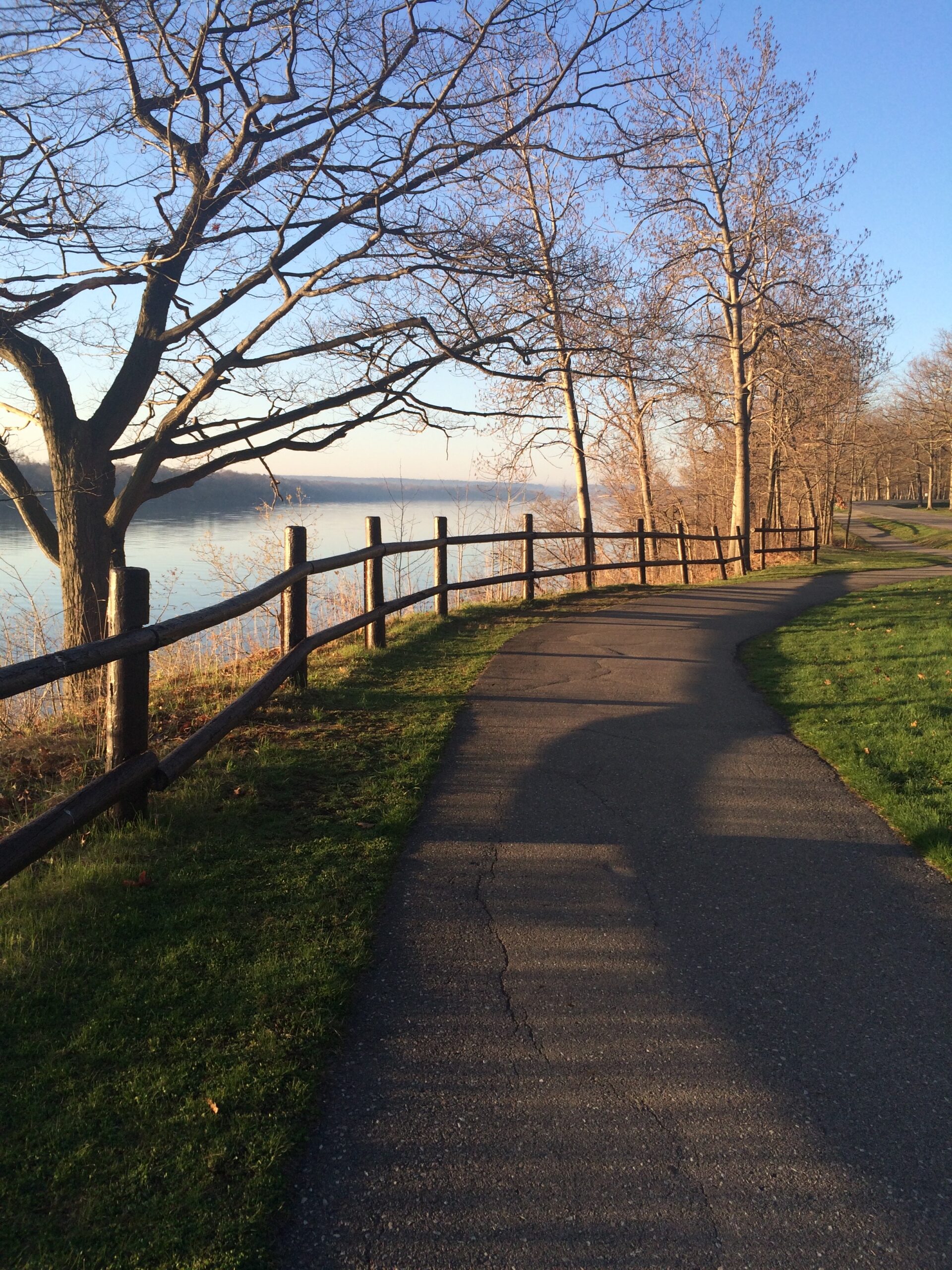
Each Friday we will explore different neighbourhoods, trails and parkland throughout Historic Niagara-on-the-Lake.Moderate pace with some weeks entirely on sidewalks and roads while others may include a mix of trails and paved pathways. Great way to build up endurance for longer more strenuous hikes.
Prepare for cooler windy conditions on open parkland and along Lake Ontario and Niagara River trails.
Plan to stay for conversation and a warm cup of coffee or tea at Sweets & Swirls, Community Centre, Niagara Stone Road, NOTL
Dundas Valley Conservation Area
https://hikesstaging.brucetrail.org/event/dundas-valley-conservation-area-8/Sorry, the registration cut-off time for this hike has been reached.Not a member? Click here to join today!Hosting Club: Iroquoia
Category: General Hike
Location (Google Maps): Dundas Valley Conservation’s AreaHike Leader(s): Pati Greenwood, Jeff Dowsett Click here to contact Hike Leader(s)
Pace: Medium – 3 to 4 km/hr
Terrain: Moderate – Some hills and/or some poor footing
Distance: 10 kmDescription
We will hike through the Dundas Valley Conservation Area on the main Bruce Trail, Conservation trails and BT side trails. Bring water and snacks. Be sure to wear appropriate clothing and footwear.Park in the main Parking lot located at 650 Governor’s Road. Parking fees will be required. See the Hamilton Conservation Authority for more information: https://conservationhamilton.ca/admissions-fees/
Please arrive at 9:15 am as we will leave promptly at 9:30 am.
Urban Walk: Bronte Village
https://hikesstaging.brucetrail.org/event/urban-walk-bronte-village/Sorry, the registration cut-off time for this hike has been reached.Not a member? Click here to join today!Hosting Club: Toronto
Category: Urban Walk
Location (Google Maps): Meet at the Bronte Athletic Park parking lot. The baseball diamond will be on your right as you enter.Hike Leader(s): Roger Harris Click here to contact Hike Leader(s)
Pace: Moderate
Terrain: Flat
Distance: 8 kmDescription
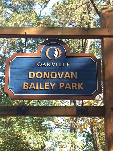
We will follow Donovan Bailey Trail to Bronte Road, then take Heritage Trail to Bronte Harbour. After a short break, we will continue along Waterfront Trail to Water’s Edge Drive, then walk southwest along Marine Drive to return to our starting point. The route is on a mixture of paved and packed gravel paths.If you would like to read up on this walk, it is described as Hike No. 11 (‘Donovan Bailey/Bronte Village Loop’) in Nicola Ross’ book ”Halton Hikes” (2016).
Please dress appropriately for the weather. Hiking books and poles will not be necessary. Bring one litre of water, and a lunch or snacks.
Fossil Glen/Frank Holley side trail loop
https://hikesstaging.brucetrail.org/event/fossil-glen-frank-holley-side-trail-loop-3/Sorry, the registration cut-off time for this hike has been reached.Not a member? Click here to join today!Hosting Club: Sydenham
Category: General Hike
Location (Google Maps):Meet at the base of the escarpment on East Linton Road. Park on the west side of the road, where the road turns north, east of km 118.2 (Map 33).
Hike Leader(s): Carol Graham-Mullin Click here to contact Hike Leader(s)
Pace: Medium: 3 to 4 km/h
Terrain: Moderate: Some hills and/or poor footing, There might be icy and slippery sections., There might be muddy sections.
Distance: 4-4.5 km.Description
We will use the main trail south into Fossil Glen and loop back to the Frank Holley sidetrail and main trail to the cabin ruins on the main trail. Then return east to the trailhead below. Please bring icers or snowshoes as the conditions warrant for that day. Poles are also recommended. Please contact the hike leader at 226-787-8804 if you are unable to register. - 25November 25, 2023
Bus Hike: Blue Mountains End to End Part V of VI
https://hikesstaging.brucetrail.org/event/blue-mountains-end-to-end-part-v/Sorry, the registration cut-off time for this hike has been reached.Not a member? Click here to join today!Trip Information
Departure Time: 08:00
Return to City Time: 19:00
Departure Point: York Mills Bus PickupOptional Items
Hosting Club: Toronto, Blue Mountains
Category: Bus Hike
Location (Google Maps): Map 22 of the Bruce Trail Reference and Guide. Km 21.9 to km11.9Hike Leader(s): George Lennon and Michael Humpage Click here to contact Hike Leader(s)
Pace: Moderate
Terrain: Variable
Distance: 10kmDescription
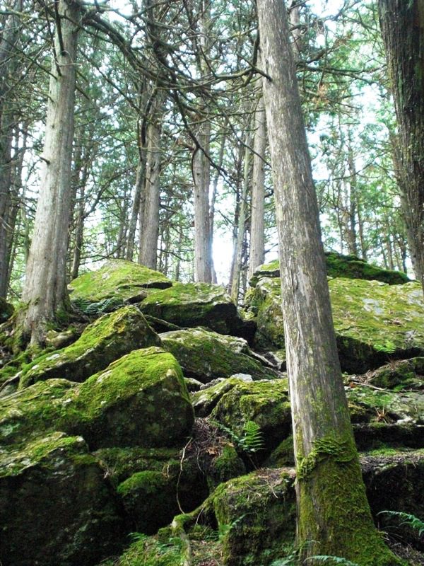
Bus departs 10 York Mills Rd at 8:00 AM and Major Mackenzie Dr and HWY 400 Park and Ride at 8:20 AM. If you wish to be picked up at the Major Mackenzie Dr and HWY 400 Park and Ride, please email hike leaders. Please arrive 15 minutes before departure. The bus waits for no one.Our hiking will resume at km 21.9 where we left off in the Nottawasaga Bluffs Conservation Area. We will pass by the ruins of a settlers’ lime kiln before entering mature cedar forests and then immature forests. Glaciers have deposited the spoon-shaped mounds of sand and gravel, called drumlins, that are on the left of the trail. Bring lunch and water. We will bid farewell to each other for the winter with a stopover in Shelburne on the way home to Toronto, and we will look to complete our end-to-end next spring.
If you are planning to order an end-to-end badge for the Blue Mountains Section please type ‘Yes’ in the Additional information Field when you register. I will collect from you your log and the $5 to pay for the badge on the hike when we hold the last of our hikes in this series next spring. I will email notice of our final hike to hikers on these Blue Mountains bus hikes when we have set the date next spring.
** Hikers are required to bring a mask and wear it on the bus. Masks must fit properly and cover the nose, mouth and chin. For the highest level of protection against Covid-19, respiratory viruses or the flu, KN95 or N95 masks are recommended. **
Car Hike: Bethesda Trail Richmond Hill
https://hikesstaging.brucetrail.org/event/car-hike-bethesda-trail-richmond-hill-13/Sorry, the registration cut-off time for this hike has been reached.Not a member? Click here to join today!Hosting Club: Toronto
Category: Car Hike
Location (Google Maps): Meet at Bethesda Trail Head Parking on Bethesda Sideroad off Bayview Avenue, across from Lake Wilcox. This parking lot is free.Hike Leader(s): Mohammad Aghamiri Click here to contact Hike Leader(s)
Pace: Moderate
Terrain: Variable
Distance: 14-17KMDescription
Join us to explore Jefferson Forest and Bond lake ,Please bring hiking poles, proper closing and shoes and lots of water,
Please carefully read safety procedures during the hike:
1-Hikers must stay between the leader and the sweep.
2-Hikers must advise the leader or the sweep if they wish to leave the group.
3- Hikers must follow the whistle instructions: 1 blast- stay where you are; 2 blasts come to the leader; 3 blasts – come to the leader quickly.
4-Hike leader may request volunteers to stop at trail intersections, they need to help hikers to the direction the group walk and wait till they see the sweep .
5-Hikers have to make sure they can see the persons behind and in front of them.
Witch of Cave Springs Hike - Last chance for this year's Screaming Tunnel Badge!
https://hikesstaging.brucetrail.org/event/witch-of-cave-springs-hike-last-chance-for-this-years-screaming-tunnel-badge/Sorry, the registration cut-off time for this hike has been reached.Not a member? Click here to join today!Hosting Club: Niagara
Category: In and Out
Location (Google Maps): Meet at Quarry Rd parking lot in BeamsvilleHike Leader(s): Angela Lytle Click here to contact Hike Leader(s)
Pace: Medium
Terrain: ModerateDescription
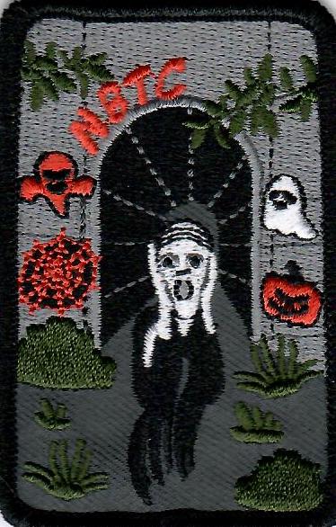
Join us for the final Cave Springs Witch Hunt hike of the season. This hike can be used towards earning the Screaming Tunnel badge.Discover the history of the 19th Century Quarry Pioneers and the Witch of Cave Springs
Please arrive by 8:45 so we can check in and be ready to head out at 9 am.
The meeting place is on Quarry Rd in Beamsville just next to the Bruce Trail. Google maps link: https://maps.app.goo.gl/Nr4gM9muiSt8DiUT8
The path to Cave Springs is quite rocky and has some hills. We recommend using hiking poles and wearing good hiking shoes. Carry water and dress for changeable weather.
The hike includes some local lore, but there’s a lot more than we can cover while hiking!
You can read more about the Witch of Cave Springs at this link, including reviewing a copy of “The Mystique of Cave Springs” by Margaret Reed: https://drive.google.com/drive/folders/1D1wreBwDD3PvD6YfqUGh1AkyJCPjhggf?usp=sharing
Wasaga Dunes
https://hikesstaging.brucetrail.org/event/wasaga-dunes/Sorry, the registration cut-off time for this hike has been reached.Not a member? Click here to join today!Hosting Club: Blue Mountains
Category: Register in person the morning of hike.
Location (Google Maps): Hike meets at Tim Horton’s, Mosley Street, Wasaga BeachHike Leader(s): Michael Treuman Click here to contact Hike Leader(s)
Pace: Medium – 3 to 4 km/hr
Terrain: Moderate – Some hills and/or some poor footing
Distance: 6 kmDescription
We will meet at Tim Hortons in Wasaga Beach – take Beachwood Drive to Mosley Street and Tim Horton’s is on the right just before the bridge). We will hike over the Dunes and along the river. The hike is partially on the Ganaraska trail. Bring a snack and water.9:00 DeCew to Morningstar Mill
https://hikesstaging.brucetrail.org/event/900-decew-to-morningstar-mill-2/Sorry, the registration cut-off time for this hike has been reached.Not a member? Click here to join today!Hosting Club: Niagara
Category: In and Out
Location (Google Maps): DeCew House, 2350 DeCew Rd, Thorold.Hike Leader(s): Debbie Demizio Click here to contact Hike Leader(s)
Pace: Medium
Terrain: ModerateDescription
This hike follows the main trail along Moody Lake to the Morningstar Mill side trail, past the DeCew Falls to Morningstar Mill. Total 5.3 kms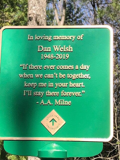
Dan Welsh Memorial Hike
https://hikesstaging.brucetrail.org/event/dan-welsh-memorial-hike-2/Sorry, the registration cut-off time for this hike has been reached.Not a member? Click here to join today!Hosting Club: Iroquoia
Category: Special Event
Location (Google Maps): Park behind Kilbride School 6611 Panton St Burlington
in the large parking lot behind the school.Hike Leader(s): Ruth Moffatt Click here to contact Hike Leader(s)
Pace: Medium – 3 to 4 km/hr
Terrain: Moderate – Some hills and/or some poor footing, Strenuous – Hilly with steep climbs and some poor footing
Distance: About 8kmDescription
This is the 4th anniversary of Dan’s passing and we will gather to hike in his memory. Our hike will take us around the River and Ruin side Trail, Cleaver Side Trail and Dan Welsh Side Trail. Please wear plaid if you’d like and share your favourite memory. Donuts and coke will be complimentary/by donation after our hike back at the parking lot, tailgate style. Proceeds to the Bruce Trail Conservancy.
Please bring enough water/snacks for a three hour hike and dress for the forecasted weather. Please bring your icers just in case.
Dan Welsh memorial badges will be available for $20 each. It is hoped that eventually there will be a memorial award in his memory.
If anyone needs a ride from Grimsby, please reach out to me.Headwaters Hike Series (North) - # 3 of 3 - Pretty River (Map 23, Blue Mountains Section)
https://hikesstaging.brucetrail.org/event/headwaters-hike-series-north-3-of-3-pretty-river/Sorry, the registration cut-off time for this hike has been reached.Not a member? Click here to join today!Hike open to BTC Members only.
Hosting Club: Dufferin Hi-Land
Category: General Hike
Location (Google Maps): Meet at the Snowmobile Parking Lot, 63597 Pretty River Rd north of Duntroon.Hike Leader(s): Margery Cruise,Susan Ford Click here to contact Hike Leader(s)
Pace: Medium
Terrain: Moderate, Strenuous
Distance: 9.9Description
We will walk 380 meters on Pretty River road to the trail start at km 46.8 (Map 23, Blue Mountains Section). We will follow the main trail to the John Haigh Side Trail follow it to the highest point of the Bruce trail. Then we turn around, retrace our steps and follow Pretty River Side Trail. When it joins the main trail, we will follow it back to Pretty River Road and walk east to the parking lot.Directions: From CR 124 and HW 89, north on CR 124 to Singhampton, continue east on CR 124 and then north to Sideroad 33 and 34 Nottawasaga. Turn left and look for Snowmobile Parking Lot.
This is a series of 7 hikes: 3 Headwaters North and 4 Headwaters South. Hikers completing all 7 hikes in this series will be eligible to purchase a Headwaters Hike Series Badge (when available) from Dufferin Hi-Land BTC. The North section is offered in the Fall of 2023, while the south section will be offered in the Spring of 2024.

#1/4 Toronto Urban Badge Hike - 18km
https://hikesstaging.brucetrail.org/event/urban-walk-1-4-toronto-urban-badge-hike-18km/Sorry, the registration cut-off time for this hike has been reached.Not a member? Click here to join today!Hosting Club: Toronto
Category: Urban Walk
Location (Google Maps): Evergreen Brick Works – TTC 28 Terminal. TTC bus 28 connects Davisville Station and Evergreen Brick Works.Hike Leader(s): Alina Lin Click here to contact Hike Leader(s)
Pace: Moderate
Terrain: Flat
Distance: 19 KMDescription
Let’s explore the city in winter and build up our appetites for the holiday season while earning the unique Toronto Urban Hike Badge.To qualify for the badge, we will embark on a 74 KM loop (map: https://onthegomap.com/s/c2c1hf3n ) through a series of four Saturday hikes scheduled for Nov 25 (18 KM), Dec 2 (17 KM), Dec 9 (23 KM), and Dec 16 (20 KM). On both Nov 25 and Dec 2, we will conclude our hikes at Leslie & Sheppard, with the option to visit the Mountain Equipment Company North York store for an introduction to winter hiking gear.
Please bring hot beverage and snacks/light lunch for our journey. We will take short breaks for restroom stops and lunch at suitable locations along the trails. The majority of the route consists of paved paths, so running shoes are recommended over hiking boots.
Badges by request will be presented at the last hike. The cost of the badge is $5 for members and $15 for non-members.
Harrison Park - Arboretum Loop
https://hikesstaging.brucetrail.org/event/harrison-park-arboretum-loop/Sorry, the registration cut-off time for this hike has been reached.Not a member? Click here to join today!Hosting Club: Sydenham
Category: Health & Nature Hike
Location (Google Maps): Parking lot by the Harrison Park Inn in Harrison Park, 137 2nd Avenue East, Owen Sound (Map 32)Hike Leader(s): Danuta Valleau Click here to contact Hike Leader(s)
Pace: Leisurely: 3 km/h or less
Terrain: Easy: Mostly flat and good footing.
Distance: about 4 kmDescription
We will cross the bridge together and walk south along the river, taking the side trail into the Grey Sauble Conservation Authority and tour the arboretum before retracing our steps via the river. Option to have lunch at the Harrison Park Inn afterwards. Please contact hike leader if interested. Bring walking poles if you have them. Supportive footwear (or snow shoes if conditions are right). Bring your own water bottle. If you are unable to register, please call or text the hike leader at 519-378-5630.
Urban Walk: Toronto Beach Walk and Glen Stewart Ravine
https://hikesstaging.brucetrail.org/event/urban-walk-toronto-beach-walk-and-glen-stewart-ravine/Sorry, the registration cut-off time for this hike has been reached.Not a member? Click here to join today!Hosting Club: Toronto
Category: Urban Walk
Location (Google Maps):Meet at the Toronto Public Library, Beaches Branch, 2161 Queen Street East, Toronto, M4L 1J
Hike Leader(s): Jeanette Vincen Click here to contact Hike Leader(s)
Pace: Moderate
Terrain: Flat, Other (Refer to Description)
Distance: 10kmDescription
Meet at the Toronto Public Library, Beaches Branch. We will walk the boardwalk and easy pathways that wind along the variety of beaches from Silver Birch Avenue to Ashbridges Bay Park. It will be an out and back route, with lots of views into Lake Ontario, you will see many points of interest, parks, Kew gardens, including the historic Leuty Lifesaving Station and the historic architecture of the Ashbridges Bay Wastewater Treatment Plant, the R.C. Harris Filtration Plant. I have frequent visits to this area and we will make our way across Queen St. to walk the Glen Stewart Ravine a nice ascent, taking in beautiful picturesque natural areas along Ames creek, meandering on elevated boardwalks and stair cases and then descending the area on some of the pleasing neighourhood streets back to our start at the Beaches Branch Library. A pleasing area that offers a little something for everyone!If you want something a little shorter you can drop-out at various areas along the way.No dogs. Good footwear, snacks/lunch and water. Dress according to the weather conditions. - 26November 26, 2023
HIKE LEADER CERTIFICATION COURSE
https://hikesstaging.brucetrail.org/event/hike-leader-certification-course-2/Sorry, the registration cut-off time for this hike has been reached.Not a member? Click here to join today!Hosting Club: Niagara
Category: Event Hikes
Location (Google Maps): PLZ308. Plaza is the building behind (attached) to the Cairns building (all glass) right above the campus store. Parking is free in Zone 1 on weekends and it is a short walk from the parking lot.Hike Leader(s): Alan Laver Click here to contact Hike Leader(s)
Description
This is a 2 session course for “Hike Ontario” Certified Hike Leader. Led by Alan Laver a Certified Hike Ontario Instructor, the first session will take place on Zoom at 6:30 to 8:30 on November 24 and will be an opportunity to introduce yourself, get an insight to the course content and share your hiking experiences. The main session on Sunday at Brock University will start at 8:30 and will be in class learning until the afternoon when practical hike leading scenarios will take place. You must bring a backpack with items you would carry on a hike as a leader as we will be sharing this. Dress for the weather and bring a packed lunch.
Most BTC members will be reimbursed by their individual clubs subject to participating in leading hikes
Course Literature will be providedContact details Alan Laver at alanjlaver@gmail.com
Boyne Valley to Kilgorie
https://hikesstaging.brucetrail.org/event/boyne-valley-to-kilgorie/Sorry, the registration cut-off time for this hike has been reached.Not a member? Click here to join today!Hosting Club: Dufferin Hi-Land
Category: General Hike
Location (Google Maps): Roadside parking near post boxes on Centre Road in Kilgorie, 30 metres south of River Road. km 33.8 BTC Map 20.Hike Leader(s): Stuart Law Click here to contact Hike Leader(s)
Pace: Medium
Terrain: Slippery and Steep Sections, Slippery Sections Likely, Strenuous
Distance: 16.5 kmsDescription
Join us for a quiet Sunday shuttle hike from the Boyne Valley to Kilgorie in the beautiful Dufferin Section. Lots of ups and downs! Please bring a garbage bag for your dirty boots and a pair of clean footwear to change into for the ride back (we will leave that stuff in the cars at the end of the hike). Please bring 2L of water, a warm drink, a snack, and a lunch. Please have your icers in your backpack just in case. Boots mandatory. Poles recommended. Please arrive at 8:45 to be ready to shuttle at 9 am sharp.Blantyre to Grey Road 40
https://hikesstaging.brucetrail.org/event/blantyre-to-grey-road-40/Sorry, the registration cut-off time for this hike has been reached.Not a member? Click here to join today!Hosting Club: Beaver Valley
Location (Google Maps): Meet in the Bruce Trail parking lot on Grey Road 40, km 105.7, Map 28, Edition 31, to shuttle to Blantyre on Grey Road 12.
Hike Leader(s): Glenda Collings Click here to contact the hike leader.
Pace: Medium
Terrain: Moderate, Some rocky footing
Length of Hike: 11.6 kmDescription
This is a lovely hike which takes us along a section of escarpment, to the terminus of the Beaver Valley Bruce Trail at Blantyre. We’ll see crevices, some scenic views, creeks, and farmland along the way. Bring snacks (and sufficient water) for a short break at the halfway point. Who knows what the weather will bring by late November, so keep your icers in the car. If there is sufficient snow, we’ll plan to shorten the hike and use snowshoes.Sunday Rambles - Crawford Lake
https://hikesstaging.brucetrail.org/event/sunday-rambles-crawford-lake/Sorry, the registration cut-off time for this hike has been reached.Not a member? Click here to join today!Hosting Club: Iroquoia
Category: General Hike
Location (Google Maps):Hike Leader(s): Colleen Mabalay Click here to contact Hike Leader(s)
Pace: Medium – 3 to 4 km/hr
Terrain: Moderate – Some hills and/or some poor footing
Distance: Approx 7kmDescription
Please register for parking with Halton Conservation before hike.Meet in first parking lot beside gate 15mins before 10am start.
Bring water & snack. Be prepared for weather conditions (snow – bring icers).
If you need to cancel day of hike please text me at (905) 815-7100
Urban Walk: Tommy Thompson Park-Toronto's Urban Wilderness (on the Leslie Street Spit) Toronto
https://hikesstaging.brucetrail.org/event/urban-walk-tommy-thompson-park-torontos-urban-wilderness-on-the-leslie-street-spit-toronto/Sorry, the registration cut-off time for this hike has been reached.Not a member? Click here to join today!Hike open to BTC Members only.
Hosting Club: Toronto
Category: Urban Walk
Location (Google Maps):Tommy Thompson Park, 1 Leslie St. Toronto
Hike Leader(s): Jeanette Vincent Click here to contact Hike Leader(s)
Pace: Moderate
Terrain: Flat
Distance: 12kmDescription
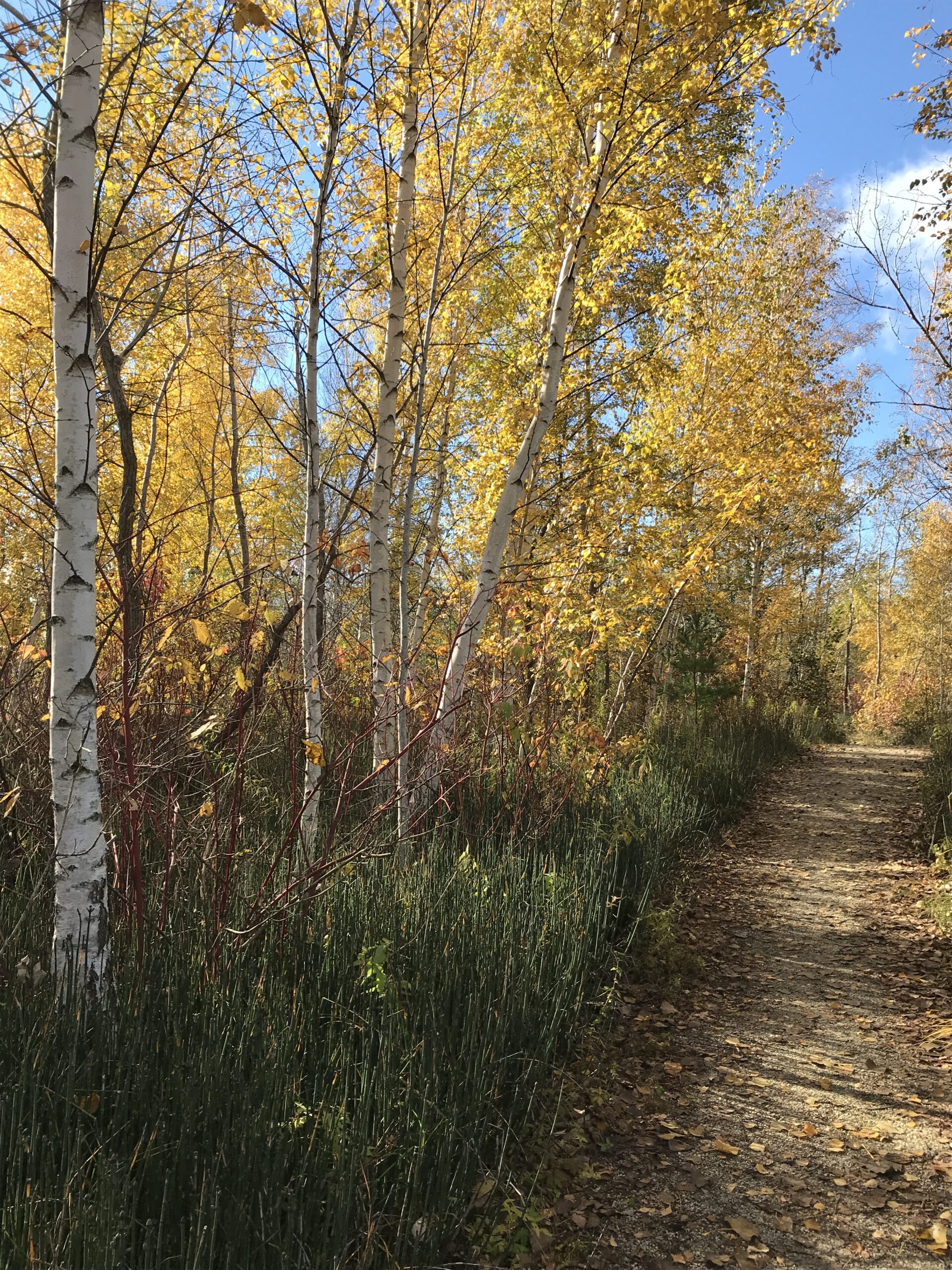
Meet at 10:30 a.m. at the entrance parking lot at 1 Leslie St. We will walk to the end of the spit and back using some of the various side trails. A unique place to experience nature and wildlife. The spit has been made from the rubble from an ever growing Toronto which began in 1959. Excellent views of Toronto and Lake Ontario.No dogs. Bring snack/lunch water. Dropouts along the way. Dress appropriate for the weather conditions.
Sunday Social Hike - Woodford Escarpment Loop(s)
https://hikesstaging.brucetrail.org/event/sunday-social-hike-woodford-escarpment-loop/Sorry, the registration cut-off time for this hike has been reached.Not a member? Click here to join today!Hosting Club: Sydenham
Category: General Hike
Location (Google Maps): Meet in the north-east corner of the parking lot at Home Depot on Highway 26 on the east side of Owen Sound.Hike Leader(s): Maureen McFarland Click here to contact Hike Leader(s)
Pace: Leisurely: 3 km/h or less
Terrain: Moderate: Some hills and/or poor footing, There might be icy and slippery sections., There might be muddy sections.
Distance: 4 kmsDescription
We will carpool to Woodford Community Hall. From there we will walk along the main trail to the Woodford Escarpment Side Trail and follow it until it meets the main trail to return to the parking lot. On this trail there are a couple of crevices (the more difficult one can be avoided), remains of a pioneer homestead, a lime kiln and more. If the group wishes to go further, we can cross the highway to do the Crevice Springs Side Trail Loop. It would add another 1.4 kms to the day. Wear good footwear and bring a snack and water. Map 30. If you are unable to register, please call or text the leader at 647-918-4180. - 27November 27, 2023

Iroquoia End 2 End in 6 Fundraiser Hike
https://hikesstaging.brucetrail.org/event/iroquoia-end-2-end-in-6/Sorry, the registration cut-off time for this hike has been reached.Not a member? Click here to join today!This is a Multi-Day Hike
You are signing up for the following dates and times:
2023-11-27 at 07:45
2023-11-28 at 07:45
2023-12-01 at 07:45
2023-12-04 at 07:45
2023-12-07 at 07:45
2023-12-08 at 07:45Hosting Club: Iroquoia
Category: Iroquoia E2E-in-Six
Location (Google Maps): Fundraiser series of 6 hikes to complete Iroquoia End to End. We will meet at the end point of each hike and carpool shuttle to trailhead. We will take turns to shuttle drivers back to their cars at the end of each hike. List of hike meeting places and trailhead coordinates will be emailed to registered hikers the week before the hikes. Refunds are not allowed.Hike Leader(s): Steven White Click here to contact Hike Leader(s)
Pace: Brisk – 4 to 5 km/hr
Terrain: Strenuous – Hilly with steep climbs and some poor footing
Distance: 19-23 km per dayDescription
This series of hikes entitle the successful hiker to obtain the new stained glass badge with the Jefferson Salamander – a beautiful and unique badge. This series of hikes is for the experienced hiker due to pace (Brisk) , strenuous sections of Iroquoia trail and length of hike each day. Hikers should anticipate fall and winter conditions – boots, icers, poles, gators, layered clothing, water, snacks, lunch, first aid kit. We will take turns shuttling from meeting place to trailhead each day and a driver will need to take the shuttle drivers back to their car at the end of the hike. We will meet each day at 7:45 and shuttle to trailhead – hikers should arrive 15 minutes early to ensure ready to leave at 7:45. Anticipate most hikes will take approx 5-6 hours including lunch and snack breaks.
Please ensure you are physically able to manage the pace, distance and potential wintry conditions of this hike before registering. Refunds are not allowed. Your fee includes the badge.9:00 Observing While Hiking
https://hikesstaging.brucetrail.org/event/900-observing-while-hiking-3/Sorry, the registration cut-off time for this hike has been reached.Not a member? Click here to join today!Hosting Club: Niagara
Location (Google Maps): Fireman’s Park, Lower Parking Lot. The entrance to the parking lot is on Dorchester just after the railway tracks
Hike Leader(s): Mary-Lyn Hopper Click here to contact Hike Leader(s)
Pace: Medium
Terrain: Moderate
Distance: Aprox 6 kmDescription
Hike along the trails around Fireman’s park looking and listening at birds and wildlife
7:00 pm Moonlight Night Hike in Niagara-on-the-Lake
https://hikesstaging.brucetrail.org/event/700-pm-moonlight-night-hike-in-niagara-on-the-lake-3/Sorry, the registration cut-off time for this hike has been reached.Not a member? Click here to join today!Hosting Club: Niagara
Category: Night
Location (Google Maps): Veteran’s Memorial Park, park just outside the park on King St.Hike Leader(s): Robin Garrett Click here to contact Hike Leader(s)
Pace: Medium
Terrain: Easy
Distance: 6-7 kmDescription
Moonlight Night Hike – Take in the magic of the rising moon over Lake Ontario and the Niagara River. This hike includes a stop to connect with your senses – sights, sounds, smells and the rhythm of your breath. Counts towards your night hike badge (5 night hikes).