
Hike Schedule
Join us for a hike! Registration required:
All hikes available to BTC members. Some hikes are open to non-members.
TIP: The calendar view displays up to 7 hikes on a day, but often there are more. Click “More events” to see them all.
Categories
- 17November 17, 2023

9:00 Niagara-on-the-lake Tour
https://hikesstaging.brucetrail.org/event/900-niagara-on-the-lake-tour-14/Sorry, the registration cut-off time for this hike has been reached.Not a member? Click here to join today!Hosting Club: Niagara
Category: Urban
Location (Google Maps): Meet on King St near Centre St, just outside of Veteran’s Memorial ParkHike Leader(s): Margaret Northfield Click here to contact Hike Leader(s)
Pace: Medium
Terrain: Easy
Distance: 5-6kmDescription
Each Friday we will explore different neighbourhoods, trails and parkland throughout Historic Niagara-on-the-Lake.
Moderate pace with some weeks entirely on sidewalks and roads while others may include a mix of trails and paved pathways. Great way to build up endurance for longer more strenuous hikes.
Prepare for cooler windy conditions on open parkland and along Lake Ontario and Niagara River trails.
Plan to stay for conversation and a warm cup of coffee or tea at Sweets & Swirls, Community Centre, Niagara Stone Road, NOTL
Loop with Loree Forest and Loree Side Trail - Cancelled
https://hikesstaging.brucetrail.org/event/loop-with-loree-forest-and-loree-side-trail/Sorry, the registration cut-off time for this hike has been reached.Not a member? Click here to join today!Hosting Club: Beaver Valley
Location (Google Maps): Meet at the corner of 21st Sideroad & 4th Line near km 2.3, Map 24, Edition 31
Hike Leader(s): Glenda Collings Click here to contact the hike leader.
Pace: Medium
Terrain: Moderate, Some steep sections
Length of Hike: 8.1 kmDescription
We will be hiking to Loree Forest from Intercept Side Trail, getting some cardio on the few climbs on the way. Once we loop the forest, we’ll continue down to the Loree side Trail, then walk back to our cars. The leaves will be gone so there will be great views – a perk of late fall hiking. Bring a snack and sufficient water. Speaking of late fall, our outing will depend on what the weather does and you’ll be kept in the loop on that.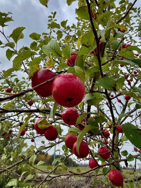
Easy Hike - John Appleton Sidetrail and the Palmer Property Hike
https://hikesstaging.brucetrail.org/event/easy-hike-john-appleton-sidetrail-and-the-palmer-property-hike/Sorry, the registration cut-off time for this hike has been reached.Not a member? Click here to join today!Hosting Club: Peninsula
Location (Google Maps): Meet at Bruce County 9 with access via the parking lot which is across from the old Barrow Bay general store.
Hike Leader(s): Marg Glendon Click here to contact Hike Leader(s)
Pace: Leisurely
Terrain: Easy, Moderate
Distance: ~ 3 1/2 KMDescription
Join Brian Popelier, BTC Ecologist on this hike as we learn about the restoration of this lovely BTC Nature Reserve. We will take a stroll here to see nature’s bounty and imagine how birds and animals depend on it for nourishment and nest building. Then – a hop, skip and jump away is the John Appleton Sidetrail and Hawthorne Sidetrail which creates a loop with the main trail , in total ~3 km. This well protected walk in the woods path meanders through the property crossing crevices and a few very short “up and down” sections.Map #:38

Urban Walk: Rattray Marsh Evening Hike
https://hikesstaging.brucetrail.org/event/urban-walk-rattray-marsh-evening-hike/Sorry, the registration cut-off time for this hike has been reached.Not a member? Click here to join today!Hosting Club: Toronto
Category: Urban Walk
Location (Google Maps):Clarkson GO Station
Hike Leader(s): Ginny Giraudi Click here to contact Hike Leader(s)
Pace: Moderate
Terrain: Flat
Distance: 12 kmDescription
We will meet inside the Clarkson GO Station near the bathrooms at 6:30 pm and walk along the lake through Rattray Marsh to Port Credit (see route here.) Head lamps or flashlights are required as the sun will have set. The after hike stop is the Archtop Coffee Bar and Market in Port Credit. Hikers can take the 23 Lakeshore Westbound Miway bus back to the Clarkson GO (Presto is accepted) or they can use the nearby Port Credit GO Station to return home. - 18November 18, 2023
Car Hike: Hike of 2 lakes King city
https://hikesstaging.brucetrail.org/event/car-hike-hike-of-2-lakes-king-city-9/Sorry, the registration cut-off time for this hike has been reached.Not a member? Click here to join today!Hosting Club: Toronto
Category: Car Hike
Location (Google Maps): Park along Fairfield Dr. or Dufferin Street, Gathering at trail head in Dufferin Street.Hike Leader(s): Mohammad Aghamiri Click here to contact Hike Leader(s)
Pace: Moderate
Terrain: Variable
Distance: 14-17KMDescription
Will explore Toronto part of Rouge park along Rouge river and Little Rouge Creek,Some safety procedures during the hike:
1-Hikers must stay between the leader and the sweep.
2-Hikers must advise the leader or the sweep if they wish to leave the group.
3- Hikers must follow the whistle instructions: 1 blast- stay where you are; 2 blasts come to the leader; 3 blasts – come to the leader quickly.
4-Hike leader may request volunteers to stop at trail intersections, they need to help hikers to the direction the group walk and wait till they see the sweep .
5-Hikers have to make sure they can see the persons behind and in front of them.
Bus Hike: Hockley Valley and Mono Cliffs
https://hikesstaging.brucetrail.org/event/bus-hike-hockley-valley-and-mono-cliffs-2/Sorry, the registration cut-off time for this hike has been reached.Not a member? Click here to join today!Trip Information
Departure Time: 08:30
Return to City Time: 18:00
Departure Point: York Mills Bus PickupOptional Items
Hosting Club: Toronto
Category: Bus Hike
Location (Google Maps): Hockley Valley and Mono CliffsHike Leader(s): Martina Furrer, Brenda Menezes, Mojgan Haghighat, Duro Vukman Click here to contact Hike Leader(s)
Pace: Moderate
Terrain: Hilly
Distance: Fast group: 16 to 18 km, Moderate group: about 13 kmDescription
Join us for an awesome hike with great views and fun hills. We will split into two groups and hike from Hockley Valley to the Split Rock Side Trail. Moderate group will hike about 13 km, and the fast group 16 to 18 km. Refreshments after if time allows.
Bus departs York Mills Station at 8:30 am.
Black Bank to Lavender
https://hikesstaging.brucetrail.org/event/black-bank-to-lavender/Sorry, the registration cut-off time for this hike has been reached.Not a member? Click here to join today!Hosting Club: Blue Mountains
Category: Register in person the morning of hike.
Location (Google Maps): Hike meets in the parking lot behind Tim Hortons on First St. in Collingwood.Hike Leader(s): David Little Click here to contact Hike Leader(s)
Pace: Medium – 3 to 4 km/hr
Terrain: Moderate – Some hills and/or some poor footing
Distance: 8 kmDescription
Car shuttle hike. We will drive to km 55.7 on the Mulmur-Nottawasaga Townline in the Dufferin Hi-Land section and leave the cars. We will then shuttle to km 47.5 on Centre Road to begin the hike. The trail climbs steeply up the east slope of the valley, passes through forest and alongside open fields. It has beautiful views to the east across the Nottawasaga Lowlands. Bring a snack and water.
Car Hike: A March and a Market
https://hikesstaging.brucetrail.org/event/car-hike-a-march-and-a-market/Sorry, the registration cut-off time for this hike has been reached.Not a member? Click here to join today!Hosting Club: Toronto
Category: Car Hike
Location (Google Maps): We will meet at the parking lot of Spirit Tree Estate Cidery located at 1137 Boston Mills Rd, Caledon. (Map 14 of the Bruce Trail Reference Guide, Edition 30)Hike Leader(s): Monica Pasquali Click here to contact Hike Leader(s)
Pace: Leisurely
Terrain: Flat, Variable
Distance: 5.8 kmDescription
Celebrate the upcoming holidays with a march along the Bruce Trail and a visit to a local artisan market!First, we’ll do an out-and-back march along the main trail of the Bruce Trail as it flows out of the Toronto section and into the Caledon Hills section. We will begin our hike at the Spirit Tree Estate Cidery parking lot and then follow the main trail on Boston Mills Road and Creditview Road in order to reach the Cheltenham Badlands. We will continue our hike along the main trail that runs through the Badlands, as well as walk along Olde Baseline Road for a short distance in order to see the Badlands in all their glory! We will then retrace our steps to return to Spirit Tree Estate Cidery.
After our hike, we’ll visit the “Handcrafted with Love” artisan market at Spirit Tree Estate Cidery to do a little holiday shopping, and we’ll follow that up with a delicious pizza lunch enjoyed outdoors at the cidery.
For the main Bruce Trail in the Toronto section: Children under 13 years of age who participate in this hike will be eligible for the Toronto Bruce Trail Club’s Youth Badge (https://torontobrucetrailclub.org/the-trail/badges) – all family members who are planning on joining us should register for the hike, including children.
For the main Bruce Trail in the Caledon section: While on our hike within the Cheltenham Badlands, I will provide assistance to hikers of all ages who are interested in earning the Caledon Hills Bruce Trail Club’s Nature Hunter Badge (http://caledonbrucetrail.ca/hiking/club-badges/nature-hunt-badge/). I will point out and identify trees and wildflowers as we hike, as well as explain plant life cycles. You should bring enough water and food for a 2-hour hike, comfortable hiking shoes, appropriate clothing for the weather, a camera if you want to work on the Caledon Hills Bruce Trail Club’s Nature Hunter Badge, and money if you intend to join us for shopping and lunch at Spirit Tree Estate Cidery (https://spirittreecider.com/) after the hike.

International Hike
https://hikesstaging.brucetrail.org/event/international-hike-2/Sorry, the registration cut-off time for this hike has been reached.Not a member? Click here to join today!Hosting Club: Niagara
Category: Urban
Location (Google Maps): Meet in the parking lot of the Floral Showhouse, 7145 Niagara River Pkwy, Niagara FallsHike Leader(s): Margaret Northfield Click here to contact Hike Leader(s)
Pace: Medium
Terrain: Easy
Distance: 10kmDescription
See the majestic Falls from several vantage points. We will hike both sides of the Niagara River, crossing the Rainbow Bridge and going to Goat Island.Bring passport or Nexus to cross the border. Bring $1 for the bridge fee.
A drink and snack are recommended. This hike will take 3-4 hours depending upon the ease/difficulty of border crossings. Please allow extra time.
9:15am Woodend
https://hikesstaging.brucetrail.org/event/915am-woodend/Sorry, the registration cut-off time for this hike has been reached.Not a member? Click here to join today!Hosting Club: Niagara
Category: In and Out
Location (Google Maps):Woodend Conservation Area – km 14.1. Enter from Taylor Rd., 140 north of Warner Rd.
Hike Leader(s): Karen Couch Click here to contact Hike Leader(s)
Pace: Leisurely
Terrain: Moderate
Distance: 6 kmDescription
Hike the main trail and portions of two side trails. The Niagara College Side Trail feature various points of interest while the main trail we will follow offers a view of multi-layered rock formations and a large block of dolostone that has broken away from the Escarpment. Look for Indigenous Marker Trees.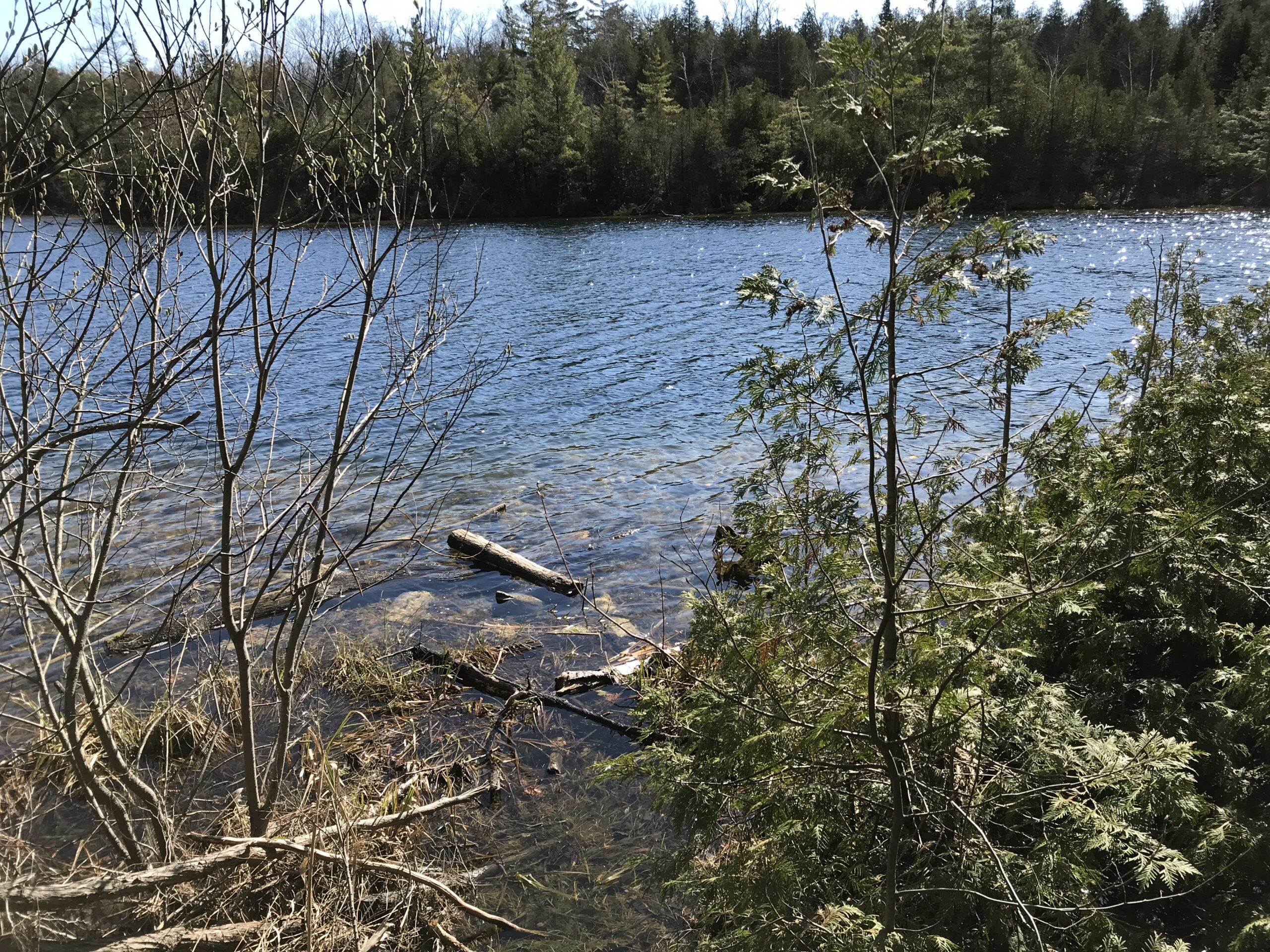
Car Hike; Crawford Lake Loop
https://hikesstaging.brucetrail.org/event/car-hike-crawford-lake-loop-2/Sorry, the registration cut-off time for this hike has been reached.Not a member? Click here to join today!Hosting Club: Toronto
Category: Car Hike
Location (Google Maps): 10 a.m. from Crawford Lake Conservation Area – 3115 Conservation Rd. Milton ON L9T 2X3, Canada (map)
Meeting point is at the parking lot next to the Visitor CentreHike Leader(s): Jeanette Vincent Click here to contact Hike Leader(s)
Pace: Moderate (3-4 km/hr)
Terrain: Variable
Distance: 8kmDescription
We will hike around Crawford Lake, a rare example of a meromictic lake and the Bruce Trail on our way to the Nassagaweya Canyon with great views and looping back to the Longhouse Village. Crawford Lake is also an important site for global scientific research. Click here to learn more about these studies and how our rare meromictic lake may help scientists define a new proposed epoch: the Anthropocene.Additional Notes:
- Reservations are not required but are recommended. If you book online, you can reserve your spot and save money on gate fees.
- Click to reserve. https://www.conservationhalton.ca/parks/crawford-lake/
For the hike
What to bring: water and snacks/lunch
What to wear: Wear hiking boots or good walking shoes. Be prepared for the weather forecast of the day.Silent Valley Loops
https://hikesstaging.brucetrail.org/event/silent-valley-loops-3/Sorry, the registration cut-off time for this hike has been reached.Not a member? Click here to join today!Hosting Club: Sydenham
Category: General Hike
Location (Google Maps): Meet in the north-east corner of the parking lot at Home Depot on Highway 26 on the east side of Owen Sound.Hike Leader(s): Maureen McFarland Click here to contact Hike Leader(s)
Pace: Medium: 3 to 4 km/h
Terrain: Moderate: Some hills and/or poor footing, Strenuous: Hilly with steep climbs and some poor footing., There might be icy and slippery sections., There might be muddy sections., There might be sections with water on the trail.
Distance: 6 kmsDescription
We will carpool to Silent Valley and hike a couple of loops – the Silent Valley Side Trail to the Avalanche Pass Side Trail. From there will we pick up the main trail going south to where it meets the Wilson Homestead Side Trail. Following the Wilson Homestead Side Trail, we pass the foundation of the settlers’ barn and well. Further on, we pass the remains of the plane that crashed in the forest 40 years ago. Good footwear is required for this hike. The Avalanche Pass Side Trail runs through an area of large boulders below the escarpment edge which can be slippery. November conditions are unpredictable, have your icers with you. Map 30. If you are unable to register, please call or text the hike leader at 647-918-4180. - 19November 19, 2023
Lavender to Kilgorie
https://hikesstaging.brucetrail.org/event/lavender-to-kilgorie/Sorry, the registration cut-off time for this hike has been reached.Not a member? Click here to join today!Hosting Club: Dufferin Hi-Land
Category: General Hike
Location (Google Maps): Roadside parking on Centre Road in Kilgorie near post boxes. 30 metres south of River Road. Km 33.8 BTC Map 20.Hike Leader(s): Stuart Law Click here to contact Hike Leader(s)
Pace: Medium
Terrain: Dependent on Conditions, Moderate, Slippery Sections Likely
Distance: 18.3 kmsDescription
Join us for a quiet Sunday shuttle hike from Lavender to Kilgorie in the beautiful Dufferin Section. We will pass through Black Bank and the new Honeywood Section of trail opened last year. We will end our hike on the banks of the Pine River heading into Kilgorie. Please bring a garbage bag for your dirty boots and a pair of clean footwear to change into for the ride back (we will leave that stuff in the cars at the end of the hike). Please bring 2L of water, a warm drink, a snack, and a lunch. Please have your icers in your backpack just in case. Boots mandatory. Poles recommended. Please arrive at 8:45 to be ready to shuttle at 9 am sharp.10:00 Decew to Morningstar Mill
https://hikesstaging.brucetrail.org/event/1000-decew-to-morningstar-mill-2/Sorry, the registration cut-off time for this hike has been reached.Not a member? Click here to join today!Hosting Club: Niagara
Category: Hike
Location (Google Maps):Hike Leader(s): Sylvia Wheeler Click here to contact Hike Leader(s)
Pace: Fast
Terrain: Moderate
Distance: 8 kmDescription
Urban Walk: Credit River Ravine
https://hikesstaging.brucetrail.org/event/urban-walk-credit-river-ravine/Sorry, the registration cut-off time for this hike has been reached.Not a member? Click here to join today!Hosting Club: Toronto
Category: Urban Walk
Location (Google Maps): Erindale Park MississaugaHike Leader(s): Ginny Giraudi Click here to contact Hike Leader(s)
Pace: Moderate
Terrain: Flat
Distance: 10 kmDescription
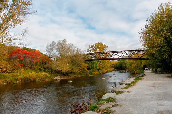
The Credit River ravine park system is beautiful in any season. Join me for this 10 km Sunday morning loop along the Credit River from Dundas to the 403 and back again through the U of T nature trail. The walk will start at the heated bathroom building in the first parking lot north of Dundas in Erindale Park and it will end at the very popular Apricot Tree Cafe on Dundas just west of Mississauga Road. Erindale park is easily accessible by Mississauga Miway buses leaving both Islington and Kipling subway stations.
Sunday Rambles - McCormack Loop
https://hikesstaging.brucetrail.org/event/sunday-rambles-mccormack-loop/Sorry, the registration cut-off time for this hike has been reached.Not a member? Click here to join today!Hosting Club: Iroquoia
Category: General Hike
Location (Google Maps): De Lottinville ParkHike Leader(s): Colleen Mabalay Click here to contact Hike Leader(s)
Pace: Medium – 3 to 4 km/hr
Terrain: Moderate – Some hills and/or some poor footing
Distance: 6kmDescription
Arrive 15mins before 10am start.Meet at Delottinville Park on Newcombe Rd, Dundas
Bring water. Be prepared for weather conditions (icers).
If you need to cancel on day of hike please text me at (905) 815-7100
Car Hike: Forks of the Credit
https://hikesstaging.brucetrail.org/event/car-hike-forks-of-the-credit-3/Sorry, the registration cut-off time for this hike has been reached.Not a member? Click here to join today!Hosting Club: Toronto
Category: Car Hike
Location (Google Maps): Forks of the Credit Provincial Park and Elora Cataract TrailwayHike Leader(s): Al Brown Click here to contact Hike Leader(s)
Pace: Moderate
Terrain: Hilly
Distance: 10 kmDescription
This will be an 10 km loop hike into the Forks of the Credit Park from the Elora Cataract Trailway. We will hike around the Kettle Lake and up to see the falls. After the hike those interested are invited to take refreshments in the village of Erin. Hiking boots are recommended plus cool weather clothing.To get to the meeting place drive north on Mississauga Road passing through the village of Belfountain. About 5 km north of Belfountain the Trailway crosses Mississauga Road. There is parking on the shoulders here but beware of no parking areas.
Sunday Social Hike - Memorial Forest loop
https://hikesstaging.brucetrail.org/event/memorial-forest-loop-9/Sorry, the registration cut-off time for this hike has been reached.Not a member? Click here to join today!Hosting Club: Sydenham
Category: General Hike
Location (Google Maps): Roadside parking at the west end of Georgian Bluffs Young’s Dr. east of km 105.8 (Map 32)Hike Leader(s): Bill Snel Click here to contact Hike Leader(s)
Pace: Leisurely: 3 km/h or less
Terrain: Moderate: Some hills and/or poor footing
Distance: 3.2 kmDescription
A loop hike in the area of Jones Falls both below and above the escarpment. Contact is Bill Snel at w.snel2.com or landline (519) 470-0584. If unable to register phone the hike leader. - 20November 20, 2023
Toronto End to End in 2
https://hikesstaging.brucetrail.org/event/toronto-end-to-end-in-2/Sorry, the registration cut-off time for this hike has been reached.Not a member? Click here to join today!Hosting Club: Iroquoia, Toronto
Category: General Hike
Location (Google Maps): Meeting place and trailhead coordinates will be emailed to registered hikers the week beforeHike Leader(s): Steven White Click here to contact Hike Leader(s)
Pace: Brisk – 4 to 5 km/hr
Terrain: Moderate – Some hills and/or some poor footing
Distance: 24-27 km per dayDescription
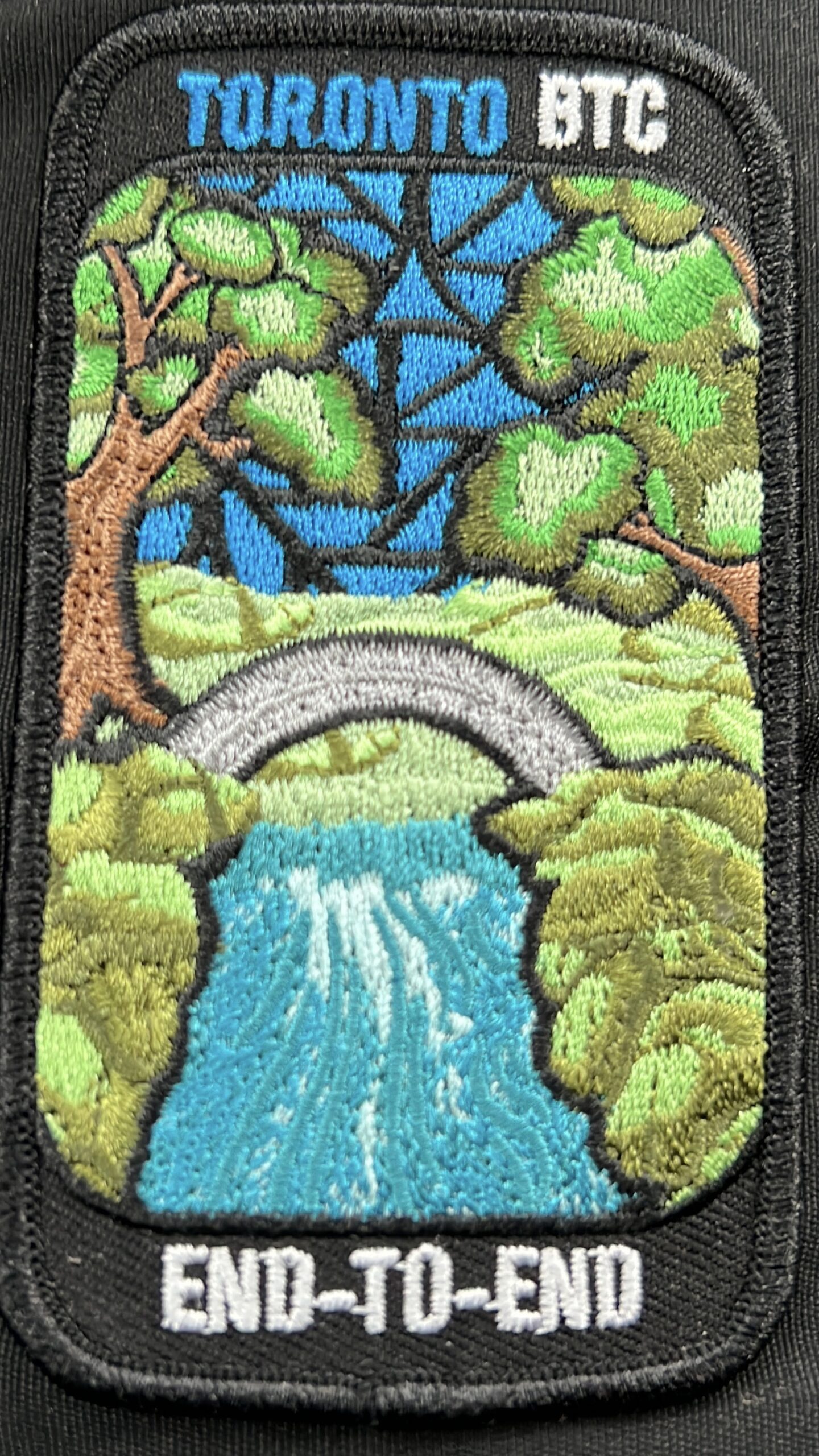
This series of hikes will entitle the successful hiker to obtain the new stained glass badge – a beautiful and unique badge. This series of hikes is for the experienced hiker due to pace (Brisk) , strenuous sections of Toronto trail and length of hike each day. Hikers should anticipate fall and winter conditions – boots, icers, poles, gators, layered clothing and come water, snacks, lunch, first aid kit. We will take turns shuttling from meeting place to trailhead each day and a driver will need to take the shuttle drivers back to their car at the end of the hike. We will meet each day at 7:45 and shuttle to trailhead – hikers should arrive 15 minutes early to ensure ready to leave at 7:45. Anticipate most hikes will take approx 6-7 hours including lunch and snack breaks. Please ensure you are physically able to manage the pace of this hike, potential wintry conditions and daily distance before registering. Refunds are not permitted. Your fee includes the badge.Car Hike: Toronto in 3 (New Fund Raising Badge)
https://hikesstaging.brucetrail.org/event/car-hike-toronto-in-3-new-fund-raising-badge/Sorry, the registration cut-off time for this hike has been reached.Not a member? Click here to join today!Hike open to BTC Members only.
This is a Multi-Day Hike
You are signing up for the following dates and times:
2023-11-20 at 08:30
2023-11-27 at 08:30
2023-12-04 at 08:30Hosting Club: Toronto
Category: Car Hike
Location (Google Maps): Km 17.4, 4th line. Coordinates N 43.615163,W 79.975157Hike Leader(s): Smadar Junkin Click here to contact Hike Leader(s)
Pace: Brisk
Terrain: Challenging, Variable
Distance: 17.4 kmsDescription
Registered hikers will earn a new badge. The new Toronto stained glass badge!!!You are registering for the three days – November 20, November 27, and Dec 4th.
Hikers need to complete all three hikes with the leader. Hikers are allowed to miss one hike that they will make up on their own and still qualify for the badge. Please keep a log of the missed hikes and give them to the leader on the last day.
The fee goes towards supporting the Toronto Bruce Trail Club, which in turn supports the mission of the Bruce Trail Conservancy “preserving a ribbon of wilderness, for everyone, forever”.
For the time being registration is limited to members of the Bruce Trail Conservancy.
This hike is intended to be BRISK (4-5k per hour). Register only if you are capable of sustaining this pace for the day over varied/rocky terrain.Hikers are expected to follow the COVID 19 guideline and stay home if they have symptoms.
Hikers may choose to wear masks.
Arrive 15 minutes early, wear sturdy footwear, always carry ID cards, bring 2 litres of water, bring your own first aid kit.
Welland Canals Hikes
https://hikesstaging.brucetrail.org/event/welland-canals-hikes-2/Sorry, the registration cut-off time for this hike has been reached.Not a member? Click here to join today!This is a Multi-Day Hike
You are signing up for the following dates and times:
2023-11-20 at 09:00
2023-11-21 at 09:00
2023-11-23 at 09:00Hosting Club: Niagara, Iroquoia
Category: General Hike
Location (Google Maps): Nov 20, 2023 – Meet in the parking lot by Allanburg Bridge 18.9km
Nov 21, 2023 – Pt 1 – Meet at Woodend Conservation, Taylor Rd 8.5km Pt 2 – Meet in Sobeys Parking lot by Johannsson’s Bar 9km
Nov 23, 2023 – Meet in the public parking lot in Port DalhousieHike Leader(s): Ruth Moffatt Click here to contact Hike Leader(s)
Pace: Brisk – 4 to 5 km/hr, Medium – 3 to 4 km/hr
Terrain: Moderate – Some hills and/or some poor footing
Distance: Day 1 18.9km, Day 2 17.5km Day 3 7kmDescription
This is a special 4 part series of hikes to commemorate the 200th anniversary of the Welland Canal. I will try to have the badges available on the last day of the hike. $10 members/$15 non-members.Please bring enough food and water for a lengthy day hike on the first two days. Our third day is a quick 7km. Dress for the expected and forecasted weather. Bring icers just in case. Please pack a first aid kit, and all the other items required for a day hike. No dogs, please.
9:00 Observing While Hiking
https://hikesstaging.brucetrail.org/event/900-observing-while-hiking-2/Sorry, the registration cut-off time for this hike has been reached.Not a member? Click here to join today!Hosting Club: Niagara
Location (Google Maps): Fireman’s Park, Lower Parking Lot. The entrance to the parking lot is on Dorchester just after the railway tracks
Hike Leader(s): Mary-Lyn Hopper Click here to contact Hike Leader(s)
Pace: Medium
Terrain: Moderate
Distance: Aprox 6 kmDescription
Hike along the trails around Fireman’s park looking and listening at birds and wildlife