
Hike Schedule
Join us for a hike! Registration required:
All hikes available to BTC members. Some hikes are open to non-members.
TIP: The calendar view displays up to 7 hikes on a day, but often there are more. Click “More events” to see them all.
Categories
- 06October 6, 2023
Wiarton to Lion's Head #2: Malcolm Bluff to Cape Croker
https://hikesstaging.brucetrail.org/event/wiarton-to-lions-head-2-malcolm-bluff-to-cape-croker/Sorry, the registration cut-off time for this hike has been reached.Not a member? Click here to join today!Hike open to BTC Members only.
Hosting Club: Dufferin Hi-Land
Category: General Hike
Location (Google Maps): Cape Croker Park camp ground entrance. Km 33.3 BTC Map36.Hike Leader(s): Stuart Law Click here to contact Hike Leader(s)
Pace: Medium
Terrain: Slippery and Steep Sections, Slippery Sections Likely, Strenuous
Distance: 18.2 kmsDescription
Join us rain or shine for this series of Peninsula shuttle hikes from Wiarton to Lion’s Head. The terrain is demanding but stunning. Hikes range from 15 to 19 km. See individual hike descriptions for details. Please be ready for rocks, poison ivy, bugs and ticks. Hiking boots and poles mandatory. Lots of climbing, some mud and a lot of laughs. Please arrive 15 minutes ahead of time because our departure times are firm. Please bring your own first aid kit with moleskin, 2.5L water, lunch, snack and a change of footwear and a garbage bag (for the shuttle). Please be prepared to use your vehicle for the shuttle. No dogs and no dropouts. Km references are to 31st Edition Bruce Trail Reference.
9:00 am Niagara-on-the-Lake Tour
https://hikesstaging.brucetrail.org/event/900-am-niagara-on-the-lake-tour-14/Sorry, the registration cut-off time for this hike has been reached.Not a member? Click here to join today!Hosting Club: Niagara
Category: Urban
Location (Google Maps): Veterans Memorial Park, park just outside the park on King StreetHike Leader(s): Robin Garrett Click here to contact Hike Leader(s)
Pace: Medium
Terrain: Easy
Distance: 6-7 kmDescription
Each Friday we will explore different neighbourhoods, trails and parkland throughout Historic Niagara-on-the-Lake.Moderate pace with some weeks entirely on sidewalks and roads while others may include a mix of trails and paved pathways. Great way to build up endurance for longer more strenuous hikes.
Prepare for cooler windy conditions on open parkland and along Lake Ontario and Niagara River trails.
Plan to stay for conversation and a warm cup of coffee or tea at Sweets & Swirls, Community Centre, Niagara Stone Road, NOTL
Slough of Despond loop
https://hikesstaging.brucetrail.org/event/slough-of-despond-loop-3/Sorry, the registration cut-off time for this hike has been reached.Not a member? Click here to join today!Hosting Club: Sydenham
Category: General Hike
Location (Google Maps): Kemble Arena parking lot for carpooling. 319897 Kemble Rock Road. Meet at 12:45. Limited parking at the trail head.Hike Leader(s): Carol Graham-Mullin Click here to contact Hike Leader(s)
Pace: Medium: 3 to 4 km/h
Terrain: Moderate: Some hills and/or poor footing
Distance: 5.5 kmDescription
President’s Path and Slough of Despond loop with an optional add on to view Skinner’s Bluff. This hike is relatively flat through fields and forests. Note : 3 stiles to climb, no walk around. Some crevices. Magnificent views of the bay and Slough of Despond. We can choose to take a short extension at the end to the lookout over Skinner’s Bluff (extra 30 minutes). If you are unable to register, please call or text the leader at 226-787-8804. - 07October 7, 2023
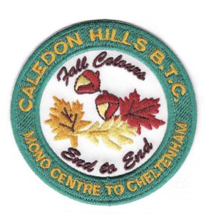
Fall Colours Club End-to-End
https://hikesstaging.brucetrail.org/event/fall-colours-club-end-to-end/Sorry, the registration cut-off time for this hike has been reached.Not a member? Click here to join today!This is a Multi-Day Hike
You are signing up for the following dates:
2023-10-07, 2023-10-08, 2023-10-09Hosting Club: Caledon Hills
Category: End-to-End
Location (Google Maps): Fung Loy Kok Taoist Tai Chi-International Centre, 248305 Side Road 5, Mono, ON L9W 6C3
GPS Co-ordinates: 43.975421, -79.989252.From Airport Road, turn east onto Side Road 5. Drive 270 metres to the entrance of the International Centre on the left. Turn right onto the first gravel road and proceed towards the pagoda-styled building. Park on the shoulder of this circular driveway. Please do not park in the main parking lot near the office. The buildings and facilities of the International Centre are off limits to participants during this Bruce Trail event.
Meeting Locations for Day 2 and Day 3 are noted in the hike description.
Hike Leader(s): Sandy Green Click here to contact Hike Leader(s)
Pace: Brisk – 4 to 5 km/hour
Terrain: Strenuous – hilly with steep climbs and some poor footing
Distance: 72.5 kilometresDescription
Make plans to complete the full 72.5 kilometres of the Caledon Hills section over the Thanksgiving long weekend.The bus will leave at 8:00 a.m. sharp, each day. Please plan to arrive at least 20 – 30 minutes before the departure time.
On Saturday, meet at the Fung Loy Kok Taoist Tai Chi-International Centre, 248305 Side Road 5, Mono, ON, 43.975421, -79.989252.
The bus will take participants to the northern end of the Caledon Hills section, at County Rd. 8 and 3rd Line EHS. The group will then hike south, back to the International Centre. Checkpoints are located 11 km, 17 km [Cut-off Time: 1:00 pm], and 26.5 into the hike.
On Sunday, meet at km 21.0, the north/east corner of Escarpment Side Road and Heart Lake Road. Park on the north side of Escarpment Side Road, well off of the road, 43.859911, -79.947606.
The bus will take hikers to km 0.0 on Creditview Road. Participants will then hike back to the meeting place on Escarpment Side Road.
Checkpoints are located 9.5 km [Cut-off Time: 11:00] and 21.0 km into the hike.
On Monday, meet at the Fung Loy Kok Taoist Tai Chi-International Centre.
The bus will take participants to Escarpment Side Road and Heart Lake Road. Everyone will then hike back to the International Centre.
Checkpoints are located 7.0 km, 14. km [Cut-off Time: 12:15 pm], and 25.0 km into the hike.
Please note that on Saturday and Monday, the final checkpoint (the end of the hike) is slightly off the Bruce Trail. There will be signs in place to direct hikers. Also note that the meeting place on Sunday is different than the other two days.

Bus Hike: Toronto Section E2E 3 of 4 - Scotsdale Farm/Terra Cotta
https://hikesstaging.brucetrail.org/event/bus-hike-toronto-section-e2e-3-of-4-scotsdale-farm-terra-cotta/Sorry, the registration cut-off time for this hike has been reached.Not a member? Click here to join today!Trip Information
Departure Time: 08:30
Return to City Time: 17:30
Departure Point: Kipling Departure PointOptional Items
Hosting Club: Toronto
Category: Bus Hike
Location (Google Maps): Toronto Section – Scotsdale Farm/Terra CottaHike Leader(s): Tom Swales & Celia Ho Click here to contact Hike Leader(s)
Pace: Moderate
Terrain: Hilly, Rocky, Variable
Distance: 15 kmDescription
Join us to hike the Toronto section of the Bruce Trail in a series of four moderate pace/moderate distance Level 2 hikes (15-16 km a day). Those who complete all 4 hikes will qualify for the Toronto club’s diamond E2E badge. The badge fee ($5 members/$15 non-members) will be collected on Hike #3.Members may alternatively choose to use the hikes to earn the new stained glass Limehouse stone bridge fundraiser badge. Available to members only the badge fee is $30 and proceeds go to protecting and preserving the Bruce Trail. Please contact the Hike Leader if you are interested in earning the fundraiser badge for further instructions. This badge can be earned only on one of the series of special group hikes led by a BTC Hike Leader and not individually.
Hikers who complete all 4 hikes will qualify for either the diamond badge or stained glass fundraiser badge, as they have chosen.
Any hikers are welcome to join the hikes regardless of working towards one of E2E badges.
There will be a refreshment/social stop in Georgetown after the hike before returning to the Kipling Station departure point by 5:30 PM
** Hikers are required to bring a mask and wear it on the bus. Masks must fit properly and cover the nose, mouth and chin. For the highest level of protection against Covid-19, respiratory viruses or the flu, KN95 or N95 masks are recommended. **
Car Hike: Erindale Park Mississauga
https://hikesstaging.brucetrail.org/event/car-hike-erindale-park-mississauga/Sorry, the registration cut-off time for this hike has been reached.Not a member? Click here to join today!Hosting Club: Toronto
Category: Car Hike
Location (Google Maps): Erindale Park Dundas Street west and Mississauga Road
Please park in parking lot after entering the parkHike Leader(s): Mohammad Aghamiri , 19 Willowbrook Rd Click here to contact Hike Leader(s)
Pace: Moderate
Terrain: VariableDescription
Please join us to hike along Credit river and see how salmon fishes go upstream and see the view of widest river around GTA,Some safety procedures during the hike:
1-Hikers must stay between the leader and the sweep.
2-Hikers must advise the leader or the sweep if they wish to leave the group.
3- Hikers must follow the whistle instructions: 1 blast- stay where you are; 2 blasts come to the leader; 3 blasts – come to the leader quickly.
4-Hike leader may request volunteers to stop at trail intersections, they need to help hikers to the direction the group walk and wait till they see the sweep .
5-Hikers have to make sure they can see the persons behind and in front of them.
Looping through Sydenham # 7 of 9
https://hikesstaging.brucetrail.org/event/looping-through-sydenham-7-of-9/Sorry, the registration cut-off time for this hike has been reached.Not a member? Click here to join today!Hosting Club: Blue Mountains
Category: Organized Hike
Location (Google Maps):Hike Leader(s): David Little Click here to contact Hike Leader(s)
Pace: Medium – 3 to 4 km/hr
Terrain: Moderate – Some hills and/or some poor footing
Distance: 11kmDescription
Glen Side Trail, Ron Savage Side Trail, Lindenwood Side Trail and Ross McLean Side Trail 7 of 9 hikes Start time: 8:30AM Hikers meet at trailhead at 8:30AM, arrange your own carpooling.
Contact hike leader for details where to meet upWiarton to Lion's Head #3: Cape Croker to Jackson's Cove
https://hikesstaging.brucetrail.org/event/wiarton-to-lions-head-3-cape-croker-to-jacksons-cove/Sorry, the registration cut-off time for this hike has been reached.Not a member? Click here to join today!Hike open to BTC Members only.
Hosting Club: Dufferin Hi-Land
Category: General Hike
Location (Google Maps): BTC parking lot on Jackson’s Cove Road at the top of the hill just west of the trail. Km 51.9 BTC Map 37.Hike Leader(s): Stuart Law Click here to contact Hike Leader(s)
Pace: Medium
Terrain: Slippery and Steep Sections, Slippery Sections Likely, Strenuous
Distance: 18.6 kmsDescription
Join us rain or shine for this series of Peninsula shuttle hikes from Wiarton to Lion’s Head. The terrain is demanding but stunning. Hikes range from 15 to 19 km. See individual hike descriptions for details. Please be ready for rocks, poison ivy, bugs and ticks. Hiking boots and poles mandatory. Lots of climbing, some mud and a lot of laughs. Please arrive 15 minutes ahead of time because our departure times are firm. Please bring your own first aid kit with moleskin, 2.5L water, lunch, snack and a change of footwear and a garbage bag (for the shuttle). Please be prepared to use your vehicle for the shuttle. No dogs and no dropouts. Km references are to 31st Edition Bruce Trail Reference.
9:00 Port Dalhousie - Jaycee Gardens & Green Ribbon Trail
https://hikesstaging.brucetrail.org/event/900-port-dalhousie-jaycee-gardens-green-ribbon-trail-3/Sorry, the registration cut-off time for this hike has been reached.Not a member? Click here to join today!Hosting Club: Niagara
Category: Urban
Location (Google Maps):Jaycee Gardens Park, 543 Ontario St., St Catharines, L2N 4N4
Hike Leader(s): Karen Couch Click here to contact Hike Leader(s)
Pace: Medium
Terrain: Easy
Distance: 10 kmDescription
This urban hike will form a loop, first crossing over Martindale Pond, then winding through town to the Green Ribbon Trail and then back close to Lake Ontario.
9:00 Cave Spring Witch Hunt
https://hikesstaging.brucetrail.org/event/900-cave-spring-witch-hunt-8/Sorry, the registration cut-off time for this hike has been reached.Not a member? Click here to join today!Hosting Club: Niagara
Category: In and Out
Location (Google Maps):Parking lot Quarry Road Beamsville
Hike Leader(s): Bill Russell Click here to contact Hike Leader(s)
Pace: Leisurely
Terrain: Moderate
Distance: 6kDescription
Discover the history of the 19th Century Quarry Pioneers and the Cave Spring Witch. Complete this hike and count it towards the Screaming Tunnel Badge
New Badge! Beaver Valley Geology Hike #3
https://hikesstaging.brucetrail.org/event/new-badge-beaver-valley-geology-hike-3/Sorry, the registration cut-off time for this hike has been reached.Not a member? Click here to join today!Hosting Club: Beaver Valley
Location (Google Maps): Meet in the Metcalfe Rock parking lot on 10th Line, near km 27.9
Hike Leader(s): Glenda Collings Click here to contact the hike leader.
Pace: Medium
Terrain: Moderate, Some rocky footing, Some steep sections, Strenuous
Length of Hike: 10.4 kmDescription
This is a series of 7 hikes to earn the Beaver Valley Geology badge. We will use the criteria listed in Beth Gilhespy’s book, Walking Through Time, Exploring Niagara Escarpment Geology in the Beaver Valley Bruce Trail Section. We’ll boost our knowledge of the local geology along the way as we take the required photos. Hikers are welcome to join any or all of the hikes, however, they must complete all 7 hikes to earn the badge. Bring sufficient water and snacks.Hike Three: The Mill Creek Valley
COVID-19 Precautions Before, During and After your Hike
- Each hiker joining a Bruce Trail Club organized hike must perform a self-screening check before hiking.
Find Ontario’s self-assessment tool here: https://covid-19.ontario.ca/self-assessment/ - If you are experiencing COVID-19 symptoms, stay home.
- Personal Protective Equipment:
- Hikers may choose to wear masks
Transportation
It is the Bruce Trail Conservancy’s current policy that car shuttles are allowed. It is at the discrepancy of individual hike leaders to make that decision.
Other Guidelines
- Arrive 15 minutes before the start of the hike.
- Wear sturdy footwear and appropriate attire for the weather and the terrain.
Hiking poles are a good idea in any season, especially if the terrain is rocky or slippery. In winter, snowshoes or icers/crampons are needed when conditions dictate.
Wearing appropriate clothing and footwear prevents injuries and shows consideration for a safe and positive group hiking experience. - Always carry I.D. and your health card.
- Bring sufficient water and snacks (or lunch if indicated). A minimum of 1L of water is recommended on all hikes, and 3L is recommended for long, challenging hikes in the heat of the summer.
- Bring sunscreen and insect repellent (for spring and summer hikes).
- Bring your own first aid kit.
- Please leave dogs at home.
Taylor Creek & West Don Ravine hike to Lawrence Subway
https://hikesstaging.brucetrail.org/event/taylor-creek-west-don-ravine-hike-to-lawrence-subway/Sorry, the registration cut-off time for this hike has been reached.Not a member? Click here to join today!Hosting Club: Toronto
Category: Urban Walk
Location (Google Maps): Start at Victoria Park subway station ticket collector. Several dropouts along the way. Final destination is Lawrence subway station on Yonge Street.Hike Leader(s): Ray Berzins Click here to contact Hike Leader(s)
Pace: Moderate
Terrain: Flat
Distance: 14 kmDescription
From Victoria Park subway we shall walk northeast along the Taylor Creek to the Don River, follow the West Don River to Sunnybrook Park, then to Sherwood Park and then to Alexander Muir Memorial Park ending up at Lawrence subway station on Yonge Street. We shall have a picnic halfway so bring a sandwich and a thermos. - Each hiker joining a Bruce Trail Club organized hike must perform a self-screening check before hiking.
- 08October 8, 2023
Niagara Falls: White Water Walk, Cham Shan Temple & Niagara Recreation Trail
https://hikesstaging.brucetrail.org/event/niagara-falls-white-water-walk-cham-shan-temple-niagara-recreation-trail/Sorry, the registration cut-off time for this hike has been reached.Not a member? Click here to join today!Hike open to BTC Members only.
Hosting Club: Toronto
Category: Urban Walk
Location (Google Maps): Niagara FallsHike Leader(s): Celia Ho Click here to contact Hike Leader(s)
Pace: Leisurely
Terrain: Flat
Distance: 10 kmDescription
Spend a leisure day at Niagara Falls by taking the Go Train. Visit the White Water Walk (White Water Walk – Explore the self-guided walk and white water rapids (niagaraparks.com)) and Cham Shan Temple (Ten Thousand Buddhas Sarira Stupa) (Ten Thousand Buddhas Sarira Stupa – Visiting Niagara Falls), and stroll along the Niagara Recreation Trail taking in the view of the falls at the Horseshoe Falls. Free time after to visit pubs/cafes/shops and other attractions. Return by Go train to Union Station at your leisure.
Itinerary:
8:45 AM – Meet at Union Go Train station to take the Go Train
11:30 AM – Arrive at Niagara Falls Go Train station
Lunch
12:00 PM – Visit White Water Walk (Optional) – Admissions = $17.50 per adult (Book your ticket here for the 12 PM timeslot: White Water Walk – Explore the self-guided walk and white water rapids (niagaraparks.com) )
1:00 PM – Visit Cham Shan Temple (Ten Thousand Buddhas Sarira Stupa) (Optional) – Admissions = N/A
2:00 to 4:00 PM – Walk to the Horseshoe Falls and back (Optional)
Please see the route map for your reference: https://onthegomap.com/s/52amkc7o
Fall Colours in Toronto Parks & Ravines: Crothers Woods
https://hikesstaging.brucetrail.org/event/fall-colours-in-toronto-parks-ravines-crothers-woods/Sorry, the registration cut-off time for this hike has been reached.Not a member? Click here to join today!Hosting Club: Toronto
Category: Urban Walk
Location (Google Maps): Meet at Crothers Woods Main Entrance at the SW Corner of Loblaws Parking LotHike Leader(s): Sajedeh Zahraei Click here to contact Hike Leader(s)
Pace: Leisurely, Moderate
Terrain: Flat, Variable
Distance: 6 KMDescription
This is the second walk in a 4 part series of fall colour walks in Toronto Parks and Ravines. You may sign up for any or all walks in the series. Join us in hiking Crothers Woods trails and enjoy the beautiful fall colours. The trail is variable and narrow in some sections which are also popular with mountain bikers. Sun Valley and Cotton Wood sections are flat where we can enjoy a leisurely walk and see sections of the Lower Don River. Wear hiking boots or comfortable running shoes, bring water and snacks.Wiarton to Lion's Head #4: Jackson's Cove to Barrow Bay
https://hikesstaging.brucetrail.org/event/wiarton-to-lions-head-4-jacksons-cove-to-barrow-bay/Sorry, the registration cut-off time for this hike has been reached.Not a member? Click here to join today!Hike open to BTC Members only.
Hosting Club: Dufferin Hi-Land
Category: General Hike
Location (Google Maps): Barrow Bay BTC parking lot on County Road #9 just south of McKague Road. Km 67.9 BTC Map 38.Hike Leader(s): Stuart Law Click here to contact Hike Leader(s)
Pace: Medium
Terrain: Slippery and Steep Sections, Slippery Sections Likely, Strenuous
Distance: 16.3 kms.Description
Join us rain or shine for this series of Peninsula shuttle hikes from Wiarton to Lion’s Head. The terrain is demanding but stunning. Hikes range from 15 to 19 km. See individual hike descriptions for details. Please be ready for rocks, poison ivy, bugs and ticks. Hiking boots and poles mandatory. Lots of climbing, some mud and a lot of laughs. Please arrive 15 minutes ahead of time because our departure times are firm. Please bring your own first aid kit with moleskin, 2.5L water, lunch, snack and a change of footwear and a garbage bag (for the shuttle). Please be prepared to use your vehicle for the shuttle. No dogs and no dropouts. Km references are to 31st Edition Bruce Trail Reference.
Urban Walk: 16 Mile Creek, Oakville
https://hikesstaging.brucetrail.org/event/urban-walk-16-mile-creek-oakville-3/Sorry, the registration cut-off time for this hike has been reached.Not a member? Click here to join today!Hosting Club: Toronto
Category: Urban Walk
Location (Google Maps):Starts and ends at Oakville GO Station
Hike Leader(s): Ginny Giraudi Click here to contact Hike Leader(s)
Pace: Moderate
Terrain: Other (Refer to Description)
Distance: 15 kmDescription
Not a big fan of dry turkey or your in-laws? Tell them you can’t attend, you have booked a hike for Thanksgiving Sunday and it is too late to cancel!This hike explores the Lion’s Valley ravine created by the 16-Mile Creek in Oakville. The hike starts and ends at the Oakville GO Station.
If you are planning to travel by GO train to Oakville from Union Station, you will be taking the 8:44 am westbound train. Please use the bathroom while on the GO train as there is little time for it at the Oakville GO station.
We will all meet at 9:25 am at the Oakville Transit Bus Platform 27 at the Oakville GO Station (click here for station diagram.) From here we will board Bus 13 at 9:40 am and take a short bus ride to the start point of our hike. Oakville Transit buses accept Presto, and if you have paid for the GO train, the fare for the Oakville bus will register as zero. We will walk a 15 km looping trail through the 16-Mile Creek ravine (click here for route map), stopping at the halfway point for lunch (port-a-potties only; bring hand sanitizer and tp) and return to the Oakville GO Station. The trail is stone dust gravel or asphalt and mostly flat except for two steep declines and two long climbs. There is one long set of stairs to descend. The after-hike pub stop is at the Beertown Public House (click here for menu) near the Oakville GO Station.
You can also drive to the Oakville Station and meet us there. Parking is free on the weekends. You may also choose to park in a parking lot located at the intersection of McCraney St. W. and Old Upper Middle Road approximately 1 km from where we enter the trail system. Please park by 9:30 am and walk to the trail entry to meet us there by 9:50 am.
Sunday Social Hike - Palisades figure 8 loop
https://hikesstaging.brucetrail.org/event/sunday-social-hike-palisades-figure-8-loop/Sorry, the registration cut-off time for this hike has been reached.Not a member? Click here to join today!Hosting Club: Sydenham
Category: General Hike
Location (Google Maps):Roadside parking on Owen Sound 7th Ave. E. just south of 1st St. E., west of km 90.2 (Map 32)
Hike Leader(s): Bill Snel Click here to contact Hike Leader(s)
Pace: Leisurely: 3 km/h or less
Terrain: Moderate: Some hills and/or poor footing, Strenuous: Hilly with steep climbs and some poor footing.
Distance: 1.8 kmDescription
A figure 8 hike on the east side of Owen Sound with many interesting rock formations. It also contains 1 Secret of Sydenham. For more information contact Bill Snel at w.snel2@gmail.com or call landline (519) 470-0584. If unable to register phone the hike leader. - 09October 9, 2023
Wiarton to Lion's Head #5: Barrow Bay to Lion's Head
https://hikesstaging.brucetrail.org/event/wiarton-to-lions-head-5-barrow-bay-to-lions-head/Sorry, the registration cut-off time for this hike has been reached.Not a member? Click here to join today!Hike open to BTC Members only.
Hosting Club: Dufferin Hi-Land
Category: General Hike
Location (Google Maps): Lion’s Head arena. 4 Tackabury Street, Lion’s Head. Paid parking ($20.00). Prior online reservation required. Please contact hike leader for details. About 1 km west of km 81.5, BTC Map 38.Hike Leader(s): Stuart Law Click here to contact Hike Leader(s)
Pace: Medium
Terrain: Slippery and Steep Sections, Slippery Sections Likely, Strenuous
Distance: 16.5 kms.Description
Join us rain or shine for this series of Peninsula shuttle hikes from Wiarton to Lion’s Head. The terrain is demanding but stunning. Hikes range from 15 to 19 km. See individual hike descriptions for details. Please be ready for rocks, poison ivy, bugs and ticks. Hiking boots and poles mandatory. Lots of climbing, some mud and a lot of laughs. Please arrive 15 minutes ahead of time because our departure times are firm. Please bring your own first aid kit with moleskin, 2.5L water, lunch, snack and a change of footwear and a garbage bag (for the shuttle). Please be prepared to use your vehicle for the shuttle. No dogs and no dropouts. Km references are to 31st Edition Bruce Trail Reference. Paid parking $20.00. Please contact hike leader for details.Urban Walk: Highland Creek Loop
https://hikesstaging.brucetrail.org/event/urban-walk-highland-creek-loop/Sorry, the registration cut-off time for this hike has been reached.Not a member? Click here to join today!Hosting Club: Toronto
Category: Urban Walk
Location (Google Maps): Morningside ParkHike Leader(s): Lindita Kalo Click here to contact Hike Leader(s)
Pace: Moderate
Terrain: Flat
Distance: 16KmDescription
Thanksgiving hike. Meet 9:45am for TTC rides at south/west corner of Ellesmere Rd & Morningside Av. 10:00am for drivers at 390 Morningside Av Parking. This lovely paved section include Highland Creek trail through forest, Waterfront trail along lake Ontario, some road walking to connect the loop. Please bring water and lunch. Optional drop at Guildwood station intersection of Kingston Rd & Celeste Dr.