
Hike Schedule
Join us for a hike! Registration required.
All hikes available to BTC members. Some hikes are open to non-members.
See Refund Policy for Paid Hikes >
TIP: The calendar view displays up to 7 hikes on a day, but often there are more. Click “View more events” to see them all.
Categories
- 09December 9, 2022

Niagara-on-the-Lake Tour
https://hikesstaging.brucetrail.org/event/niagara-on-the-lake-tour-34/Sorry, the registration cut-off time for this hike has been reached.Not a member? Click here to join today!Hosting Club: Niagara
Category: Urban
Location (Google Maps): Meet on King St near Centre St (just outside of Veteran’s Memorial ParkHike Leader(s): Margaret Northfield Click here to contact Hike Leader(s)
Pace: Medium
Terrain: Easy
Distance: 5-6kmDescription
Each Friday we will explore different neighbourhoods, trails and parkland throughout Historic Niagara-on-the-Lake.Moderate pace with some weeks entirely on sidewalks and roads while others may include a mix of trails and paved pathways. Great way to build up endurance for longer more strenuous hikes.
Prepare for cooler windy conditions on open parkland and along Lake Ontario and Niagara River trails.
Plan to stay for conversation and a warm cup of coffee or tea at Sweets & Swirls, Community Centre, Niagara Stone Road, NOTL2020
North Street to Penstocks
https://hikesstaging.brucetrail.org/event/north-street-to-penstocks/Sorry, the registration cut-off time for this hike has been reached.Not a member? Click here to join today!Hosting Club: Beaver Valley
Location (Google Maps): Meet on the shoulder, on the south side, turn cars to face east, at the end of North St. in Eugenia. (North St. is directly north of The Top O’ The Rock store.) km 58.3, Map 26, Edition 30.
Hike Leader(s): Glenda Collings Click here to contact the hike leader.
Pace: Medium
Terrain: Some steep sections
Length of Hike: Approx. 6 kmDescription
We’ll be hiking along the escarpment through forest to the Beaver Valley landmark “The Penstocks” and then returning to our cars. Some great views to be had! Please bring snowshoes and icers/crampons and we’ll decide on the day which we need.
COVID-19 Precautions Before, During and After your HikeEach hiker joining a Bruce Trail Club organized hike must perform a self-screening check before hiking.
Find Ontario’s self-assessment tool here: https://covid-19.ontario.ca/self-assessment/
If you are experiencing COVID-19 symptoms, stay home.
Personal Protective Equipment:
Hikers may choose to wear masksTransportation
It is the Bruce Trail Conservancy’s current policy that car shuttles are allowed. It is at the discrepancy of individual hike leaders to make that decision.
Other Guidelines
Arrive 15 minutes before the start of the hike.
Wear sturdy footwear and appropriate attire for the weather and the terrain.
Hiking poles are a good idea in any season, especially if the terrain is rocky or slippery. In winter, snowshoes or icers/crampons are needed when conditions dictate.
Wearing appropriate clothing and footwear prevents injuries and shows consideration for a safe and positive group hiking experience.
Always carry I.D. and your health card.
Bring sufficient water and snacks (or lunch if indicated). A minimum of 1L of water is recommended on all hikes, and 3L is recommended for long, challenging hikes in the heat of the summer.
Bring sunscreen and insect repellent (for spring and summer hikes).
Bring your own first aid kit.
Please leave dogs at home. - 10December 10, 2022
8:00 Iroquoia E2E #3
https://hikesstaging.brucetrail.org/event/830-iroquoia-e2e-3/Sorry, the registration cut-off time for this hike has been reached.Not a member? Click here to join today!Hosting Club: Niagara
Category: Car Pool
Location (Google Maps): 87.3 to 68.8 1826 Snake Road. Roadside Parking N43.317174 W79.892363 Car Pool to West side of Walkers Line Across from Cemetery. 87.3 N43.419107 W79.861377 Paid ParkingHike Leader(s): Alan Laver Click here to contact Hike Leader(s)
Pace: Medium
Terrain: Moderate
Distance: 18.5kDescription
This is the 3rd of 7 hikes to complete the Iroquoia section of the Bruce Trail. Dress for the weather and bring icers, gators, snacks and water
Car Hike: Seaton Trail North
https://hikesstaging.brucetrail.org/event/car-hike-seaton-trail-north/Sorry, the registration cut-off time for this hike has been reached.Not a member? Click here to join today!Hosting Club: Toronto
Category: Car Hike
Location (Google Maps): Seaton trail head at Whitevale villageHike Leader(s): Mohammad Aghamiri , 19 Willowbrook Rd Click here to contact Hike Leader(s)
Pace: Brisk, Moderate
Terrain: Hilly, Variable
Distance: 14-17KMDescription
We will hike along Seaton trail and enjoy the lovely sceneries of forest and river at the same timeRed Hill Creek to MacDui Dr. (+Sidetrails) Shuttle Hike
https://hikesstaging.brucetrail.org/event/red-hill-creek-to-macdui-dr-shuttle-hike/Sorry, the registration cut-off time for this hike has been reached.Not a member? Click here to join today!Hosting Club: Iroquoia
Category: Sideways
Location (Google Maps): Red Hill Creek Side Trail to MacDui Dr. Side TrailHike Leader(s): Freddy Wang Click here to contact Hike Leader(s)
Pace: Brisk – 4 to 5 km/hour
Terrain: Moderate – some hills and/or some poor footing
Distance: 16.6 kmDescription
This is one for the badge hunters. We’ll not only complete 12.3 km of the Bruce Trail, we’ll also complete all following side trails along the way as there-and-backs: Mohawk, Red Hill, Kingsview Dr., Paramount Park, Glover Mountain Rd., New Mountain Rd, Veever’s Park, Oakridge Drive, Millen Road, and MacDui Drive which will count towards the Iroquoia Side Trail Challenge badge.We will meet at the street parking on MacDui Drive, then shuttle to the Mohawk 4 Ice Centre on Mountain Brow Blvd. From there, we will complete the Mohawk Side Trail, then hike east along the Bruce Trail through King’s Forest, Felker’s Conservation Area, Devil’s Punch Bowl, and returning to MacDui Dr. Side Trail back to our cars. We will be in the forest for the majority of the hike.
Bring water, snacks, and clothing layers. Poles optional. Please arrive at 8:15 am as we will leave promptly at 8:30 am.
Questions? Contact Hike leader – Freddy Wang – fwang175@gmail.com. 416-788-1567.
Please check email before leaving home. Hike may be cancelled due to weather. Please contact hike leader if you need to cancel last minute. Thank you.
9:00 Woodend Hike
https://hikesstaging.brucetrail.org/event/900-woodend-hike/Sorry, the registration cut-off time for this hike has been reached.Not a member? Click here to join today!Hosting Club: Niagara
Category: Loop
Location (Google Maps): Meet at Woodend Conservation Area parking lot off Taylor Road.Hike Leader(s): Dan Wilson Click here to contact Hike Leader(s)
Pace: Leisurely
Terrain: Moderate
Distance: 6 kmDescription
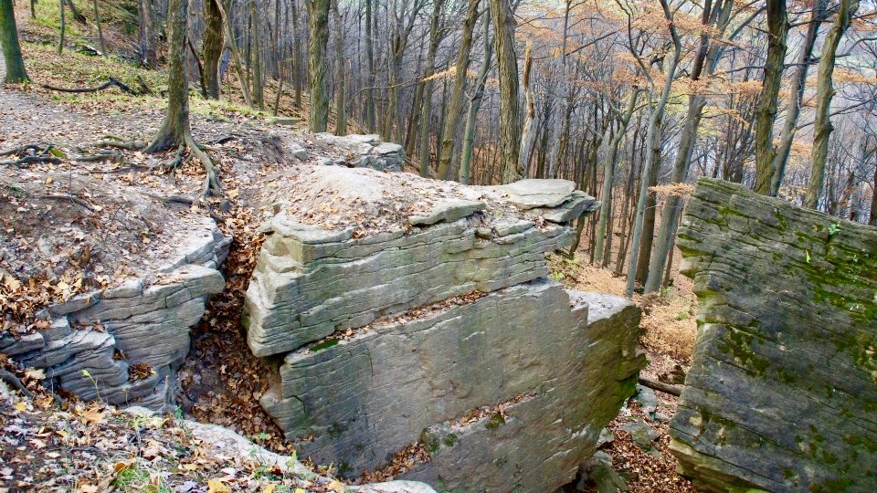
We will hike the main trail, as well as a few side trails above and below the escarpment. Please bring hiking poles and icers, if necessary.Bognor Marsh
https://hikesstaging.brucetrail.org/event/bognor-marsh-4/Sorry, the registration cut-off time for this hike has been reached.Not a member? Click here to join today!Hosting Club: Sydenham
Category: General Hike
Location (Google Maps): Meet in the north-east corner of the parking lot at Home Depot on Highway 26 on the east side of Owen Sound.Hike Leader(s): Maureen McFarland Click here to contact Hike Leader(s)
Pace: Medium: 3 to 4 km/h
Terrain: Moderate: Some hills and/or poor footing, There might be icy and slippery sections.
Distance: 6.5 kmsDescription
We will explore Bognor Marsh and hope to keep our feet dry if the ground is frozen. We take the main trail around the marsh and continue north until we meet the Bognor Marsh Side Trail. We return via the side trail to the parking lot on the main trail. Depending upon the conditions, icers or snowshoes may be needed. Hiking poles are helpful. (Map 29).If you wish to meet at Bognor Marsh, please contact the hike leader.
Margaret Paull
https://hikesstaging.brucetrail.org/event/margaret-paull/Sorry, the registration cut-off time for this hike has been reached.Not a member? Click here to join today!Hosting Club: Blue Mountains
Category: Register on-line or sign-in morning of hike
Location (Google Maps): Hike meets in the parking lot behind Tim Hortons on First St. in Collingwood.Hike Leader(s): Myra Campbell Click here to contact Hike Leader(s)
Pace: Leisurely – 3 km/hr. or less
Terrain: Easy – Mostly flat and usually good footing, Moderate – Some hills and/or some poor footing
Distance: 5kmDescription
We will drive via Grey Rd 119 to the end of the 6th Line in the Beaver Valley section. We will hike along the white blazed trail to km 11.3 where it joins up with the Margaret Paull Side Trail. We will follow the side trail back to the white blazed trail, then return to the cars. Bring water and a snack. Map 24 Ed. 30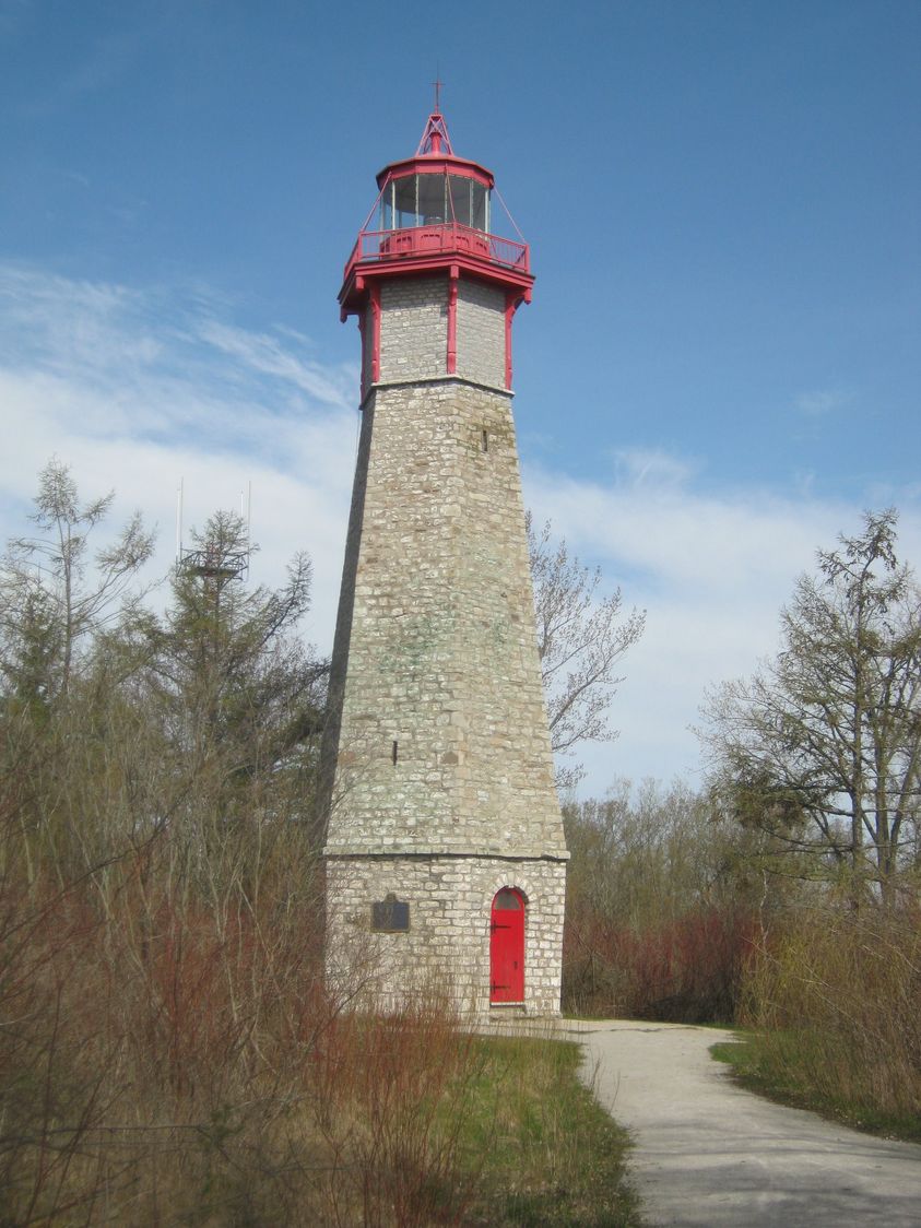
Toronto Island by Night
https://hikesstaging.brucetrail.org/event/toronto-island-by-night/Sorry, the registration cut-off time for this hike has been reached.Not a member? Click here to join today!Hosting Club: Toronto
Category: Urban Walk
Location (Google Maps): Jack Layton Ferry TerminalHike Leader(s): Tom Swales, David Royle, Andrew Proczek, Peter Leeney. Roland Mark Click here to contact Hike Leader(s)
Pace: Leisurely
Terrain: Flat, Other (Refer to Description)
Distance: 9 kmDescription
- Join us for a leisurely walk on The Toronto Islands from Ward Island to the Gibraltar Point Lighthouse, returning via the paths and trails along the northern side with great views of the city at night.
Route: https://onthegomap.com/s/rdt1vns0
Please bring a headlamp or flashlight. Icers are strongly recommended but keep an eye on the weather forecast. The lake side of the island is generally breezy so dress in layers. Bring a litre of water and possibly snacks.
After the walk we’ll head to a pub near the ferry terminal for refreshments and seasonal cheer.
We will take the Ward Island Ferry scheduled for 4 pm, please arrive at the Jack Layton Terminal by 3:45.
Fares: Adult Return, $8.70 ; Senior Return (65+), $5.60 ; Youth Return (under 19 with ID), $5.60 ; Junior Return (under 14), $4.10. You can purchase your ticket online at: https://secure.toronto.ca/FerryTicketOnline/tickets2/index.jsp
Our aim will be to catch the 6:45 return ferry from Ward Island so we can be at the Fox on Bay Pub by about 7:15. Please email Tom at tjswales@gmail.com if you want to join us at the pub so we can provide them with an accurate count.
The Fox, 35 Bay. https://www.foxonbay.ca/
- 11December 11, 2022
Sunday Rambles
https://hikesstaging.brucetrail.org/event/sunday-rambles-2/Sorry, the registration cut-off time for this hike has been reached.Not a member? Click here to join today!Hike open to BTC Members only.
Hosting Club: Iroquoia
Category: General Hike
Location (Google Maps): Ancaster Little League Park – 286 Jerseyville Rd W Ancaster (across from the Ancaster Lions Outdoor Pool)Hike Leader(s): Colleen Mabalay Click here to contact Hike Leader(s)
Pace: Medium – 3 to 4 km/hr
Terrain: Strenuous – Hilly with steep climbs and some poor footing
Distance: Approx. 10kDescription
We will follow the Spring Valley Trail, Martins Road, Headwaters Trail etc. in the western part of the Dundas Valley. Bring water and a snack (poles would also be useful).2:00pm Glenridge Quarry Loop
https://hikesstaging.brucetrail.org/event/200pm-glenridge-quarry-loop/Sorry, the registration cut-off time for this hike has been reached.Not a member? Click here to join today!Hike open to BTC Members only.
Hosting Club: Niagara
Category: Loop
Location (Google Maps): Glenridge Quarry parking lot, St. David’s Rd., Map 3Hike Leader(s): Larry Lloyd Click here to contact Hike Leader(s)
Pace: Leisurely
Terrain: Easy
Distance: 6 kmDescription
A combination of open trails with spectacular views across Lake Ontario and wooded trails including the main trail. - 12December 12, 2022
9:00 Hiking in and around Rotary Park
https://hikesstaging.brucetrail.org/event/900-hiking-in-and-around-rotary-park-9/Sorry, the registration cut-off time for this hike has been reached.Not a member? Click here to join today!Hosting Club: Niagara
Location (Google Maps): 395 Pelham Road, regional Road 69, St. Catharines
Hike Leader(s): Sheila Massey Click here to contact Hike Leader(s)
Pace: Medium
Terrain: Moderate
Distance: 6-7 kmDescription
Hiking various trails in and around Rotary Park and along 12 Mile CreekEasy Monday Hikes
https://hikesstaging.brucetrail.org/event/easy-monday-hikes-3/Sorry, the registration cut-off time for this hike has been reached.Not a member? Click here to join today!Hosting Club: Peninsula
Location (Google Maps): Cape Hurd Alvar Bay Nature Reserve – located at 745 Cape Hurd Road about 20 minutes south of Tobermory. Follow Cape Hurd Road west, past MacArthur Road. After the curve on the road, travel about 1 km. Cape Hurd Alvar Bay Nature Reserve is located on the west side of the road. Roadside parking.
Hike Leader(s): Marg Glendon
Pace: Leisurely
Terrain: Easy
Distance: ~2 kmDescription
Easy hikes are short hikes (<3 KM) that are generally flat with little elevation change and mostly clear of tree roots and rocks. Hikes are adjusted according to weather conditions. Footwear with good tread and ankle support are recommended. Hiking poles are recommended, but not required. Bring a small backpack to carry water and light snacks.We will begin our hike at the roadside and walk along the Cape Hurd Reserves Nature Trail to the shoreline. The shoreline is rocky, explore the shoreline at your comfort level. The Cape Hurd Alvar Nature Reserve is home to rare species such as the Massasauga Rattlesnake, Little Brown Myotis Bat and the Eastern Wood-Pewee. We will have a nutrition break at the shoreline and retrace our steps to the beginning of our hiie.
Learn more about Cape Hurd Alvar Nature Reserve here: https://escarpment.ca/see-our-reserves/bruce-county-and-huron-shore/cape-hurd-alvar-bay
Minimum group size- 4

19:00 Winter Festival of Lights
https://hikesstaging.brucetrail.org/event/1900-winter-festival-of-lights/Sorry, the registration cut-off time for this hike has been reached.Not a member? Click here to join today!Hosting Club: Niagara
Category: Night
Location (Google Maps): Floral Showhouse, Niagara Parkway, just south of the FallsHike Leader(s): Margaret Northfield Click here to contact Hike Leader(s)
Pace: Leisurely
Terrain: Easy
Distance: 5-6kmDescription
Get your cameras ready for the Annual Winter Festival of Lights hike. Get into a festive mood with a walk around the Falls for this annual event. Stay afterwards for hot apple cider and festive treats. Feel free to share your favourite treats.