
Hike Schedule
Join us for a hike! Registration required:
All hikes available to BTC members. Some hikes are open to non-members.
TIP: The calendar view displays up to 7 hikes on a day, but often there are more. Click “More events” to see them all.
Categories
- 17December 17, 2022
Car Hike: Glasgow Village Whitchurch-Stouffville
https://hikesstaging.brucetrail.org/event/car-hike-glasgow-village-whitchurch-stouffville-3/Sorry, the registration cut-off time for this hike has been reached.Not a member? Click here to join today!Hosting Club: Toronto
Category: Car Hike
Location (Google Maps): Glasgow Trail, Concession Road 2Park in parking lot or along the road
Hike Leader(s): Mohammad Aghamiri Click here to contact Hike Leader(s)
Pace: Moderate
Terrain: Variable
Distance: 15-16KMDescription
Approximately 5-hour hike, mostly flat, in the Uxbridge areaIt is wintertime, please bring your icers, hiking poles, warm layers of clothing, boots, and hot drinks.
8:30 Iroquoia E2E #4
https://hikesstaging.brucetrail.org/event/830-iroquoia-e2e-4/Sorry, the registration cut-off time for this hike has been reached.Not a member? Click here to join today!Hosting Club: Niagara
Category: Car Pool
Location (Google Maps): 68.8 to 50.6 Gate house Museum . Enter from 621 Sulphur Springs Road. N43.236833 W79.998578 Car Pool to 1826 Snake Road. Roadside Parking N43.317174 W79.892363 Paid ParkingHike Leader(s): Alan Laver Click here to contact Hike Leader(s)
Pace: Medium
Terrain: Moderate
Distance: 18.2kDescription
This is the 4th of 7 hikes to complete the Iroquoia section of the Bruce Trail. Dress for the weather and bring icers, gators, snacks and water

9:00 AM Rim of Africa
https://hikesstaging.brucetrail.org/event/900-am-rim-of-africa/Sorry, the registration cut-off time for this hike has been reached.Not a member? Click here to join today!Hike open to BTC Members only.
Hosting Club: Niagara
Category: Loop
Location (Google Maps): Beginning at the Short Hills Provincial Park parking lot on Pelham Rd. Map 3 – north of km 40.9Hike Leader(s): Karen Couch Click here to contact Hike Leader(s)
Pace: Medium
Terrain: Moderate
Distance: 5.3 kmDescription
This hike features gently rolling terrain, a majestic Carolinian forest, Terrace Falls and numerous streams. This section of the Bruce Trail is twinned with a section of the Rim of Africa Trail in South Africa. During this hike information about the BTC’s International Friendships Trails will be shared.Limehouse Loops
https://hikesstaging.brucetrail.org/event/limehouse-loops-4/Sorry, the registration cut-off time for this hike has been reached.Not a member? Click here to join today!Hosting Club: Iroquoia
Category: General Hike
Location (Google Maps): Limehouse Conservation Area parking lot at the baseball diamonds. Just southwest of km 20.4 on BTC Map 12 (30th Ed.).Hike Leader(s): Stuart Law Click here to contact Hike Leader(s)
Pace: Medium – 3 to 4 km/hr
Terrain: Moderate – Some hills and/or some poor footing
Distance: 18 kmDescription
Take a break from the Holiday craziness with a 18km stroll taking in a series of loops that will include the Hole in the Wall, the Black Creek Side Trail, the 17 Sideroad Side Trail, part of the Vanderleck Side Trail, the Canada Goose Side Trail and the Main Trail connecting them all. Please bring lunch, warm drink, water, a snack for elevensies, a smile and an appreciation of nature.
CANCELLED - Clara's Climb - 8km
https://hikesstaging.brucetrail.org/event/claras-climb-10km/Sorry, the registration cut-off time for this hike has been reached.Not a member? Click here to join today!Hosting Club: Iroquoia
Category: General Hike
Location (Google Maps): Livingstone Dr, Dundas at Cascades ParkHike Leader(s): Mike Gill Click here to contact Hike Leader(s)
Pace: Medium – 3 to 4 km/hr
Terrain: Strenuous – Hilly with steep climbs and some poor footing
Distance: 8kmDescription
A hike to prepare you for the next Olympics! Follow in the footsteps of Olympian Clara Hughes as we walk along the Bruce Trail to the top of Sydenham Hill. We’ll continue on to take in the view of Boer’s Falls and then return along the same route.There is a steep climb / descent along the Sydenham Hill and some narrow, single file sections to be careful of.
Icers are mandatory during winter months.
Park along Livingstone Dr.
Festive Transcarioca Trail
https://hikesstaging.brucetrail.org/event/festive-transcarioca-trail/Sorry, the registration cut-off time for this hike has been reached.Not a member? Click here to join today!Hosting Club: Blue Mountains
Category: Register on-line or sign-in morning of hike
Location (Google Maps): Hike meets in the parking lot behind Tim Hortons on First St. in Collingwood.Hike Leader(s): Dick Edwards Click here to contact Hike Leader(s)
Pace: Medium – 3 to 4 km/hr
Terrain: Moderate – Some hills and/or some poor footing
Distance: 7kmDescription
We will park at km 10.6 on 6/7 Sideroad Nottawasaga. This is a lovely snowshoe hike with rolling hills, pretty woods, and fields. We head to km 17.2. Bring a snack or lunch and water.
*The 180 km Transcarioca Trail crosses Rio de Janeiro from Barra de Guaratiba to Morro da Urca, at the foot of the Sugar Loaf Mountain. Map 22 Edition 30Bayview Escarpment Loop Hike
https://hikesstaging.brucetrail.org/event/bayview-escarpment-loop-hike/Sorry, the registration cut-off time for this hike has been reached.Not a member? Click here to join today!Hosting Club: Sydenham
Category: Snowshoe Hike
Location (Google Maps): Roadside parking along St. Vincent-Sydenham Townline where the road turns left, at km 55.2 (Map 30)
or 9:30 at HD in Owen Sound to carpoolHike Leader(s): Danuta Valleau Click here to contact Hike Leader(s)
Pace: Leisurely: 3 km/h or less
Terrain: Moderate: Some hills and/or poor footing
Distance: 4.5 kmDescription
We start from km 55.2 to follow main trail through forest and along escarpment edge and return on the side trail through mixed hardwood forest.Urban Walk: Humber River/Black Creek Trail
https://hikesstaging.brucetrail.org/event/urban-walk-humber-river-black-creek-trail/Sorry, the registration cut-off time for this hike has been reached.Not a member? Click here to join today!Hosting Club: Toronto
Category: Urban Walk
Location (Google Maps): Meet Jane Subway Station outside the Station Attendant’s BoothHike Leader(s): Tom Swales Click here to contact Hike Leader(s)
Pace: Moderate
Terrain: Variable
Distance: 9 kmDescription
Join us for a morning hike north on the Humber Trail to Dundas Street and eastbound on the Black Creek and Lavender Creek Trail to the Junction Craft Brewery in the rennovated “Destructor” Incinerator building. Light snacks available for purchase, a variety of rotating non-alcoholic beverages are available.Urban Walk: Toronto Beach Walk
https://hikesstaging.brucetrail.org/event/urban-walk-toronto-beach-walk/Sorry, the registration cut-off time for this hike has been reached.Not a member? Click here to join today!Hosting Club: Toronto
Category: Urban Walk
Location (Google Maps): Meet at the Toronto Public Library, Beaches Branch, 2161 Queen Street East, Toronto, M4L 1JHike Leader(s): Jeanette Vincent; David Royle; Brenda Menezes Click here to contact Hike Leader(s)
Pace: Leisurely
Terrain: Flat
Distance: 8kmDescription
Meet at the Toronto Public Library, Beaches Branch. We will walk the boardwalk and easy pathways that wind along the variety of beaches from Silver Birch Avenue to Ashbridges Bay Park. It will be an out and back route, with lots of views into Lake Ontario, you will see many points of interest, parks, Kew gardens, including the historic Leuty Lifesaving Station and the historic architecture of the Ashbridges Bay Wastewater Treatment Plant, the R.C. Harris Filtration Plant. I’ve had frequent visits to this area as Greg, my late husband, grew up in the beach with many fond memories. A pleasing area that offers a little something for everyone!No dogs. Good footwear, snacks and water. - 18December 18, 2022
9:00 Louth Conservation Area
https://hikesstaging.brucetrail.org/event/900-louth-conservation-area-2/Sorry, the registration cut-off time for this hike has been reached.Not a member? Click here to join today!Hosting Club: Niagara
Category: Loop
Location (Google Maps): Louth Conservation AreaHike Leader(s): Alicia Aitchison Click here to contact Hike Leader(s)
Pace: Medium
Terrain: Moderate
Distance: ~ 6 kmDescription
Join us for a hike through beautiful Louth Conservation Area – we will walk the newly created, award winning side trails to see both the upper & lower falls.Terrain can be challenging with lots of beautiful rocks & some hills.
Meet at the Louth Conservation Area parking lot on Staff Avenue.
Registration required.

Peninsula Blue Series - Hopeness, Jack Poste and Don Irish Side Trails
https://hikesstaging.brucetrail.org/event/peninsula-blue-series-hopeness-jack-poste-and-don-irish-side-trails-2/Sorry, the registration cut-off time for this hike has been reached.Not a member? Click here to join today!Hike open to BTC Members only.
Hosting Club: Peninsula
Location (Google Maps): Roadside Parking at the south end of Cathedral Dr, Lion’s Head, ON N0H 1W0, Canada
Hike Leader(s): Saabir Sohrab Click here to contact Hike Leader(s)
Pace: Medium
Terrain: Difficult, Easy, Moderate
Distance: 12 Approx.Description
December 18, 2022 – This hike is through the mature forest of Hope Bay Forest Provincial Nature Reserve We will hike the Hopeness, Jack Poste and Don Irish Side Trails and loop back on the main trail for some gorgeous lookouts overlooking the Hope Bay.Dress according to weather in layers. Bring water, lunch and wear appropriate footwear for rugged terrain.Time commitment is approximately 4-5hrs.Please arrive a few minutes before our starting time of 9:30am
Mimico Creek Trail, Part 1 - Wayne Crockett's Frustrating Pre-hike from May 23, 2020
https://hikesstaging.brucetrail.org/event/mimico-creek-trail-wayne-crocketts-frustrating-pre-hike-from-may-23-2020/Sorry, the registration cut-off time for this hike has been reached.Not a member? Click here to join today!Hosting Club: Toronto
Category: Urban Walk
Location (Google Maps): Meet at Kipling Subway Station for 10 am, at the west end of bus platforms by the washrooms to catch the #111, The East Mall at 10:02. It is a 15-minute bus ride that will take us to the start of the hike at The East Mall & Eglinton Avenue West. If coming directly to the hike by car there is parking by trail access point at the end of West Deane Valley Road (curbside parking). West Deane Valley Road runs east from the East Mall. If you are exercising this option, please arrive by 10:15, walk down along the trail to the bridge and wait for the group to arrive. It is necessary to inform the hike leaders ahead of time or you may miss us.Hike Leader(s): Andrew Proczek; Tom Swales Click here to contact Hike Leader(s)
Pace: Moderate
Terrain: Flat, Variable
Distance: 12.5 kmDescription
In November we lost one of the most dedicated and personable hike leaders our club has ever seen in Wayne Crockett. As well as his impeccable leadership skills and knowledge of Canadian history, Wayne was known for his dry-wit humor. Attempting the Mimico Creek Trail, south of Bloor Street, on an early morning in Spring, during another Covid lockdown, Wayne posted on his Facebook page, “…based on someone once telling me that with a little perseverance, you can find a path along the Mimico Creek from Bloor to the lake shore (about 4 km in a straight line). They lied or I misremembered. I did find some nice stretches of natural path running within a metre or two of the creek but they always dead ended and I had to retrace and do some road walking to find another point of access… Not going to be added to my repertoire, there would be a mutiny for sure.” And commenting on his own picture of some ducks lounging in the creek he wrote, “They were laughing. Ha, this Hooman just walked by here going the other way five minutes ago….” I plan to keep a few of Wayne’s frustrations as part of the hike, with the group not knowing if we are passing through or having to double back. Let the ducks laugh! Little did you know, Wayne, that we would follow you anywhere.Come join Tom Swales and I as we undertake to hike the Mimico Creek Trail in two parts. Part 2 will go in January 2023. Originally planned as one long hike, upon a second pre-hike we realized that because we are now in winter conditions with packed snow and icy patches that a longer hike will be too exhausting. Also we are waiting for the Berry St. footbridge to reopen so we can hike the preferred route and avoid any unnecessary road walking. Wayne’s prophecy of mutiny may well have come to pass!
Wayne began his hike at Tom Riley Park from Dundas Street and meandered his way to Humber Bay Park and then east along the waterfront trail towards home. We will begin Part 1 much further north from Eglington Avenue, walking on beautiful forest trails on the west side of the creek through West Deane Park as far as past Rathburn Road. Next doubling back on Martin Grove Road we will cross over and pick up the trail on the east side at Ravenscrest Park. Further on there will be a stretch of road walking along Burnhamthorpe Road (not too unpleasant) before we reach Tom Riley Park and then begin to follow Wayne’s route to his first frustration. Reaching the Van Dusen Blvd footbridge we will head in an easterly direction towards Park Lawn Cemetery, leaving south of Van Dusen for Part 2. Wayne loved to come to Park Lawn Cemetery in recent years to sight a group deer that make there home there during the winter months. With any luck we may spot them. Passing through the cemetery we will join up with the Humber River Trail and finish our hike at Old Mill Subway Station.
Dropouts at Bloor St. (at 8.3 km, Islington Subway Station is just steps west of there), Royal York Road (at 9.6 km, #76 Bus takes you to Royal York Station or you can walk up in 15 minutes.
The route: https://onthegomap.com/s/64r55jlm
Please pack a lunch and have your icers with you in case we need them.
Tommy Thompson Park (on the Leslie Street Spit) Toronto
https://hikesstaging.brucetrail.org/event/tommy-thompson-park-on-the-leslie-street-spit-toronto/Sorry, the registration cut-off time for this hike has been reached.Not a member? Click here to join today!Hosting Club: Toronto
Category: Urban Walk
Location (Google Maps): Tommy Thompson Park, 1 Leslie St. TorontoHike Leader(s): Jeanette Vincent Click here to contact Hike Leader(s)
Pace: Moderate
Terrain: Flat
Distance: 12kmDescription
Meet at the entrance parking lot at 1 Leslie St. We will walk to the end of the spit and back using some of the various side trails. A unique place to experience nature, the spit has been made from the rubble from an ever growing Toronto. Excellent views of Toronto and Lake Ontario. No dogs. Bring snack/lunch water. Dropouts along the way.
Dundas Rail Trail to DVCA
https://hikesstaging.brucetrail.org/event/dundas-rail-trail-to-dvca/Sorry, the registration cut-off time for this hike has been reached.Not a member? Click here to join today!Hosting Club: Iroquoia
Category: General Hike
Location (Google Maps): MEET at Hamilton Rail Trail -Binkley Road parking lot
To find Binkley Road parking lot -Take Governor’s road heading west past the main entrance of DVCA to Binkley Road
Turn left onto Binkley road and quick right turn onto Old Highway 99
The parking lot is beside the rail trail entrance on the leftHike Leader(s): Cathie Green Click here to contact Hike Leader(s)
Pace: Medium – 3 to 4 km/hr
Terrain: Moderate – Some hills and/or some poor footing
Distance: Approximately 12 kmsDescription
Winter hike on trails leading into Dundas Valley Conservation area. We will start on the Hamilton Rail Trail from the Binkley Road parking lot and follow that to Gravel Pit Road and onto the Headwaters trail We will hike to the Lookout trail, have a break/lunch and head back via the Reforestation Trail, Mineral Spring Roads and back onto the rail trail to our parked cars. Suitable trail for dogs as long as leashed and friendly. Please have water to hike and wear suitable clothing for the weather- Bring a snack/lunch, hiking boots, poles and ICERS -Dundas Valley trails can be quite icy depending on the weatherTo find Binkley Road parking lot -Take Governor’s road heading west past the main entrance of DVCA to Binkley Road Turn left onto Binkley road and quick right turn onto Old Highway 99The parking lot is beside the rail trail entrance on the left
Any questions or concerns, please email me at cathiekygreen@gmail.com or text 416-931-2095
Hike the Merle Gunby loop
https://hikesstaging.brucetrail.org/event/hike-the-merle-gunby-loop/Sorry, the registration cut-off time for this hike has been reached.Not a member? Click here to join today!Hosting Club: Sydenham
Category: General Hike
Location (Google Maps): Tourism Office parking lot at 717875 Hwy. 6 just north of the traffic lights at Springmount, west of km 104.4 (Map 32)Hike Leader(s): Bill Snel Click here to contact Hike Leader(s)
Pace: Leisurely: 3 km/h or less
Terrain: Moderate: Some hills and/or poor footing
Distance: 2.3 kmDescription
Hike a loop near Jones Falls. Contact Bill Snel at w.snel2@gmail.com or landline (519) 470-0584. - 19December 19, 2022
Iroquoia E2E-in-10 led by Steven White | Weekdays, Brisk
https://hikesstaging.brucetrail.org/event/iroquoia-e2e-in-10-led-by-steven-white-weekdays-brisk/Sorry, the registration cut-off time for this hike has been reached.Not a member? Click here to join today!Hike open to BTC Members only.
This is a Multi-Day Hike
You are signing up for the following dates:
2022-12-19, 2022-12-22, 2022-12-23, 2022-12-28, 2022-12-30, 2023-01-02, 2023-01-04, 2023-01-06, 2023-01-09, 2023-01-11Hosting Club: Iroquoia
Category: Iroquoia E2E-in-Ten
Location (Google Maps): Various locations throughout the Iroquoia section of the Bruce TrailHike Leader(s): Steven White Click here to contact Hike Leader(s)
Pace: Brisk – 4 to 5 km/hr
Terrain: Moderate – Some hills and/or some poor footing
Distance: 10-16 kms per hikeDescription
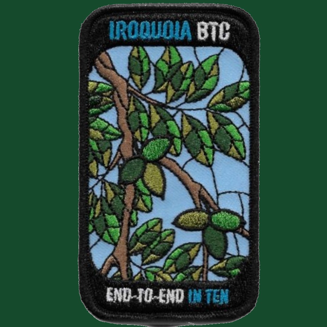
This is a special series of 10 hikes with a new accomplishment badge. The registration fee includes the new special event badge, however, it will be up to a hiker who has not earned the badge in time to receive it on the last hike to arrange to pick up the badge or have it posted to them.The fee goes towards supporting the Iroquoia Bruce Trail Club, which in turn supports the mission of the Bruce Trail Conservancy, which is: “Preserving a ribbon of wilderness, for everyone, forever.”
For the time being, registration for the Iroquoia E2E-in-Ten will be limited to members of the Bruce Trail Conservancy. Hikers can belong to any section.
A maximum of 3 (of the 10) hikes can be self-completed as a result of scheduling challenges, but it is intended that this badge be earned while hiking as part of a group led by a certified hike leader.
Please note there are no refunds!
This particular set of 10 hikes is intended to be BRISK (4-5km/h) where conditions safely allow. Please be honest about your degree of physical fitness prior to registration.
TRANSPORTATION
This series will be through hikes and will require car shuttling, you must be willing to drive or to be a passenger. Some parking locations require paid parking, and hikes that enter Halton Conservation Areas will require reservations. The fee for the E2E-in-Ten does not cover any parking/entry fees for hikers who are not members of the Halton CA and/or Hamilton CA. If the group has enough hikers who are members of a CA, those will be the cars chosen to park in those areas so as to minimize costs. At least one hike starts at one CA and ends at another, so parking fees are unavoidable for non-CA members.

Niagara Bruce Trail Benchlands Hike
https://hikesstaging.brucetrail.org/event/niagara-bruce-trail-benchlands-hike/Sorry, the registration cut-off time for this hike has been reached.Not a member? Click here to join today!Hosting Club: Niagara, Iroquoia
Category: General Hike
Location (Google Maps): We are meeting at the first parking area but there are three parking areas for this hike altogether, as follows:
1. Mountainview Conservation Area – West side of Mountainview Rd between McLeod St and Locust Lane 43.157888, -79.497415
2. Jordan Hollow King St (Hwy 81) across from Boo’s Restaurant 3039 King St Jordan Station
43.142022, -79.372672
3. Jordan Main St Parking lot across from Jordan Art Gallery (43.1491405, -79.3698233)Hike Leader(s): Ruth Moffatt Click here to contact Hike Leader(s)
Pace: Brisk – 4 to 5 km/hr, Medium – 3 to 4 km/hr
Terrain: Dependent on Conditions, Moderate – Some hills and/or some poor footing, Strenuous – Hilly with steep climbs and some poor footing
Distance: Approx 15km in totalDescription
This is a 3-part hike with 3 parking locations. Please carpool if you are able.Part hike, part history, part viticulture, this outing explores the area referred to as the Niagara Bench.
Please bring enough snacks, water and your icers in case of icy trail conditions.
Requirements for the badge are found here:http://niagarabrucetrail.club/wp/wp-content/uploads/2022/12/Niagara-Benchlands-Badge.pdf
Badges will be available following the third hike. M$10/NM$15An optional stop following the third hike for coffee and a treat.

9:00am NBTC Side Trail Challenge #5 - The Twelve
https://hikesstaging.brucetrail.org/event/900am-nbtc-side-trail-challenge-5-the-twelve-2/Sorry, the registration cut-off time for this hike has been reached.Not a member? Click here to join today!Hosting Club: Niagara
Category: In and Out
Location (Google Maps): Park off Glendale Avenue between Riverview Blvd & Twelve Mile CreekHike Leader(s): Robin Garrett Click here to contact Hike Leader(s)
Pace: Brisk
Terrain: Moderate
Distance: 11 kmDescription
This hike follows the east bank of Twelve Mile Creek to downtown then back and continues on the side trail towards Brock University until it meets the Main Trail and then back. Counts towards the NBTC Side Trail badge. Required photos include: Graffiti under the bridges, Twelve Mile Creek, Pedestrian bridge over Hwy 406.Easy Monday Hikes
https://hikesstaging.brucetrail.org/event/easy-monday-hikes-4/Sorry, the registration cut-off time for this hike has been reached.Not a member? Click here to join today!Hosting Club: Peninsula
Location (Google Maps): Meet at Dunks Bay Parking Lot located at the end of Dunks Bay Road in Tobermory.
Hike Leader(s): Marg Glendon Click here to contact Hike Leader(s)
Pace: Leisurely
Terrain: Easy
Distance: ~2 1/2 kmDescription
Easy hikes are short hikes (<3 KM) that are generally flat with little elevation change and mostly clear of tree roots and rocks. Hikes are adjusted according to weather conditions. Footwear with good tread and ankle support are recommended. Hiking poles are recommended, but not required. Bring a small backpack to carry water and light snacks.Meet at Dunks Bay Parking Lot at the end of Dunks Bay Road in Tobermory. We will car shuttle to the Northern Cairn in Tobermory to start our hike. Wear masks for the car shuttle please. Our hike today will start at the Bruce Trail Northern Cairn located near the Princess Hotel on Bay St. It’s at this very location that Ray Lowes officially opened the Bruce Trail in 1967. The Cairn was designed by Ruth Arnsberger and built by Ivan Lemcke. Learn about the history of the Bruce Trail as we walk along the main trail through the village, past the Visitor’s Centre and finally reaching Dunks Bay. Here, we will take a short rest here to enjoy the peace and quiet of the lovely sandy beach, before returning to the Meeting Place. We will finish our hike here. All hike participants are invited to the Meeting Place to enjoy some festive goodies and hot apple cider.
Minimum group size- 4
- 20December 20, 2022
9:00 NEW VENUE Rockway Conservation
https://hikesstaging.brucetrail.org/event/900-new-venue-rockway-conservation-3/Sorry, the registration cut-off time for this hike has been reached.Not a member? Click here to join today!Hosting Club: Niagara
Location (Google Maps): Rockway Conservation Area
Pelham Road, St CatherinesPace: Medium
Terrain: Moderate
: 10kmDescription
Changing it up for December only.Hike the trails in and around Rockway towards Louth or effingham
9:15 Short hike, Pelham Road, Short Hills
https://hikesstaging.brucetrail.org/event/915-short-hike-pelham-road-short-hills-30/Sorry, the registration cut-off time for this hike has been reached.Not a member? Click here to join today!Hosting Club: Niagara
Location (Google Maps): Pelham Road entrance, Short Hills Provincial Park
Hike Leader(s): janet davey Click here to contact Hike Leader(s)
Pace: Medium
Terrain: Moderate
Distance: 6 kmsDescription
Hike the main and side trails in Short Hills. Bring hiking boots and water.McCluskey's Rock
https://hikesstaging.brucetrail.org/event/mccluskeys-rock-3/Sorry, the registration cut-off time for this hike has been reached.Not a member? Click here to join today!Hosting Club: Beaver Valley
Location (Google Maps): Park @ km 39.3 Fox Ridge Road, Beaver Valley section (do not block laneways).
Map 25 Edition 30Hike Leader(s): Kristina Rettie Click here to contact the hike leader.
Pace: Brisk, Medium
Terrain: Some rocky footing, Some steep sections, Strenuous
Length of Hike: 8.5kmDescription
We will follow the road allowance south before turning in and ascending the Escarpment. Proceeding through a level section of forest and descending across a scree slope, the trail continues across the base of the Escarpment before ascending to the top. Along the top it skirts McCluskey’s Rock and descends a wide valley to reach the Ken Young Side Trail. We will take this side trail to 7B then follow the road back onto the main trail and re-trace our steps back the same way.Scotsdale Farm, Map 13
https://hikesstaging.brucetrail.org/event/scotsdale-farm-map-13-3/Sorry, the registration cut-off time for this hike has been reached.Not a member? Click here to join today!Hosting Club: Caledon Hills
Category: Tuesday Hikers
Location (Google Maps): Scotsdale Farm parking lot.
From Highway 401 go north on Trafalgar Rd. until it merges with Highway 7, turn left on Highway 7, after about 4 km Trafalgar Rd. will branch-out to the right, take Trafalgar Rd., entrance to Scotsdale Farm is on the right after about 1.5 km. An unpaved road leads to the parking on the left.Hike Leader(s): Mohammad Shafiq Click here to contact Hike Leader(s)
Pace: Medium – 3 to 4 km/hour
Terrain: Moderate – some hills and/or some poor footing
Distance: 13 kmDescription
Will go on main Bruce Trail and side trails in Scotsdale and Silver Creek Conservation Area, Duff Pit, Reservoir, Trafalgar, Maureen Smith and parts of Bennett Heritage in a loop.
Bring water, snack and if prefer a warm drink.
Recommend poles, gaiters and icers.
Dress according to weather, in layers.My contact # 416-566-0503