
Hike Schedule
Join us for a hike! Registration required.
All hikes available to BTC members. Some hikes are open to non-members.
See Refund Policy for Paid Hikes >
TIP: The calendar view displays up to 7 hikes on a day, but often there are more. Click “View more events” to see them all.
Categories
- 30November 30, 2022
Terra Cotta Conservation Area
https://hikesstaging.brucetrail.org/event/terra-cotta-conservation-area-4/Sorry, the registration cut-off time for this hike has been reached.Not a member? Click here to join today!Hike open to BTC Members only.
Hosting Club: Iroquoia
Category: Hikers R Us
Location (Google Maps): Meet at Roadside parking where the main Trail meets Heritage Road. Four hundred meters south of km 44.5 on Map 14 Ed. 30.0Hike Leader(s): Victoria Best Click here to contact Hike Leader(s)
Pace: Medium – 3 to 4 km/hr
Terrain: Moderate – Some hills and/or some poor footing, Slippery Sections Likely
Distance: 15 kmDescription
This is a loop hike on the Main Bruce Trail, the Terra Cotta Side Trail and the Rock Side Trail.
The distance hiked will be reduced if weather is inclement.
Dress appropriately for the weather and for slippery and rocky trail conditions. Bring lunch and water, hiking boots, and no dogs please.
Please arrive 15 minutes before the hike start time of 9:30 AM. Register and cancel participation using the hiking schedule.RBG North Shore Trail - Cancelled
https://hikesstaging.brucetrail.org/event/rbg-north-shore-trail-8/Sorry, the registration cut-off time for this hike has been reached.Not a member? Click here to join today!Hosting Club: Iroquoia
Category: Good Companions
Location (Google Maps): Meet in the parking lot by the Pavillion at the RBG Nature Center (Arboretum) at 9:45am.Hike Leader(s): Linda Robinson Click here to contact Hike Leader(s)
Pace: Leisurely – 3km/hr or less
Terrain: Easy – Mostly flat and usually good footing
Distance: about 6-7kmDescription
Bring along water, snack and icers in case of snow.Parking fees apply.
- 01December 1, 2022
9:00 am NEW TIME Long Hike Jordan to Moyer / Louth
https://hikesstaging.brucetrail.org/event/900-am-new-time-long-hike-jordan-to-moyer-louth-4/Sorry, the registration cut-off time for this hike has been reached.Not a member? Click here to join today!Hosting Club: Niagara
Category: In and Out
Location (Google Maps):Jordan Hollow Park 3039 King St Jordan
Hike Leader(s): Alan Laver Click here to contact Hike Leader(s)
Pace: Medium
Terrain: Moderate
Distance: 10kDescription
From Jordan Hollow Hike the main trail to Upper and Lower Balls Falls, Moyer Road or Louth and Return. You must register for each hike. Dress for the weatherBring Poles, snack a drink and ices

9:00 NBTC Side Trail Challenge #5 – The Twelve (REPEAT)
https://hikesstaging.brucetrail.org/event/900-nbtc-side-trail-challenge-5-the-twelve-repeat/Sorry, the registration cut-off time for this hike has been reached.Not a member? Click here to join today!Hosting Club: Niagara
Category: In and Out
Location (Google Maps): Park off Glendale Avenue between Riverview Blvd & Twelve Mile CreekHike Leader(s): Sam Rutherford Click here to contact Hike Leader(s)
Pace: Brisk
Terrain: Moderate
Distance: 11 kmsDescription
This hike follows the east bank of Twelve Mile Creek to downtown then back and continues on the side trail towards Brock University until it meets the Main Trail and then back. Counts towards the NBTC Side Trail badge. Required photos include: Graffiti under the bridges, Twelve Mile Creek, Pedestrian bridge over Hwy 406. This hike is for anyone who just wants to enjoy this unique side trail as well as those working towards the Side Trail badge.9:15 Short hike, Jordan Hollow
https://hikesstaging.brucetrail.org/event/915-short-hike-jordan-hollow-34/Sorry, the registration cut-off time for this hike has been reached.Not a member? Click here to join today!Hosting Club: Niagara
Category: Loop
Location (Google Maps): Jordan Hollow Park, JordanHike Leader(s): Bill Russell Click here to contact Hike Leader(s)
Pace: Medium
Terrain: Strenuous
Distance: 6 kmsDescription
Hike the main trail and side trails around Jordan and Balls Falls.Cartwright- Berry Tract to Borer's Falls and back
https://hikesstaging.brucetrail.org/event/borers-falls-to-cartwright-and-back/Sorry, the registration cut-off time for this hike has been reached.Not a member? Click here to join today!Hosting Club: Iroquoia
Category: Thursday Group
Location (Google Maps): Meet at the end of Wesley Avenue and park on the grass along the east / right hand side of the road for a 9:30 departure. We will hike through the RBG Berry Track and the HNC Cartwright property go up to the Borer Falls parking lookout and back. To get to Wesley Avenue, drive along Valley Road or Old Guelph Road, turn onto Patterson Road and Wesley will be to your south. See Map 9 in the BTC guide.Hike Leader(s): Paul Toffoletti Click here to contact Hike Leader(s)
Pace: Medium – 3 to 4 km/hr
Terrain: Moderate – Some hills and/or some poor footing
Distance: Approx. 8kmDescription
Please bring enough water and snacks for the hike as well as icers in the event the trails are icy.Explore the Interior Skinner’s Woods
https://hikesstaging.brucetrail.org/event/explore-the-interior-skinners-woods-2/Sorry, the registration cut-off time for this hike has been reached.Not a member? Click here to join today!Hosting Club: Sydenham
Category: General Hike
Location (Google Maps):Roadside parking on Gleason Lake Rd at the corner of Colpoy’s Range Rd (where the Curly Harnden and Len Holley Side Trails meet), south of km 163.1 (Map 35)
Hike Leader(s): Robert Knapp Click here to contact Hike Leader(s)
Pace: Medium: 3 to 4 km/h
Terrain: Moderate: Some hills and/or poor footing
Distance: 6 kmDescription
This loop hike begins with the Len Holley Side Trail, then follows the snowmobile trail to the Skinner’s Woods Side Trail. We will return to our cars via the Len Holley Side Trail. Bring a snack. Approx. 3 hours.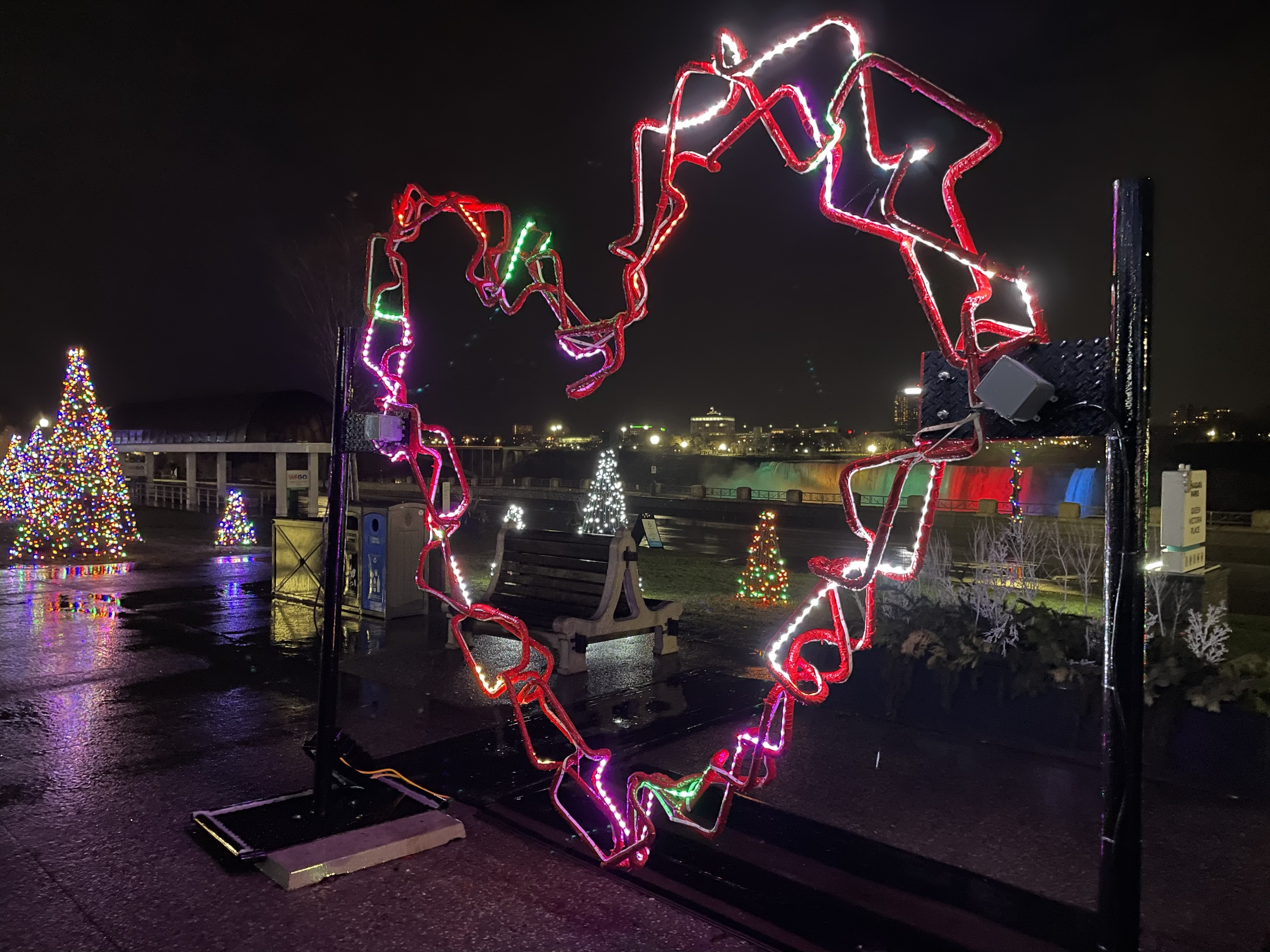
19:00 Festival of Lights Hike
https://hikesstaging.brucetrail.org/event/1900-festival-of-lights-hike/Sorry, the registration cut-off time for this hike has been reached.Not a member? Click here to join today!Hosting Club: Niagara
Category: Night
Location (Google Maps): Floral Showhouse, Niagara Parkway, just south of the FallsHike Leader(s): Margaret Northfield Click here to contact Hike Leader(s)
Pace: Leisurely
Terrain: Easy
Distance: 5-6kmDescription
Get your cameras ready for the Annual Winter Festival of Lights hike. Meet at the Floral Showcase along the Niagara Parkway (parking fees apply – annual pass for the Parkway is the best deal). Get into the festive mood with this walk around the Falls area. Stay afterwards to share hot apple cider and treats. You are welcome to share your favorite holiday treat. - 02December 2, 2022

9:00 am Niagara-on-the-Lake Tour
https://hikesstaging.brucetrail.org/event/900-am-niagara-on-the-lake-tour-6/Sorry, the registration cut-off time for this hike has been reached.Not a member? Click here to join today!Hosting Club: Niagara
Category: Urban
Location (Google Maps): Veterans Memorial Park, park just outside the park on King StreetHike Leader(s): Robin Garrett Click here to contact Hike Leader(s)
Pace: Medium
Terrain: Easy
Distance: 6-7 kmDescription
Each Friday we will explore different neighbourhoods, trails and parkland throughout Historic Niagara-on-the-Lake.Moderate pace with some weeks entirely on sidewalks and roads while others may include a mix of trails and paved pathways. Great way to build up endurance for longer more strenuous hikes.
Prepare for cooler windy conditions on open parkland and along Lake Ontario and Niagara River trails.
Plan to stay for conversation and a warm cup of coffee or tea at Sweets & Swirls, Community Centre, Niagara Stone Road, NOTL
- 03December 3, 2022
8:00 Iroquoia E2E #2
https://hikesstaging.brucetrail.org/event/830-iroquoia-e2e-2/Sorry, the registration cut-off time for this hike has been reached.Not a member? Click here to join today!Hosting Club: Niagara
Category: Car Pool
Location (Google Maps): 102.6 to 87.3 West side of 5147 Walkers Line Across from Cemetery. N43.419107 W79.861377 Carpool to Twiss Road Roadside Parking.102.6 N43.447743 W79.953436 Paid ParkingHike Leader(s): Alan Laver Click here to contact Hike Leader(s)
Pace: Medium
Terrain: Moderate
Distance: 15.3kDescription
This is the 2nd of 7 hikes to complete the Iroquoia section of the Bruce Trail. Dress for the weather and bring icers, gators, snacks and water
Boyd Conservation Park Vaughan
https://hikesstaging.brucetrail.org/event/boyd-conservation-park-vaughan-5/Sorry, the registration cut-off time for this hike has been reached.Not a member? Click here to join today!Hosting Club: Toronto
Category: Car Hike
Location (Google Maps): Boyd Conservation Park Vaughan
Park for free in parking lot before park entrance on Islington AvenueHike Leader(s): Mohammad Aghamiri Click here to contact Hike Leader(s)
Pace: Brisk, Moderate
Terrain: Hilly, Variable
Distance: 15-16KMDescription
Explore the trails that wind through the beautiful Humber River valley at Boyd Conservation Area and the William Grainger Greenway.CANCELED Kemble Wetlands
https://hikesstaging.brucetrail.org/event/kemble-wetlands-3/Sorry, the registration cut-off time for this hike has been reached.Not a member? Click here to join today!Hosting Club: Sydenham
Category: General Hike
Location (Google Maps): The Galaxy Theatre parking lot. Meet in the parking lot at the tall “Galaxy Centre” sign next to the traffic lights.
1020 10th St. W., Owen SoundHike Leader(s): Franziska Edney Click here to contact Hike Leader(s)
Pace: Medium: 3 to 4 km/h
Terrain: Moderate: Some hills and/or poor footing
Distance: 5.5 kmsDescription
We will hike on the blue Don Richards Side Trail to the white trail, which will take us to The Cedar Point Side Trail. We then follow the trail south to the Kemble Wetland Trail, back to the cars. Map 34. Hiking time approx. 2 hrs. Poles advised. Please contact hike leader if not interested in car pooling.Dunedin Reserve Figure 8
https://hikesstaging.brucetrail.org/event/dunedin-reserve-figure-8/Sorry, the registration cut-off time for this hike has been reached.Not a member? Click here to join today!Hosting Club: Blue Mountains
Category: Register on-line or sign-in morning of hike
Location (Google Maps): Hike meets in the parking lot behind Tim Hortons on First St. in Collingwood.Hike Leader(s): Dick Edwards Click here to contact Hike Leader(s)
Pace: Medium – 3 to 4 km/hr
Terrain: Moderate – Some hills and/or some poor footing
Distance: 8kmDescription
We will head to Dunedin Valley Nature Preserve parking on 6/7 Sideroad at Conc. 10. Following the white blazed trail south on Conc. 10, we enter the nature preserve on the east side. This area covers mixed terrain and provides a chance to experience a variety of habitats. The trail goes along the banks of a tributary of the Noisy River. After crossing Conc.10, we proceed through some farmers fields to a great view at the bench. We will then return following the road. Bring a snack or lunch and water. Map 21 Ed. 30Cape Chin Side Trail
https://hikesstaging.brucetrail.org/event/cape-chin-side-trail/Sorry, the registration cut-off time for this hike has been reached.Not a member? Click here to join today!Hosting Club: Peninsula
Location (Google Maps): Parking lot at South end of Carter Rd.
Hike Leader(s): Barbara Reuber Click here to contact Hike Leader(s)
Pace: Leisurely
Terrain: Easy
Distance: 3.5 kmDescription
This easy hike will walk out along the Cape Chin Side Trail and return via the main trail along the beach. If all hikers are interested, we will add an additional 1 km to hike to the lookout at Smokey Head and back. Total time commitment is about 2 hours.Bring water, a snack and sturdy shoes.

Clappison Woods to Smokey Hollow MAP 9-CANCELLED
https://hikesstaging.brucetrail.org/event/clappison-woods-to-smokey-hollow-map-9/Sorry, the registration cut-off time for this hike has been reached.Not a member? Click here to join today!Hosting Club: Iroquoia
Category: General Hike
Location (Google Maps): Meet at Waterdown Walmart Hwy 5 and Hwy 6-Clappisions CornersHike Leader(s): Cathie Green Click here to contact Hike Leader(s)
Pace: Medium – 3 to 4 km/hr
Terrain: Strenuous – Hilly with steep climbs and some poor footing
Distance: 12-14 kmsDescription
We will meet at the green x-see map-the far side of Walmart parking near the trucking laneway-we will walk down this laneway to the back of the store and walk along edge of quarryto the Bruce trail following the white blazes east to Smokey Hollow ending at Grand Falls-Moderately difficult – some rocky and steep sections- and stairs to view the falls-
We will take a lunch break at the river and then head back same route along Grindstone Creek- Important to bring ICERS, hiking poles, water, snacks, appropriate footwear and clothing
Any questions or concerns, please text or email me Cathie 416 931 2095 cathiekygreen@gmail.com
Hilton Falls Ramble. CANCELLED
https://hikesstaging.brucetrail.org/event/hilton-falls-ramble-4/Sorry, the registration cut-off time for this hike has been reached.Not a member? Click here to join today!Hosting Club: Iroquoia
Category: General Hike
Location (Google Maps): Hilton Falls Conservation AreaHike Leader(s): Anne Armstrong Click here to contact Hike Leader(s)
Pace: Leisurely – 3km/hr or less
Terrain: Moderate – Some hills and/or some poor footing
Distance: Approx. 9 km.Description
Meet in the parking lot at 9:45 am. for a 10:00 am. start to join us for a ramble around the Hilton Falls Conservation Area with its many trails, from easy to more challenging. We will circle the lake and continue on to the Falls. From there we will venture into the Halton Agreement Forest and return to the main Conservation Area trails. We will see the remnants of the mill that used to operate at the Falls. Expect some rocky, uneven terrain. Bring water and a snack. Poles will be useful. Depending on conditions icers might be necessary. Note: Registration required via the Halton Conservation Authority website.
Leader: Anne Armstrong 905 617 3937 hikingrandma@gmail.comScotsdale Farm
https://hikesstaging.brucetrail.org/event/car-hike-scotsdale-farm/Sorry, the registration cut-off time for this hike has been reached.Not a member? Click here to join today!Hosting Club: Toronto
Category: Car Hike
Location (Google Maps): Scotsdale Farm main and side trails.Directions: North on Trafalgar Road past Georgetown to Hwy 7. Northwest of & to Silver Creek. Turn right onto Trafalgar Road. Go north about 1.5 km. The parking area is about 0.5 km from the Trafalgar Rd.
Hike Leader(s): Alex Brown Click here to contact Hike Leader(s)
Pace: Moderate
Terrain: Variable
Distance: 10 kmDescription
We will hike along the main and side trails on Scotsdale Farm including the newly opened section connecting to the Duff Pit Side Trail. Hike length is flexible and will be based on weather.After the hike those interested are invited to join me for refreshments at the Sheppard’s Crook in the of centre of Georgetown.
Urban Walk: Unionville/Toogood Pond
https://hikesstaging.brucetrail.org/event/urban-walk-unionville-toogood-pond/Sorry, the registration cut-off time for this hike has been reached.Not a member? Click here to join today!Hike open to BTC Members only.
Hosting Club: Toronto
Category: Urban Walk
Location (Google Maps): Meet outside south exit of Markham Pan Am Centre by the flag poles. If commuting by GO Train from Toronto meet in the Great Hall of Union Station (off Front Street) near the information desk with the clock above it by 9:55 to take the 10:14 AM Stouffville Line Train to Unionville GO Station where we will walk to the Pan Am Centre to meet those who are driving to the hike.Hike Leader(s): Tom Swales, Juliet Williams Click here to contact Hike Leader(s)
Pace: Moderate
Terrain: Flat
Distance: 12 KMDescription
Join us for a hike to Toogood Pond and a loop through the trails north of the pond to 16th Avenue returning to Main Street Unionville where their “Old Tyme Christmas” will run from 2:00 – 6:00 featuring light displays and live music. There will be option of a pub stop. The hike will end at Main Street where hikers may return to the start at their leisure walking south on Main Street to the Markham Pan Am Centre and the GO Train Station.