
Hike Schedule
Join us for a hike! Registration required.
All hikes available to BTC members. Some hikes are open to non-members.
See Refund Policy for Paid Hikes >
TIP: The calendar view displays up to 7 hikes on a day, but often there are more. Click “View more events” to see them all.
Categories
- 13November 13, 2022
Car Hike: Hockley Valley - Blue and White hikes (2) - 19KM
https://hikesstaging.brucetrail.org/event/car-hike-hockley-valley-blue-and-white-hikes-2-19km/Sorry, the registration cut-off time for this hike has been reached.Not a member? Click here to join today!Hosting Club: Toronto
Category: Car Hike
Location (Google Maps):We meet at the Mono 5 Sideroad parking on the North side of the road where the trail crosses the road.
Hike Leader(s): Fayyaz Mahmood Click here to contact Hike Leader(s)
Pace: Brisk
Terrain: Challenging, Hilly
Distance: 18.8KMDescription
Here is your opportunity to hike the Side Trails and hilly, wooded sections of the Main Bruce Trail in Hockley Valley.
We will walk South from the parking lot Map 18, 45.5KM (Ed 30) to Coolihans Sideroad Map 17, 35.2KM. We will then hike back on the Glen Haffy Side Trail rejoining the Main Trail to return back to the cars.
Bring 1.5 – 2 liters of water and your lunch. Please dress for the weather.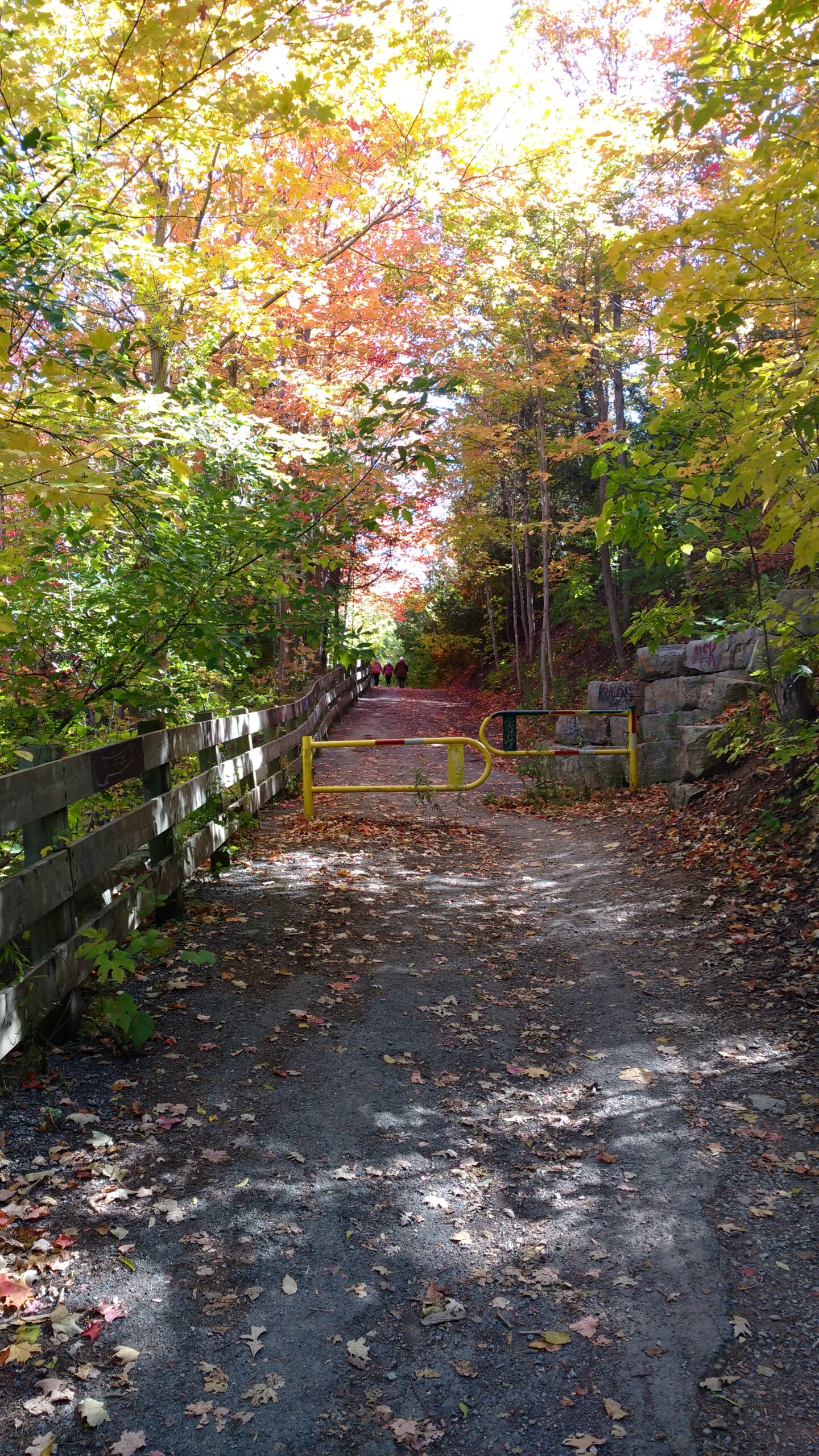
Urban Walk: 16 Mile Creek, Oakville
https://hikesstaging.brucetrail.org/event/urban-walk-16-mile-creek-oakville/Sorry, the registration cut-off time for this hike has been reached.Not a member? Click here to join today!Hosting Club: Toronto
Category: Urban Walk
Location (Google Maps):Starts and ends at Oakville GO Station
Hike Leader(s): Ginny Giraudi / Tom Swales Click here to contact Hike Leader(s)
Pace: Moderate
Terrain: Other (Refer to Description)
Distance: 15 kmDescription
If you are planning to travel by GO train to Oakville, you will be taking the 8:44 am westbound train, so please arrive 15 minutes prior to that. Please use the bathroom while on the GO train as there is little time for it at the Oakville GO station. You can also drive to the Oakville Station and meet us there. Parking is free on the weekends.We will all meet at 9:25 am at the Oakville Transit Bus Platform 27 at the Oakville GO Station (click here for station diagram.) From here we will board Bus 13 at 9:40 am and take a short bus ride to the start point of our hike. Oakville Transit buses accept Presto, and if you have paid for the GO train, the fare for the Oakville bus will register as zero when you tap your Presto card (please note: if you are using the cellphone $10 weekend day pass, the bus driver may not accept it for the Oakville Transit discount and you may be required to pay the Oakville Transit Bus Fare.) We will walk a 15 km looping trail through the 16-Mile Creek ravine (click here for route map), stopping at the halfway point for lunch (port-a-potties only; bring hand sanitizer and tp) and return to the Oakville GO Station. The trail is stone dust gravel or asphalt and mostly flat except for two steep declines and three long climbs. There is one long set of stairs to descend. The after-hike pub stop is at the Beertown Public House (click here for menu) near the Oakville GO Station.
14:00 NBTC Side Trail Challenge #4 Upper Canada Heritage & Alfred's Trot - Make-Up Hike
https://hikesstaging.brucetrail.org/event/1400-nbtc-side-trail-challenge-4-upper-canada-heritage-alfreds-trot-make-up-hike/Sorry, the registration cut-off time for this hike has been reached.Not a member? Click here to join today!Hosting Club: Niagara
Category: Loop
Location (Google Maps): Concession 2 & York Road. Park on York Road just west of Concession 2.Hike Leader(s): Sam Rutherford Click here to contact Hike Leader(s)
Pace: Medium
Terrain: Moderate
Distance: 8 kmsDescription
This hike follows the Upper Canada Heritage Trail to the main trail and includes a loop along Alfred’s Trot side trail and back. This hike will count towards the NBTC Side Trail badge. Required photos include: drystone wall and ruins of lime kilns. - 14November 14, 2022

9:00am NBTC Side Trail Challenge #1 - Woodend - Wetland Ridge Loop (REPEAT)
https://hikesstaging.brucetrail.org/event/900am-nbtc-side-trail-challenge-1-woodend-wetland-ridge-loop-repeat/Sorry, the registration cut-off time for this hike has been reached.Not a member? Click here to join today!Hosting Club: Niagara
Category: Loop
Location (Google Maps): Entrance to Woodend Conservation Area off Taylor RoadHike Leader(s): Robin Garrett Click here to contact Hike Leader(s)
Pace: Medium
Terrain: Moderate
Distance: 8kDescription
This hike follows the main trail to Wetland Ridge side trail; includes in and out along the Niagara College side trail; back along the Wetland Ridge side trail until it meets the main trail; Margaret Kalogeropoulos side trail and back to the main trail. Bring poles and prepare for muddy conditions. Counts toward the Niagara Side Trail Badge. Required photos include: outdoor classroom, First Nations, Métis & Inuit garden, constant gardener bench, wood duck nesting box, lime kiln ruins, and Margaret Kalogeropoulos side trail sign.You must complete all 20 side trails with required photos to earn your badge.
9:00 Hiking in and around Rotary Park
https://hikesstaging.brucetrail.org/event/900-hiking-in-and-around-rotary-park-2/Sorry, the registration cut-off time for this hike has been reached.Not a member? Click here to join today!Hosting Club: Niagara
Location (Google Maps): 395 Pelham Road, regional Road 69, St. Catharines
Hike Leader(s): Sheila Massey Click here to contact Hike Leader(s)
Pace: Medium
Terrain: Moderate
Distance: 6kDescription
Hiking various trails in and around Rotary Park and along 12 Mile Creek - 15November 15, 2022
9:00 NEW TIME Long Hike Wiley Road Short Hills
https://hikesstaging.brucetrail.org/event/900-new-time-long-hike-wiley-road-short-hills-2/Sorry, the registration cut-off time for this hike has been reached.Not a member? Click here to join today!Hosting Club: Niagara
Location (Google Maps):
Short Hills Wiley Road Entrance
Pace: Medium
Terrain: Moderate
: 10kmDescription
Explore Short Hills and the majestic side trails of Scarlett Tanager, Hemlock. Swayze Falls and Terrace. Register for each hike
Bring Poles water, snack and dress for the weather
Silver Creek, Map 13
https://hikesstaging.brucetrail.org/event/silver-creek-map-13/Sorry, the registration cut-off time for this hike has been reached.Not a member? Click here to join today!Hosting Club: Caledon Hills
Category: Tuesday Hikers
Location (Google Maps): Parking at Fallbrook Trail / Sideroad 27 (where the Bruce Trail crosses Fallbrook Trail). Do not park near school.
Driving directions: From Highway 401, north on Trafalgar Road, it will connect with Highway 7 – turn left, after about 4 km, turning right on Trafalgar Road (branching out), turn right on Sideroad 27, it will cross 8th Line, continue on Sideroad 27; at junction with Fallbrook Trail, turn right and park roadside.Hike Leader(s): Mohammad Shafiq Click here to contact Hike Leader(s)
Pace: Medium – 3 to 4 km/hour
Terrain: Moderate – some hills and/or some poor footing
Distance: 13 kmDescription
Will hike Main Bruce Trail and side trails in Silver Creek area, Great Esker, Bennett Heritage, Maureen Smith and Roberts. Drop out possible at 11 km.
– bring water and snack.
– poles recommended.
– dress according to weather, in layers.
– observe COVID precautions as new variant is around - 16November 16, 2022
Bayview Escarpment Sydenham
https://hikesstaging.brucetrail.org/event/bayview-escarpment-sydenham/Sorry, the registration cut-off time for this hike has been reached.Not a member? Click here to join today!Hosting Club: Beaver Valley
Location (Google Maps): Meet on St. Vincent Sydenham Townline, km 55.2, Map 30, Edition 30
Hike Leader(s): Glenda Collings Click here to contact the hike leader.
Pace: Medium
Terrain: Moderate
Length of Hike: 13.8 kmDescription
This is a loop hike which includes the River Kwai and Bayview Escarpment Side Trails plus the Lebanon Mountain Friendship Trail, with views from the escarpment edge.COVID-19 Precautions Before, During and After your Hike
- Each hiker joining a Bruce Trail Club organized hike must perform a self-screening check before hiking.
Find Ontario’s self-assessment tool here: https://covid-19.ontario.ca/self-assessment/ - If you are experiencing COVID-19 symptoms, stay home.
- Personal Protective Equipment:
- Hikers may choose to wear masks
Transportation
It is the Bruce Trail Conservancy’s current policy that car shuttles are allowed. It is at the discrepancy of individual hike leaders to make that decision.
Other Guidelines
- Arrive 15 minutes before the start of the hike.
- Wear sturdy footwear and appropriate attire for the weather and the terrain.
Hiking poles are a good idea in any season, especially if the terrain is rocky or slippery. In winter, snowshoes or icers/crampons are needed when conditions dictate.
Wearing appropriate clothing and footwear prevents injuries and shows consideration for a safe and positive group hiking experience. - Always carry I.D. and your health card.
- Bring sufficient water and snacks (or lunch if indicated). A minimum of 1L of water is recommended on all hikes, and 3L is recommended for long, challenging hikes in the heat of the summer.
- Bring sunscreen and insect repellent (for spring and summer hikes).
- Bring your own first aid kit.
- Please leave dogs at home.
11:00 am Hike & Picnic
https://hikesstaging.brucetrail.org/event/1100-am-hike-picnic-5/Sorry, the registration cut-off time for this hike has been reached.Not a member? Click here to join today!Hosting Club: Niagara
Category: Loop
Location (Google Maps): Locust Grove Picnic AreaHike Leader(s): Marion Hanover Click here to contact Hike Leader(s)
Pace: Medium
Terrain: Moderate
Distance: 7 kmDescription
Hike around Queenston area. Optional outdoor gathering in Locust Grove including pot luck picnic. - Each hiker joining a Bruce Trail Club organized hike must perform a self-screening check before hiking.